Tyers to Walhalla
54 km
distance
1h 20m
Contour time
6.6
avg score
Sealed
surface
640m
max elevation
Scenery
640m elevation
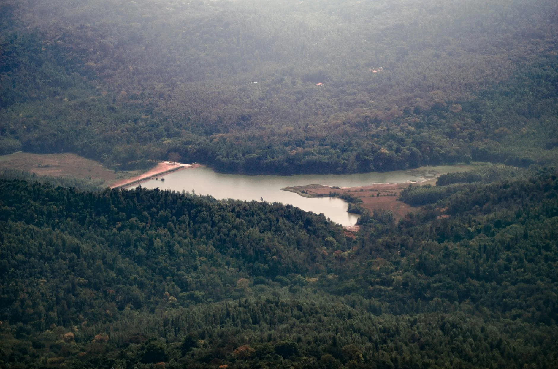
The Thomson Valley is central Gippsland's water catchment - the Thomson Reservoir supplies much of Melbourne's drinking...
Road quality
6.6 RQS
Every segment scored on 40+ data signals.
Accessibility
Fully sealed
Best in Motorbike & Rally. Peak season: Year-round.
7-day forecast
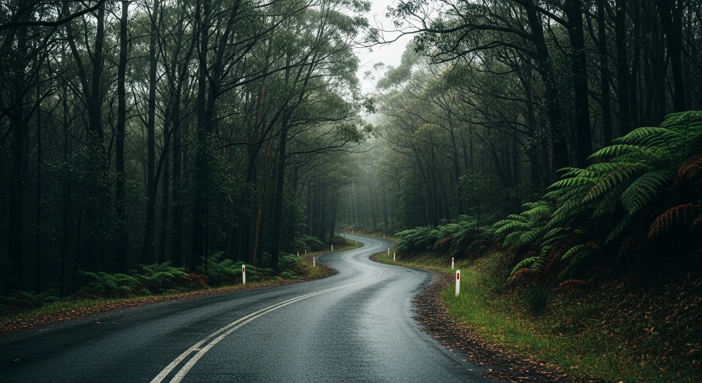
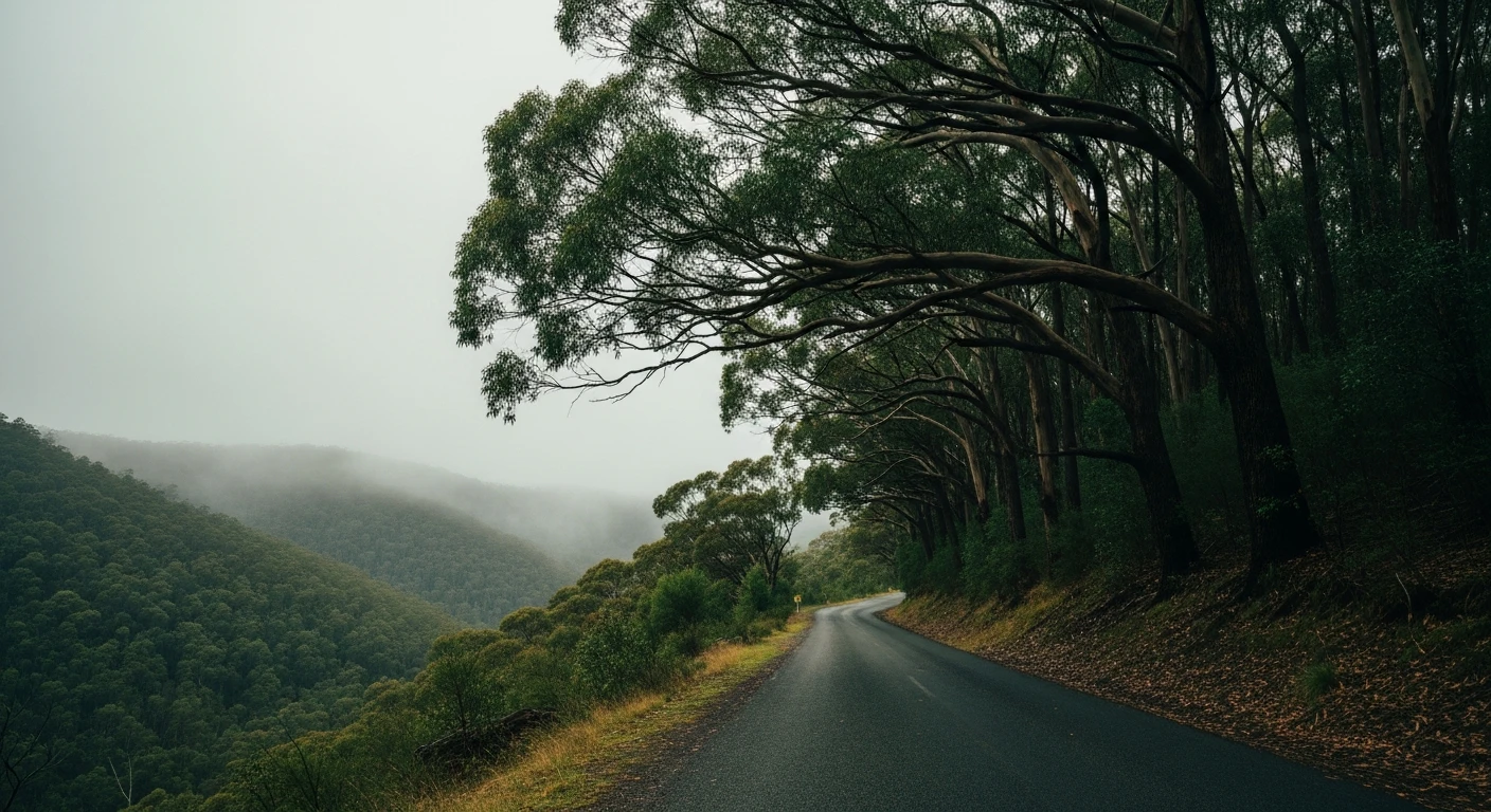
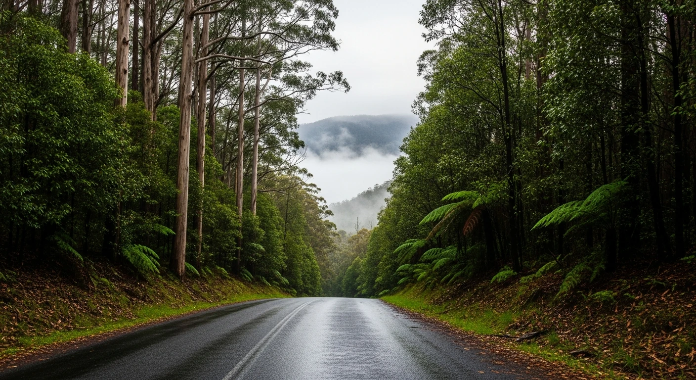
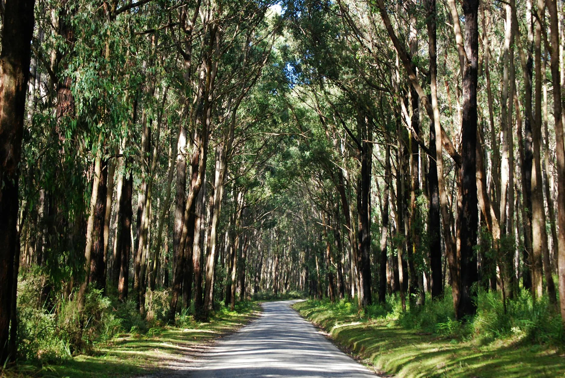
Mountain ash forest and river valley views all the way to Walhalla. Good sealed surface and light traffic through the whole run.
Scored 6.6/10 by Contour's road quality algorithm across curviness, surface, elevation and traffic. Best suited for motorbike & rally drivers.
The road
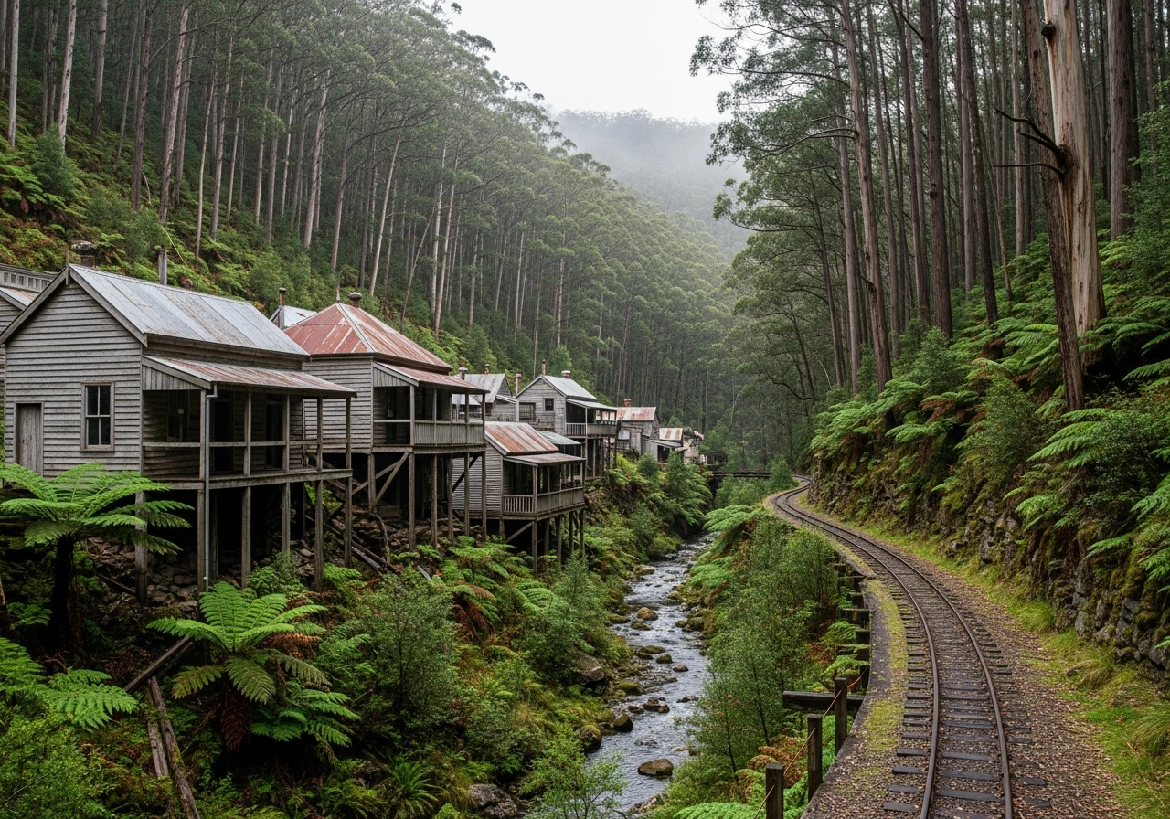
Walhalla is one of those places that drivers seek out specifically because the road to get there is part of the experience. The 54-kilometre sealed run from Tyers follows the Thomson River valley north before climbing through mountain ash forest into the town, which sits in a narrow creek valley at the end of the road. There is no through traffic because the road ends at Walhalla - which means no trucks, no hurry and no one who is not there specifically because they want to be. The road surface is well-maintained and the corners through the upper mountain ash section are tight and satisfying. The river valley sections have a different quality - wider, open views across to the Thomson Reservoir, with the road running along contour lines above the water. The approach into Walhalla itself is the highlight: the valley narrows until the road can barely fit, old timber buildings appear on the hillside and the whole scene feels genuinely preserved rather than reconstructed. The town has a working narrow-gauge railway, several heritage buildings and a pub that makes a point of not being too fancy about any of it.
Walhalla is one of those places that drivers seek out specifically because the road to get there is part of the experience.
Why this road
The region
The Thomson Valley is central Gippsland's water catchment - the Thomson Reservoir supplies much of Melbourne's drinking water. The valley is forested and largely inaccessible, which has kept the Walhalla road quiet and the surrounding country intact. Tyers is a small settlement on the edge of the Thomson catchment, about 20 kilometres north of Traralgon. Walhalla at the end of the road was Victoria's richest gold mining town in the 1870s, producing more gold per head of population than anywhere else in the colony. At its peak it had 1,500 residents, a brewery, several hotels and an underground mine stretching 1.3 kilometres into the hillside.
History
Walhalla's Long Tunnel mine produced 55 tonnes of gold between 1865 and 1914. When the mine closed the town was largely abandoned - by 1930 only a handful of people remained. The preservation of the original timber buildings happened by accident rather than design, simply because no one bothered to tear them down.
Before you go
Fuel in Tyers or Moe - there is no fuel at Walhalla. The pub at Walhalla serves food and the narrow-gauge railway runs on weekends. The road narrows significantly in the last 5 kilometres and is not suitable for large caravans. Allow extra time - the road encourages you to go slowly and the town deserves an hour. Open year-round. No mobile coverage in the upper valley.
See a routing error?
Flag itWorth stopping for
Walhalla Goldfields Railway
A narrow-gauge heritage railway that runs 4.5km into the mountain ash forest on weekend afternoons - one of Victoria's best short rail experiences.
Long Tunnel Extended Mine
Self-guided tours into the original 1865 gold mine, deep under the hillside behind the main street - cold, dark and genuinely atmospheric.
Route
Start
Tyers
End
Walhalla
Gallery
More roads like this