Wilsons Promontory
57 km
distance
55 min
Contour time
4.9
avg score
Sealed
surface
Scenery
Victoria
Wilsons Promontory National Park covers 500 square kilometres at the southern tip of Victoria and is one of the most...
Road quality
4.9 RQS
Every segment scored on 40+ data signals.
Accessibility
Fully sealed
Best in Sports car. Peak season: Year-round.
7-day forecast
Sealed run through coastal heathland and granite country. The destination is the point here but the road earns it.
Scored 4.9/10 by Contour's road quality algorithm across curviness, surface, elevation and traffic. Best suited for sports car drivers.
The road
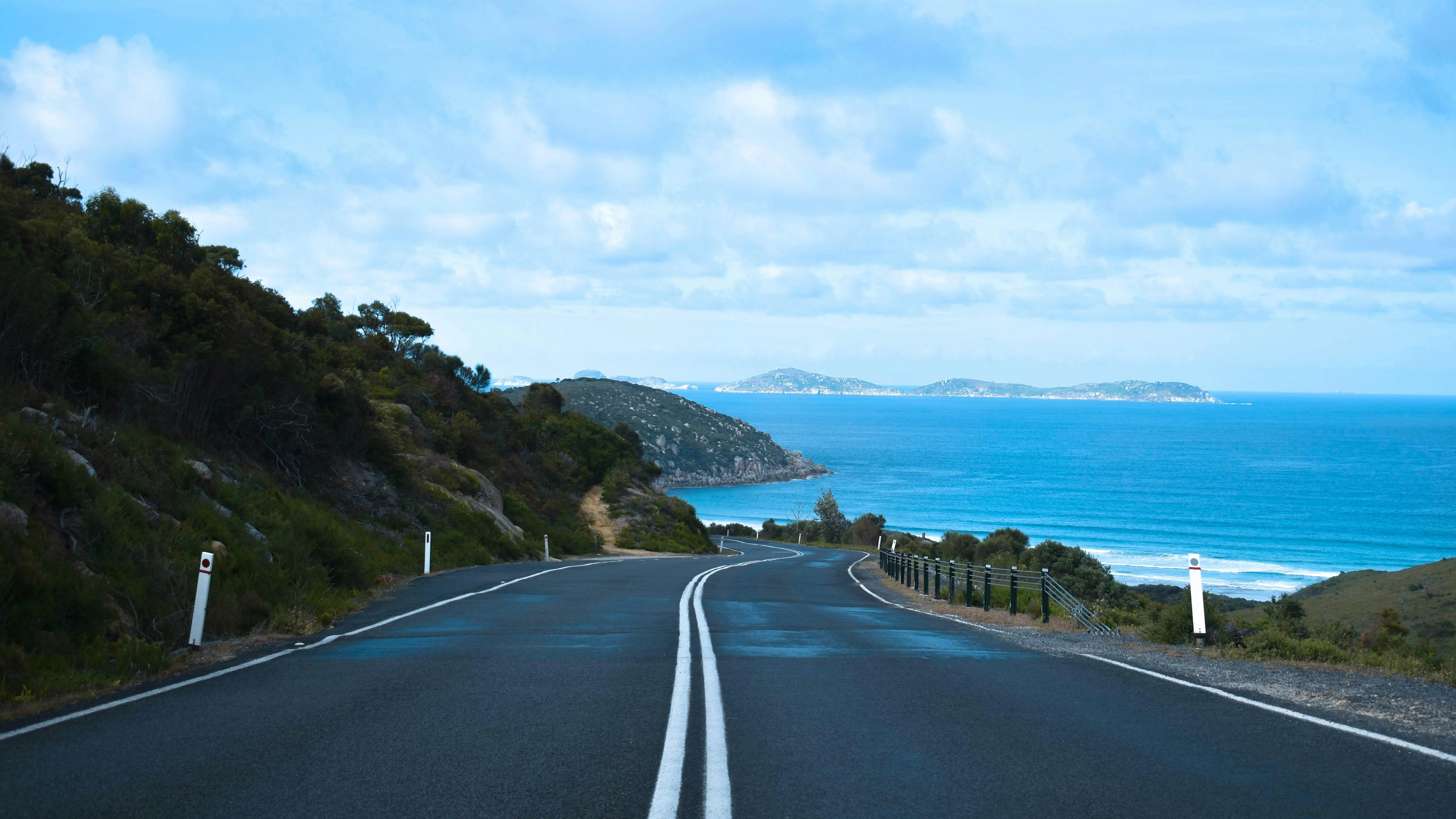
Wilsons Promontory is the southernmost point of mainland Australia and the road to get there is better than most people expect. The 32-kilometre sealed run from the park entrance at Yanakie to Tidal River crosses the low granite ridge at the base of the promontory through coastal heathland, heath scrub and pockets of banksia woodland, with wombats and wallabies that treat the road as their personal territory. The corners are not technical - the road is wide, well-sealed and clearly built for park access rather than driving pleasure - but the landscape through the peninsula is genuinely striking. The granite outcrops close to the road on the upper section have the scale and character of a much bigger mountain range. Tidal River at the end is the park's main campground and visitor centre, sitting on a tidal river mouth with a sand beach and views south to Squeaky Beach. The park limits vehicle access by daily permit in peak periods, which keeps the road from becoming congested. Coming in winter or mid-week means you may have the road almost to yourself.
Wilsons Promontory is the southernmost point of mainland Australia and the road to get there is better than most people expect.
Why this road
The region
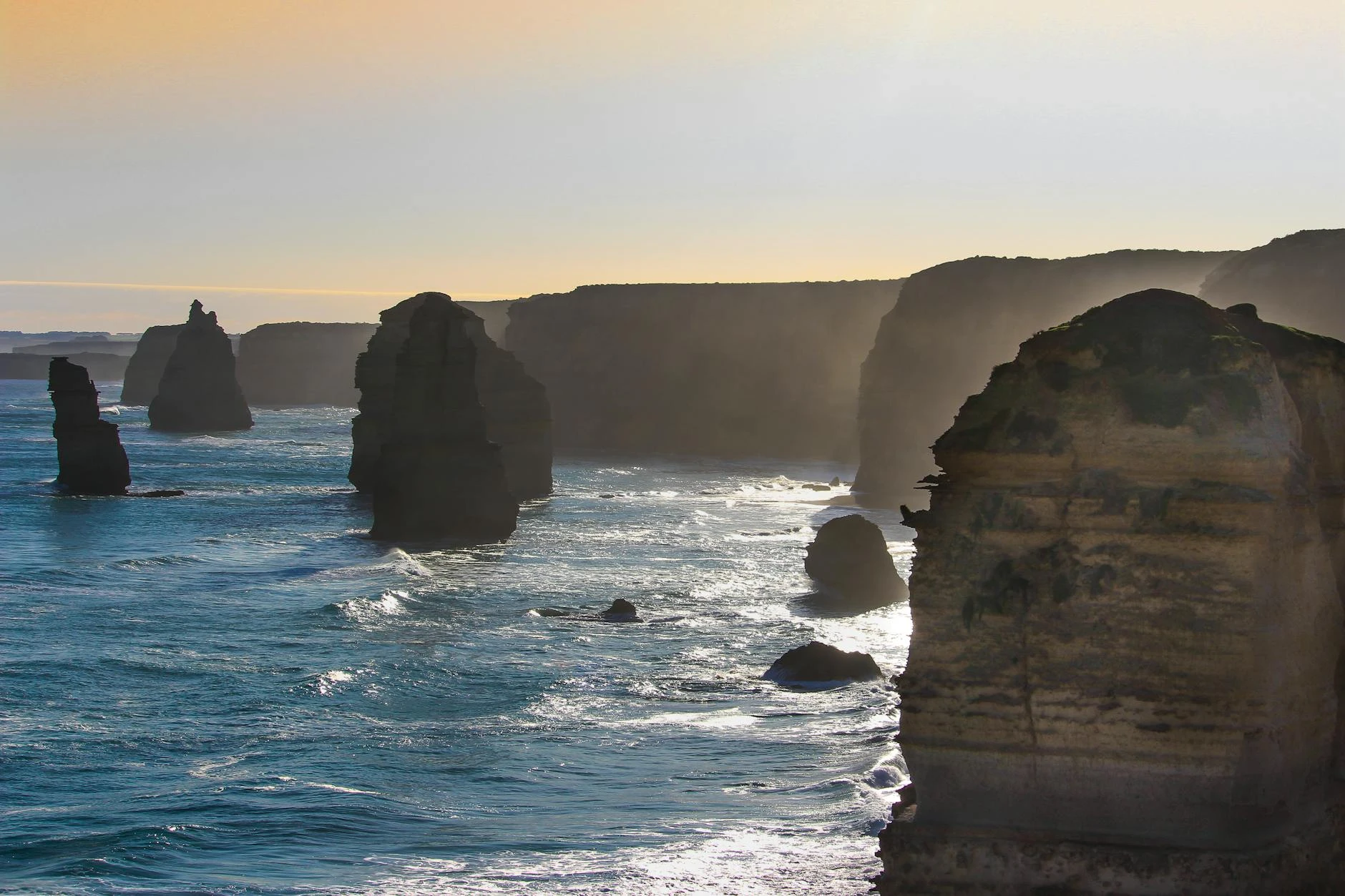
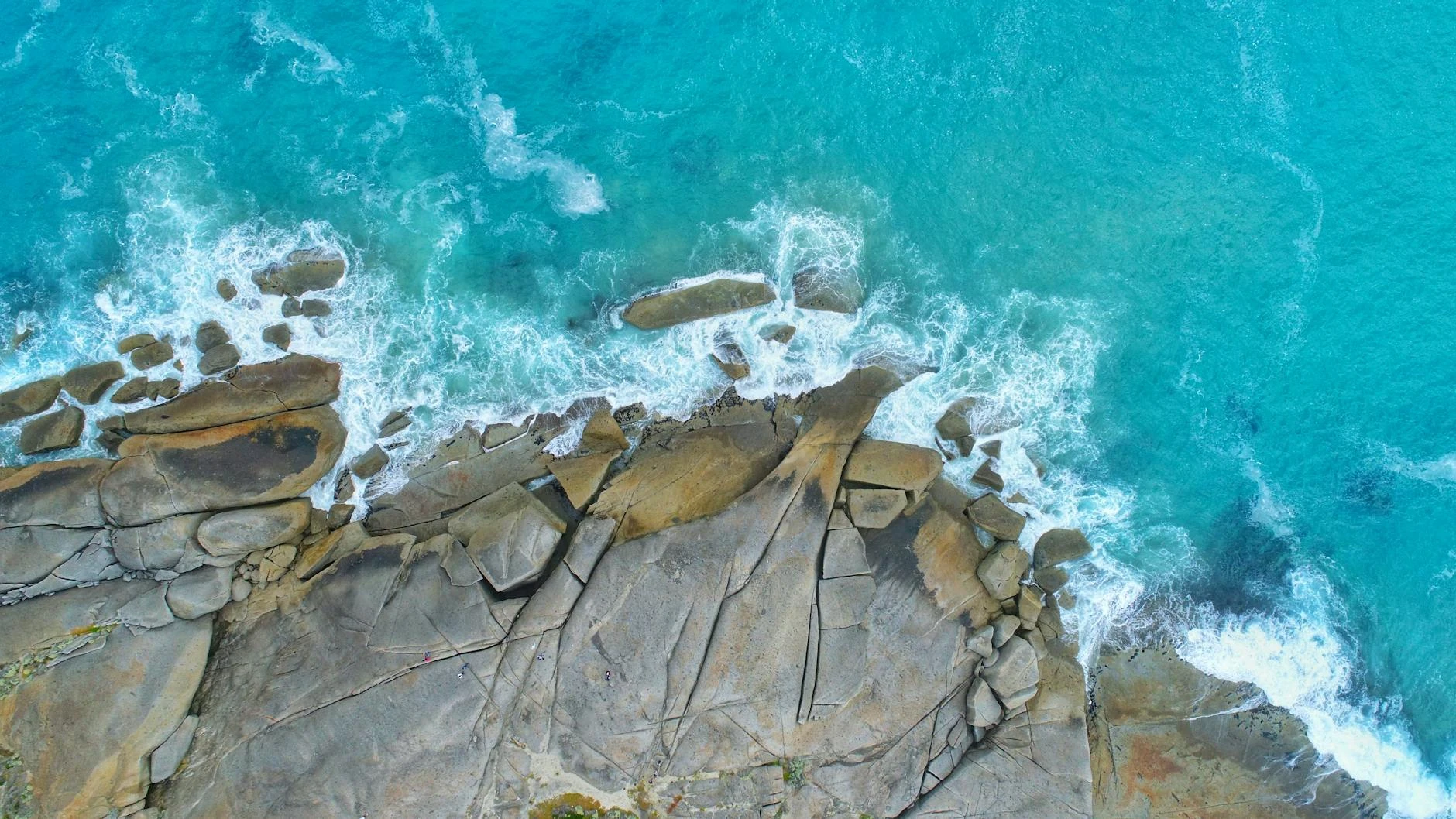
Wilsons Promontory National Park covers 500 square kilometres at the southern tip of Victoria and is one of the most visited national parks in Australia. The granite mountains of the promontory rise to 754 metres at Mount Latrobe and are surrounded on three sides by the Bass Strait. Tidal River is the main visitor hub with accommodation, a shop and a ranger station. The walking tracks from Tidal River access some of the best coastal scenery in Victoria, including Squeaky Beach (named for the squeaking sound of its quartz sand), Oberon Bay and the overnight walk to South Point lighthouse.
Before you go
Fuel at Foster - there is no fuel inside the park. A national park entry fee applies. During peak periods (Christmas and Easter) vehicle access is by timed entry permit, bookable through Parks Victoria. The road to Tidal River is fully sealed and well-maintained. Wombats on the road at dusk and dawn are the main hazard - they move slowly and do not react to headlights. Do not drive the park road at night if you can avoid it.
See a routing error?
Flag itWorth stopping for
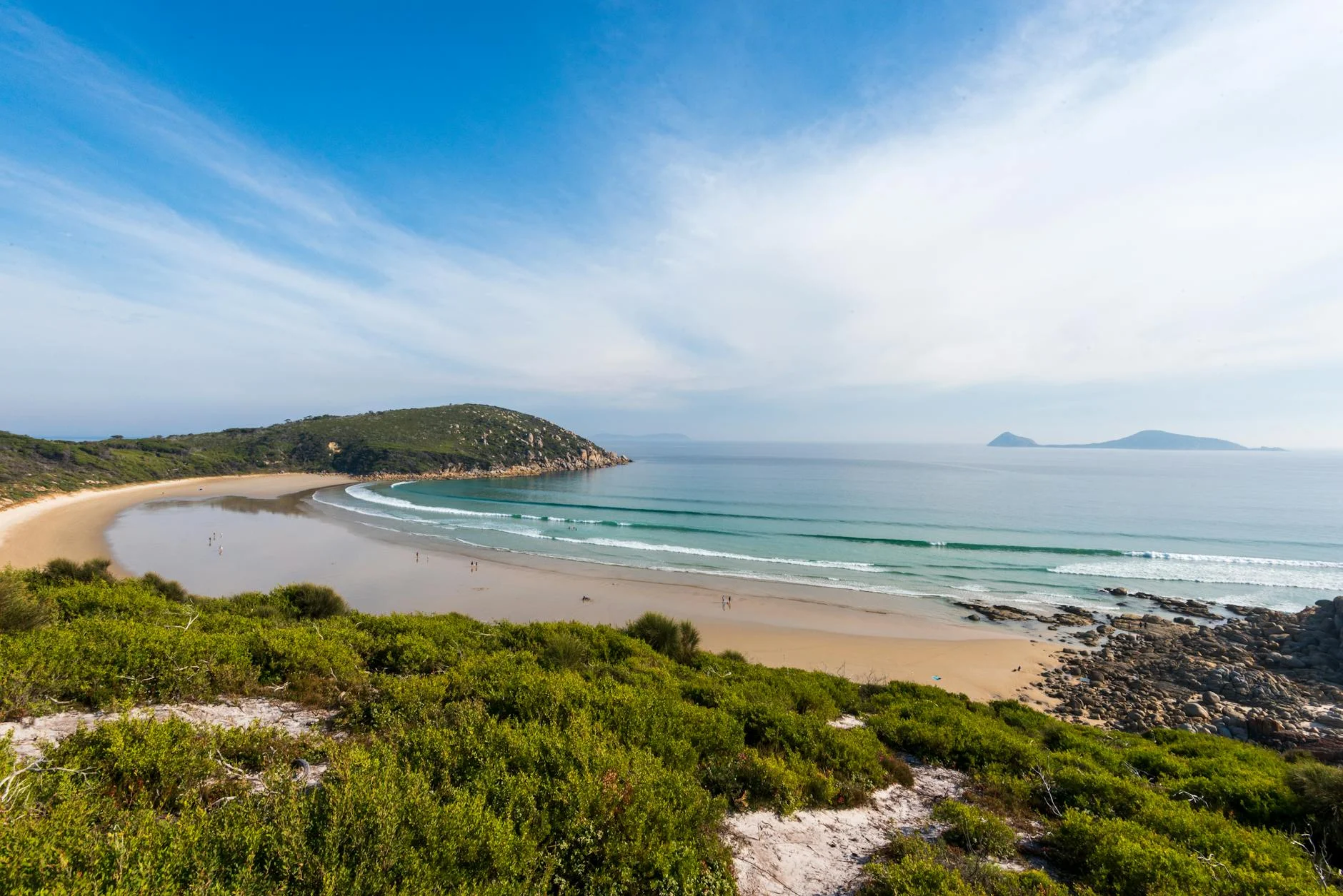
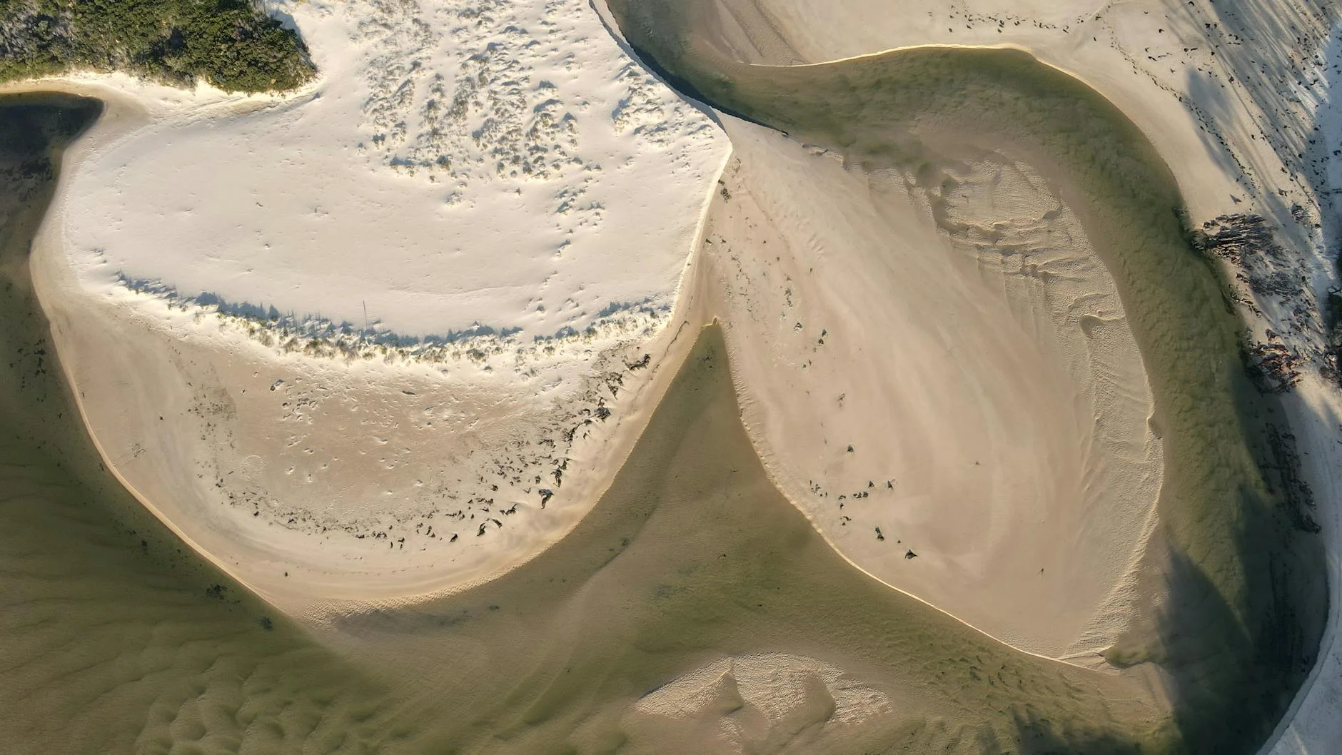
Squeaky Beach
A pure quartz sand beach that audibly squeaks when you walk on it, 20 minutes on foot from Tidal River campground - the most distinctive beach experience in Victoria.
South Point Lighthouse Track
A 19km return walk to Australia's southernmost mainland lighthouse, accessible only on foot from Tidal River - plan an overnight camp if you want to do it properly.
Route
Start
Foster
End
Tidal River
Gallery
More roads like this