Great Ocean Road
243 km
distance
4h 30m
Contour time
7.4
avg score
Sealed
surface
Scenery
Victoria
The Great Ocean Road passes through three distinct landscapes. The Surf Coast (Torquay to Lorne) is tight coastal road...
Road quality
7.4 RQS
Strong. Above average on most quality signals.
Accessibility
Fully sealed
Best in Sports car. Peak season: Year-round.
7-day forecast
Smooth sealed road the whole way. The cliff sections from Anglesea to Lorne are the tightest and most technical. Past Apollo Bay the road climbs into the Otways before opening onto the Shipwreck Coast - wider and faster but with the Apostles and Gorge at the end.
Scored 7.4/10 by Contour's road quality algorithm across curviness, surface, elevation and traffic. Best suited for sports car drivers.
The road
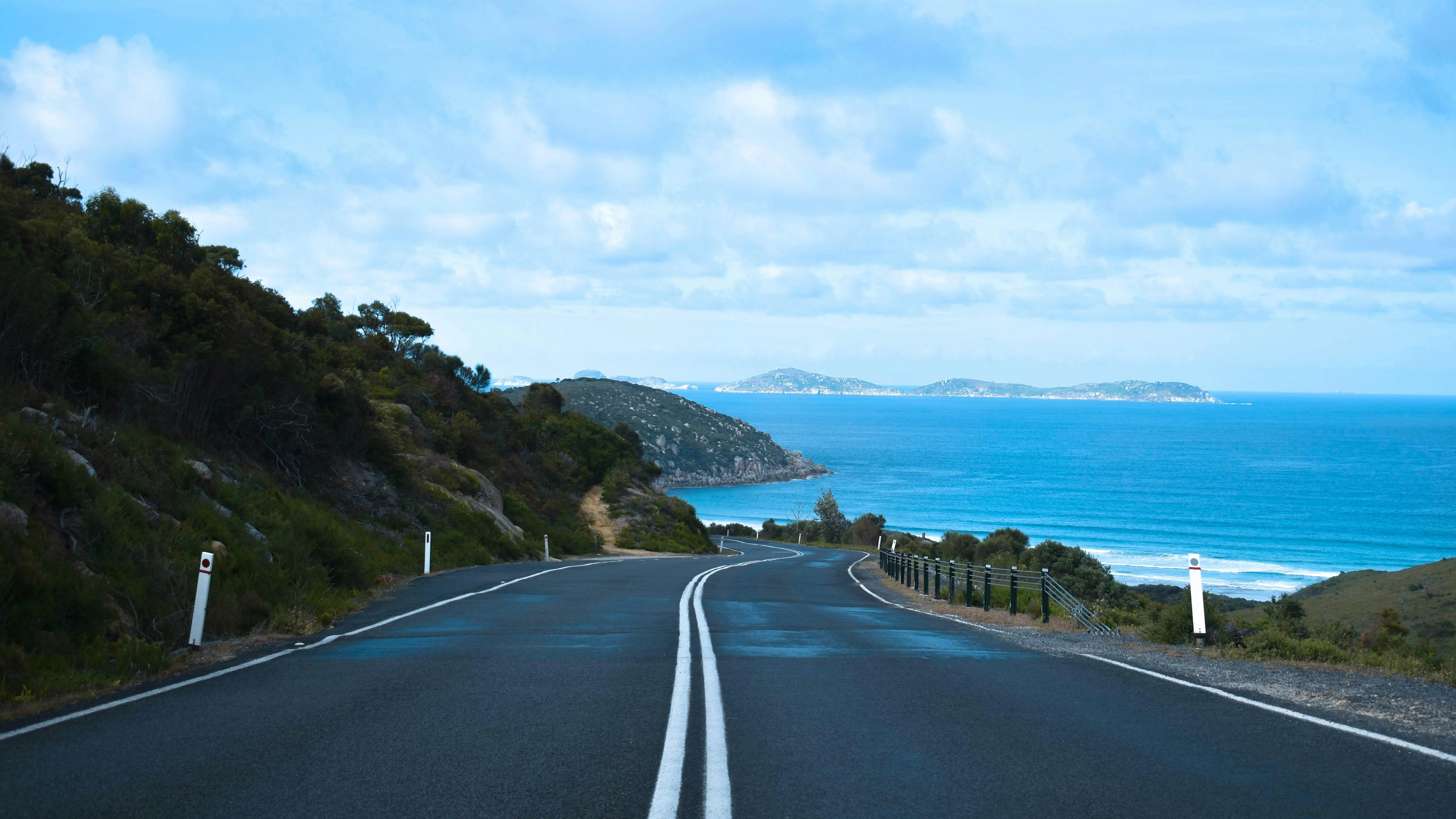
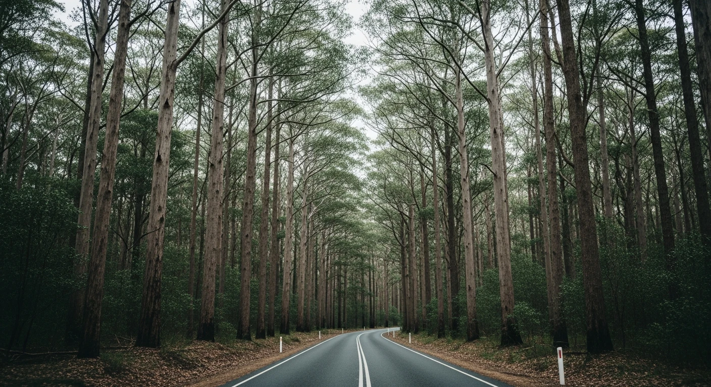
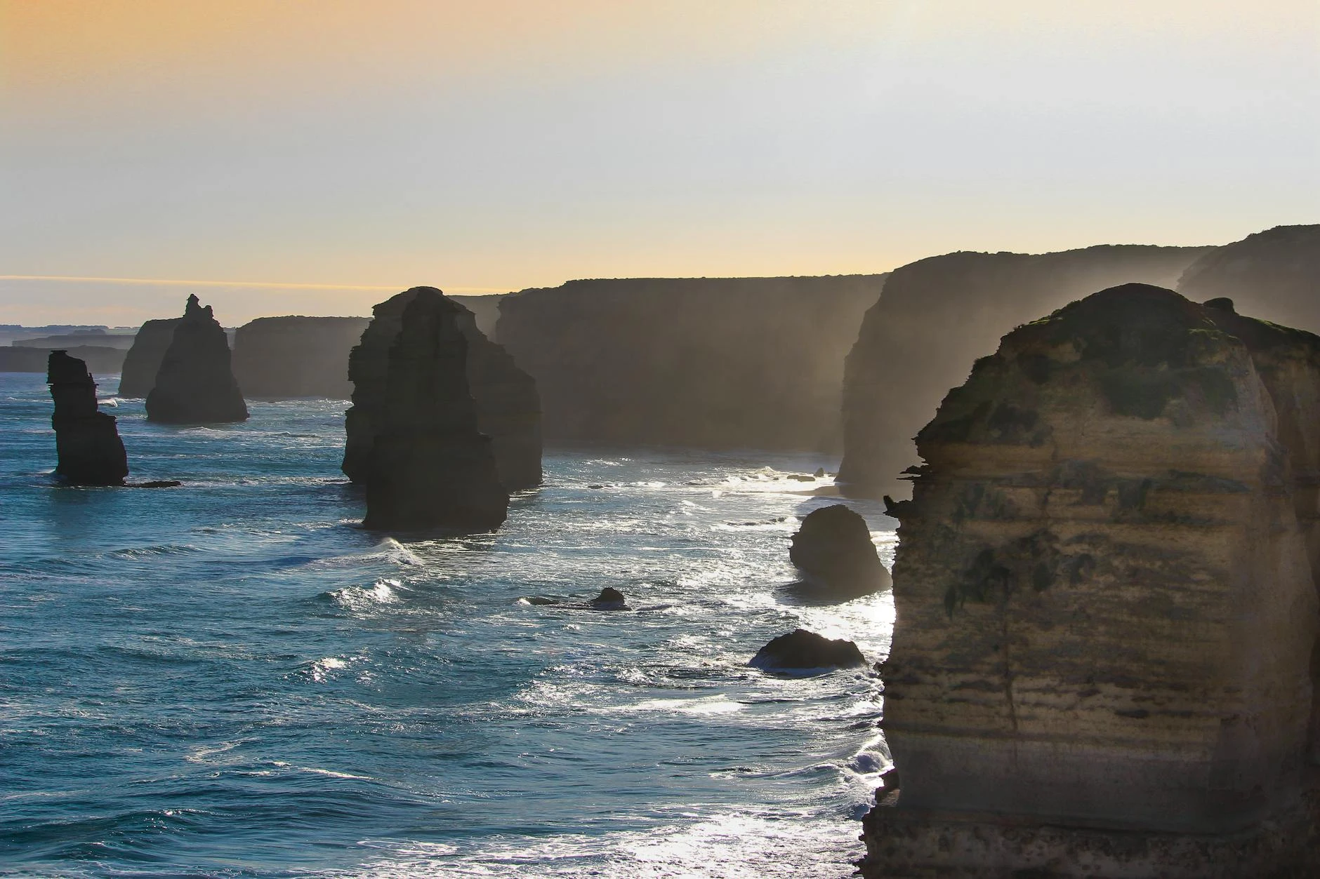
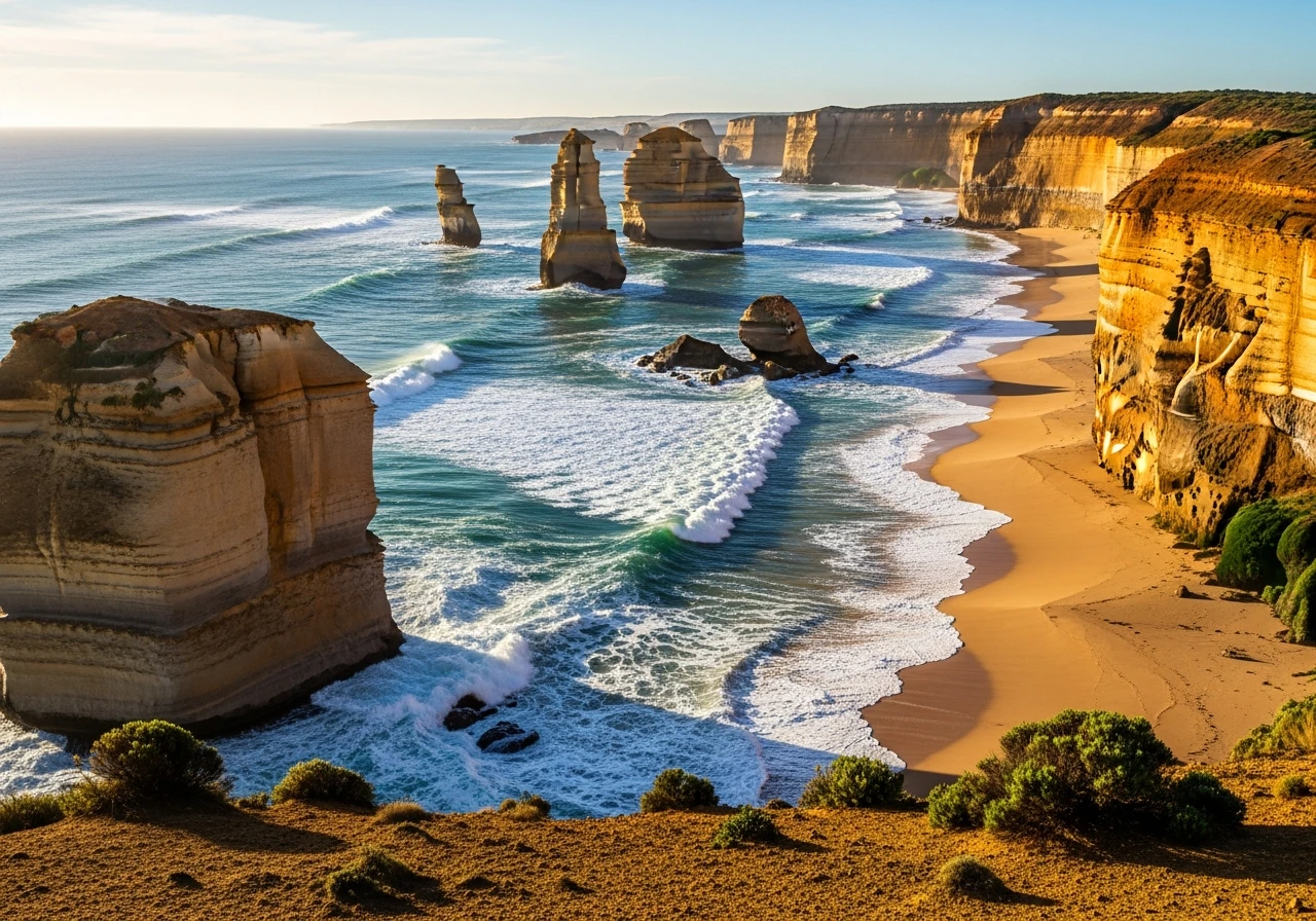
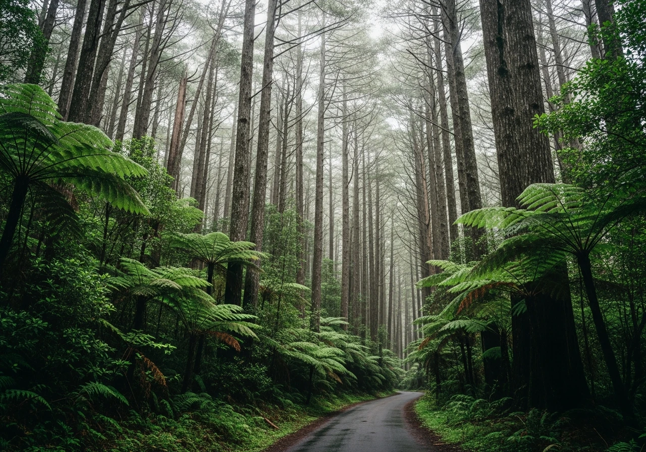
The Great Ocean Road runs 243 km from Torquay to Allansford, built entirely by hand between 1919 and 1932 by returned servicemen as a memorial to the fallen. It is Australia's most famous drive and earns the reputation. The first section - Torquay to Lorne - is tight and technical. Past Anglesea the road narrows and the cliffs close in, the ocean visible hundreds of metres below. Aireys Inlet, Fairhaven and Lorne sit at intervals along the cliff face. After Lorne the road climbs through the Otway Ranges before descending into Apollo Bay. From Apollo Bay the road tracks inland through the Otways - dense eucalypt forest, steep gullies, no mobile coverage - before breaking out onto the Shipwreck Coast near Princetown. This is where the character of the road changes. The cliffs flatten and the geology shifts to soft limestone eroded by the Southern Ocean. The Twelve Apostles are first visible from the viewpoint at Gibson Steps, where you can walk down to the beach and stand at the base of the stacks. Further west, Loch Ard Gorge is quieter and worth more time than most people give it. The gorge is named after the iron clipper that wrecked here in 1878, killing 52 of 54 people on board. London Arch, just past Port Campbell, collapsed in 1990 while tourists were standing on it - two people were stranded on the newly formed arch for several hours. The final section from Port Campbell to Allansford is straight and fast, a deliberate contrast to everything that came before.
The Great Ocean Road runs 243 km from Torquay to Allansford, built entirely by hand between 1919 and 1932 by returned servicemen as a memorial to the fallen.
Why this road
The region
The Great Ocean Road passes through three distinct landscapes. The Surf Coast (Torquay to Lorne) is tight coastal road above limestone cliffs, the spiritual home of Australian surfing. The Otway Ranges (Lorne to Princetown) is mountain ash and rainforest with near-zero traffic once you leave Apollo Bay. The Shipwreck Coast (Princetown to Allansford) is open, windswept limestone with the Twelve Apostles, Loch Ard Gorge and London Arch along the cliff edge. Each section has its own character and the road makes more sense when you understand you are driving through three different places, not one.
History
The Great Ocean Road was built entirely by hand between 1919 and 1932 by 3,000 returned servicemen. It was conceived as both a memorial to those who died in World War I and a public works project for men struggling to re-enter civilian life. It remains the world's largest war memorial. The Shipwreck Coast section earned its name before the road existed - over 80 vessels wrecked on this stretch of coastline between 1836 and 1908, drawn too close by inaccurate charts and the ferocious Southern Ocean swell.
Before you go
Allow a full day - 270 minutes of drive time plus stops is a genuine day out. Fuel at Torquay, Lorne, Apollo Bay and Port Campbell. There is nothing between Lorne and Apollo Bay. Mobile coverage drops out completely through the Otways. The Twelve Apostles car park fills by 9am in summer - go before 8am or after 3pm. The Apostles viewing platform is 10 minutes walk from the car park. Loch Ard Gorge has its own separate car park 2 km west and is significantly quieter. The road is open year-round. Westerly swells push spray onto the cliff sections in winter. Summer school holidays make the Torquay to Lorne section frustratingly slow on weekends.
See a routing error?
Flag itWorth stopping for
Bells Beach
One of Australia's most famous surf breaks, 10 minutes from Torquay - worth a walk to the viewing platform above the break.
Gibson Steps, Port Campbell
Stairs cut into the limestone cliff face leading to a beach at the base of the Apostles. You can walk up to the stacks at low tide - the best way to understand the scale of them.
Loch Ard Gorge
2 km west of the Apostles. A narrow ocean gorge named after the 1878 shipwreck that killed 52 people. Quieter than the Apostles and worth 30 minutes.
Cape Otway Lightstation
One of Australia's oldest surviving lighthouses (1848), reached via a sealed road through the Otways from Apollo Bay. Open daily for self-guided tours.
Route
Start
Torquay
End
Allansford
Gallery
More roads like this