Mundaring
10 km
distance
15 min
Contour time
7.0
avg score
Sealed
surface
Scenery
Western Australia
Mundaring Weir was one of the great engineering achievements of early Australian history. The 560-kilometre Goldfields...
Road quality
7.0 RQS
Every segment scored on 40+ data signals.
Accessibility
Fully sealed
Best in Sports car. Peak season: Year-round.
7-day forecast
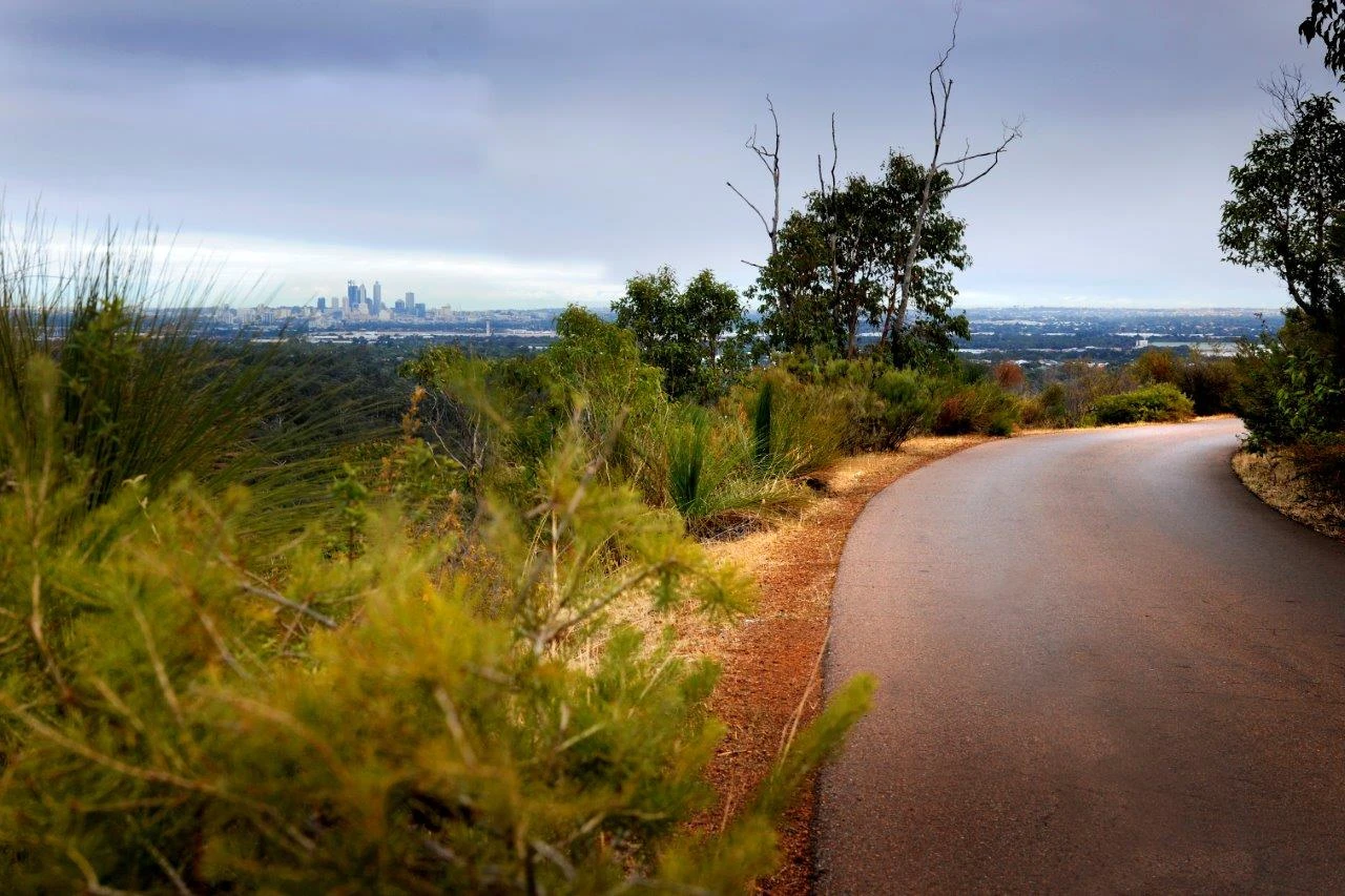
Good sports car and motorbike road. The 2024 Tarmac West ran 'Parkerville' stages (5.81 km each) in this area. The reservoir shoreline section is atmospheric early in the morning.
Scored 7.0/10 by Contour's road quality algorithm across curviness, surface, elevation and traffic. Best suited for sports car drivers.
The road
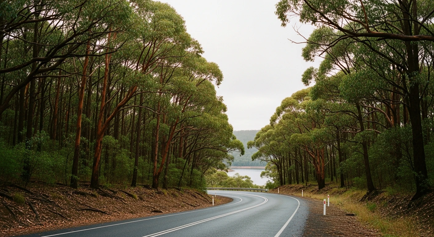
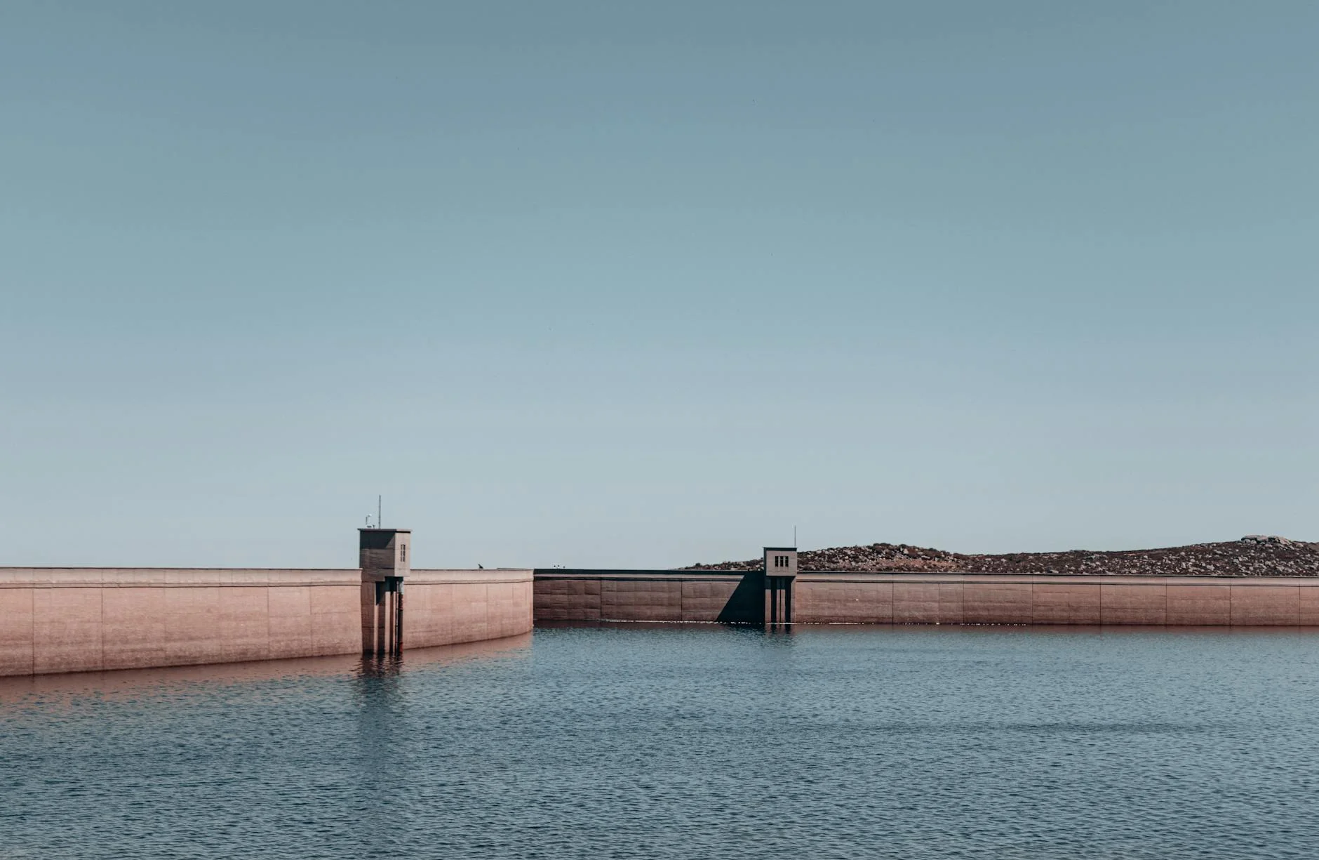
The Mundaring stage runs along Mundaring Weir Road between the weir and the township through jarrah forest along the Helena River valley. The Mundaring Weir was completed in 1902 to supply water to the Kalgoorlie goldfields via a 560-kilometre pipeline - an engineering achievement that is still in use today and one of the most significant in Australian history. The road follows the reservoir shoreline for the opening section before climbing through jarrah forest to the township. The 2024 Tarmac West rally ran 'Parkerville' stages in this area at 5.81 km each pass, though the full road between the weir and township is approximately 10 km. Mundaring township has good food and a weekend market. The Mundaring Weir Hotel overlooks the reservoir and is a popular stop for Sunday lunch. The weir itself has picnic facilities and walking tracks along the old pipeline route.
The Mundaring stage runs along Mundaring Weir Road between the weir and the township through jarrah forest along the Helena River valley.
Why this road
The region
Mundaring Weir was one of the great engineering achievements of early Australian history. The 560-kilometre Goldfields Water Supply Scheme pipeline carried water from the Darling Range to the Kalgoorlie goldfields, completed in 1903. The dam and pipeline system are still operational. The reserve around the weir contains excellent jarrah forest and the reservoir is a popular picnic destination for Perth residents.
Before you go
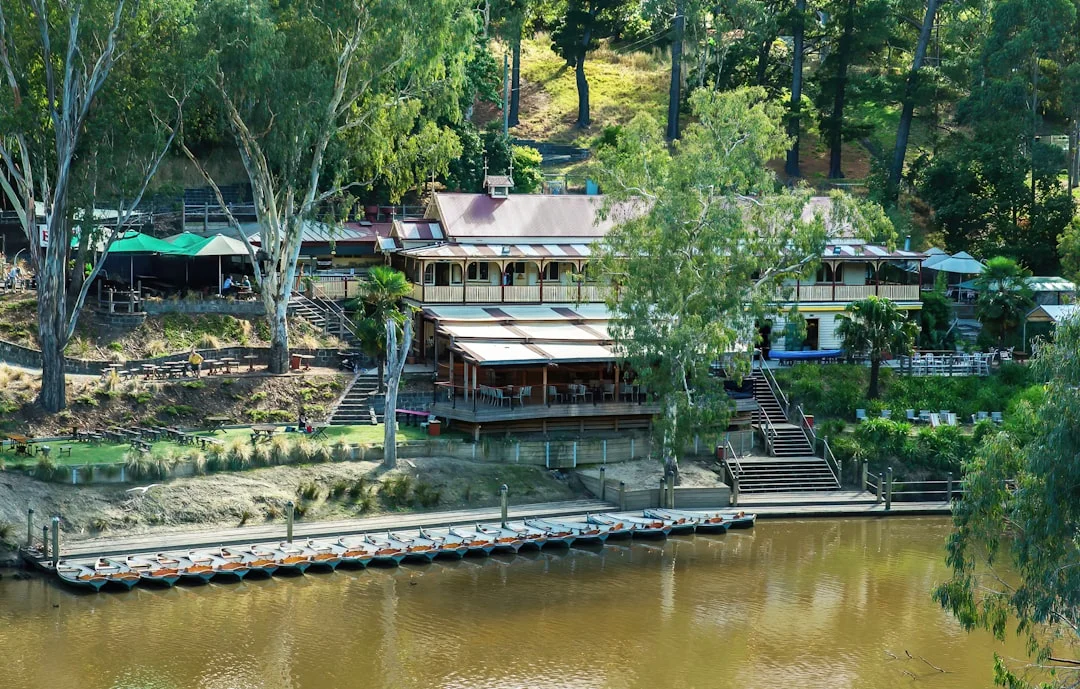
Fuel in Mundaring. The Mundaring Weir Hotel is open for meals and has good views of the reservoir. Weir area has picnic facilities and walking tracks. The Helena River follows the road for much of the route. Open year-round.
See a routing error?
Flag itWorth stopping for
Mundaring Weir and No. 1 Pumping Station
The 1902 dam and goldfields pipeline infrastructure - one of WA's most significant engineering heritage sites.
Mundaring Weir Hotel
Historic hotel overlooking the reservoir, open for lunch and dinner with good views.
Route
Start
Mundaring Weir
End
Mundaring Township
Gallery
More roads like this