Dead Horse Gap
8 km
distance
12 min
Contour time
7.6
avg score
Sealed
surface
Scenery
New South Wales
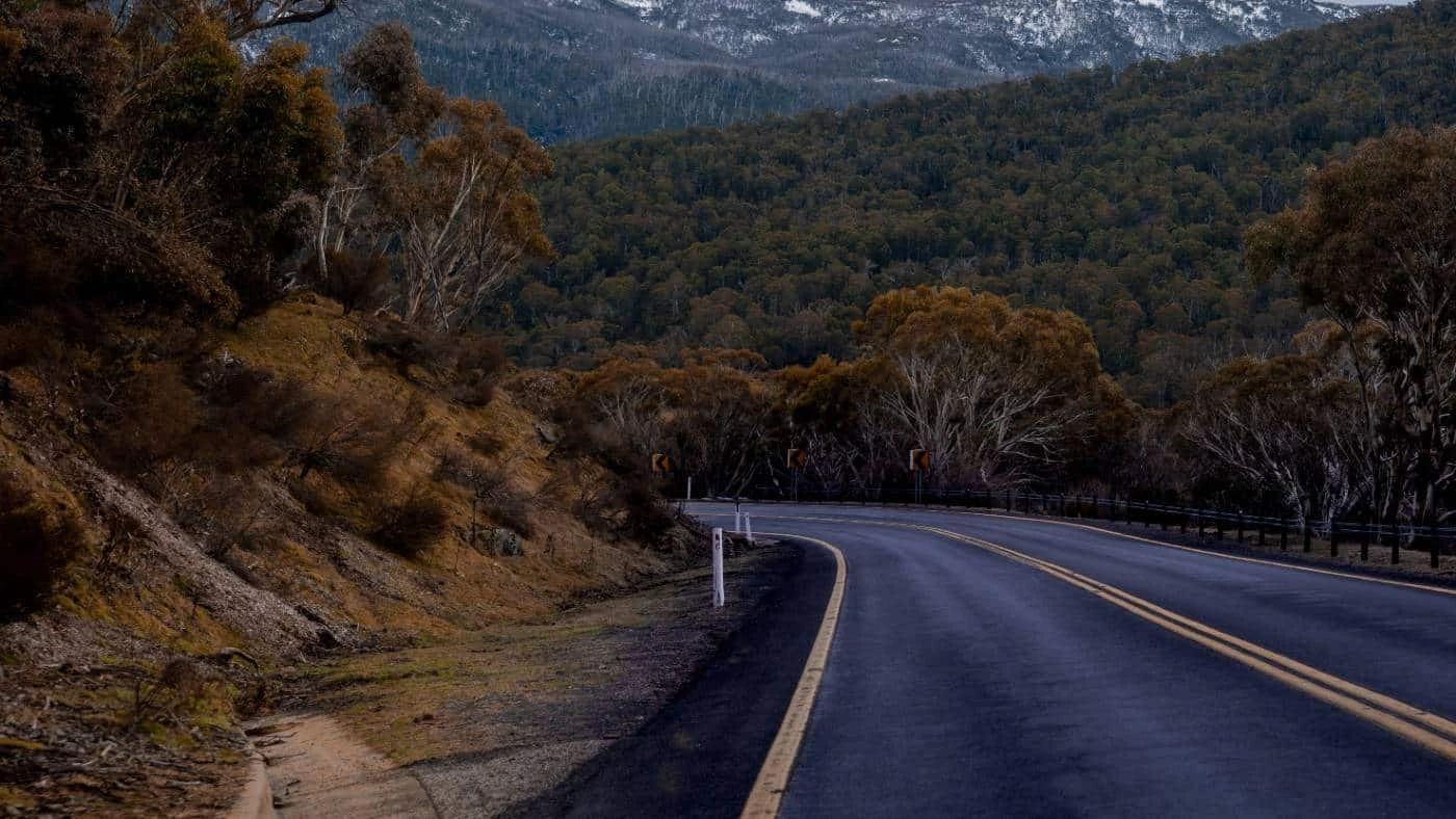
Dead Horse Gap sits at 1,580 metres on the Alpine Way between Thredbo and the Victorian border. The gap is one of the...
Road quality
7.6 RQS
Strong. Above average on most quality signals.
Accessibility
Fully sealed
Best in Motorbike & Rally. Peak season: Nov-Apr.
7-day forecast
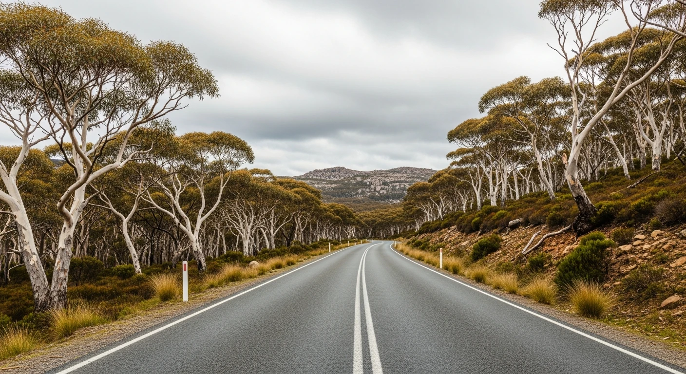
Outstanding motorbike road. Sports car equally rewarding. The snowgum woodland above 1,400 metres is one of the best alpine road environments in Australia.
Scored 7.6/10 by Contour's road quality algorithm across curviness, surface, elevation and traffic. Best suited for motorbike & rally drivers.
The road
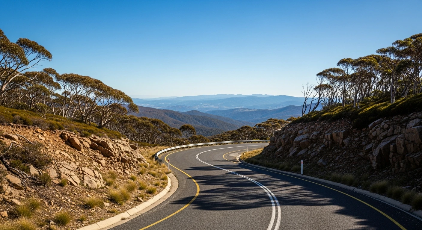
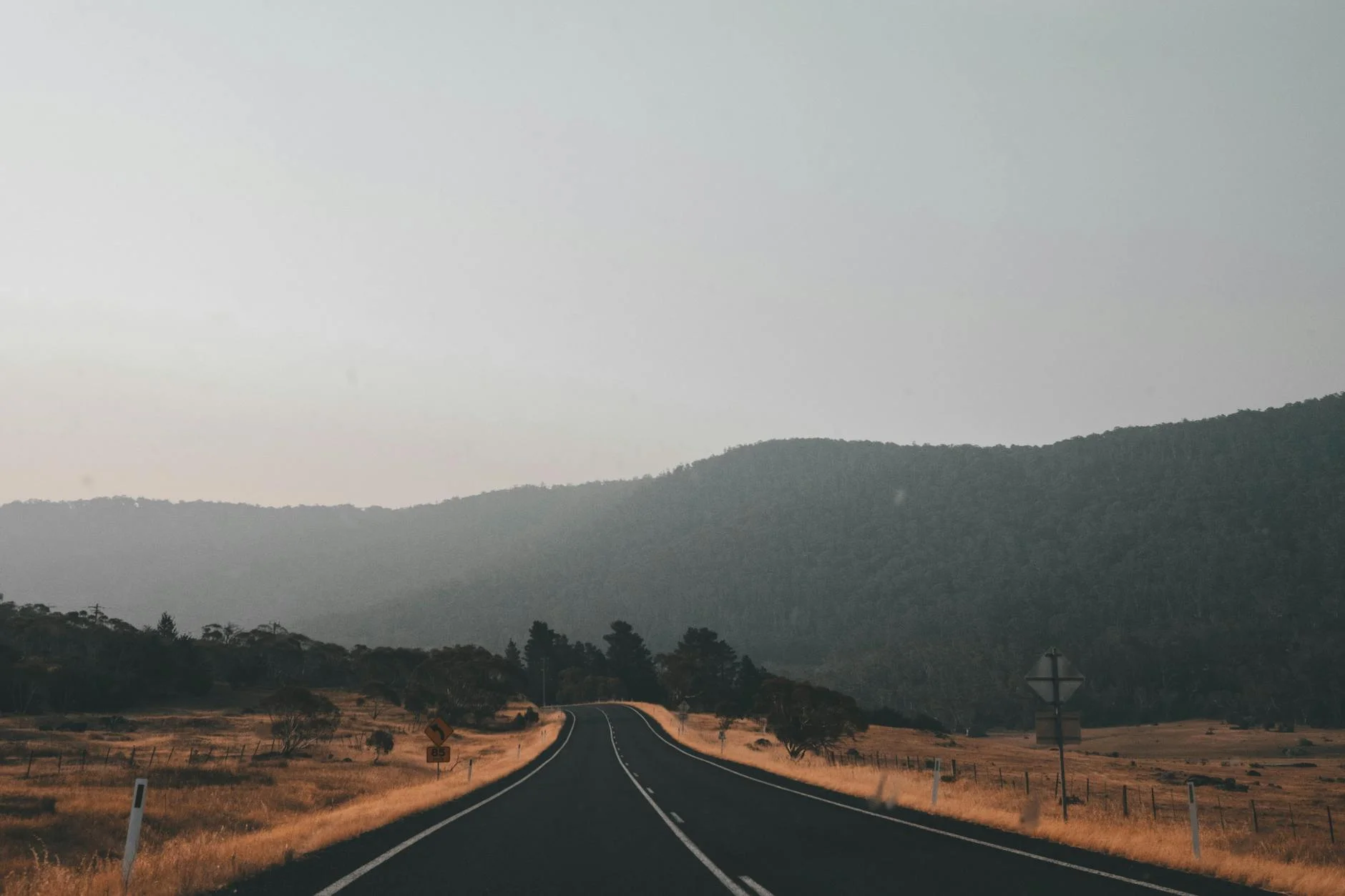
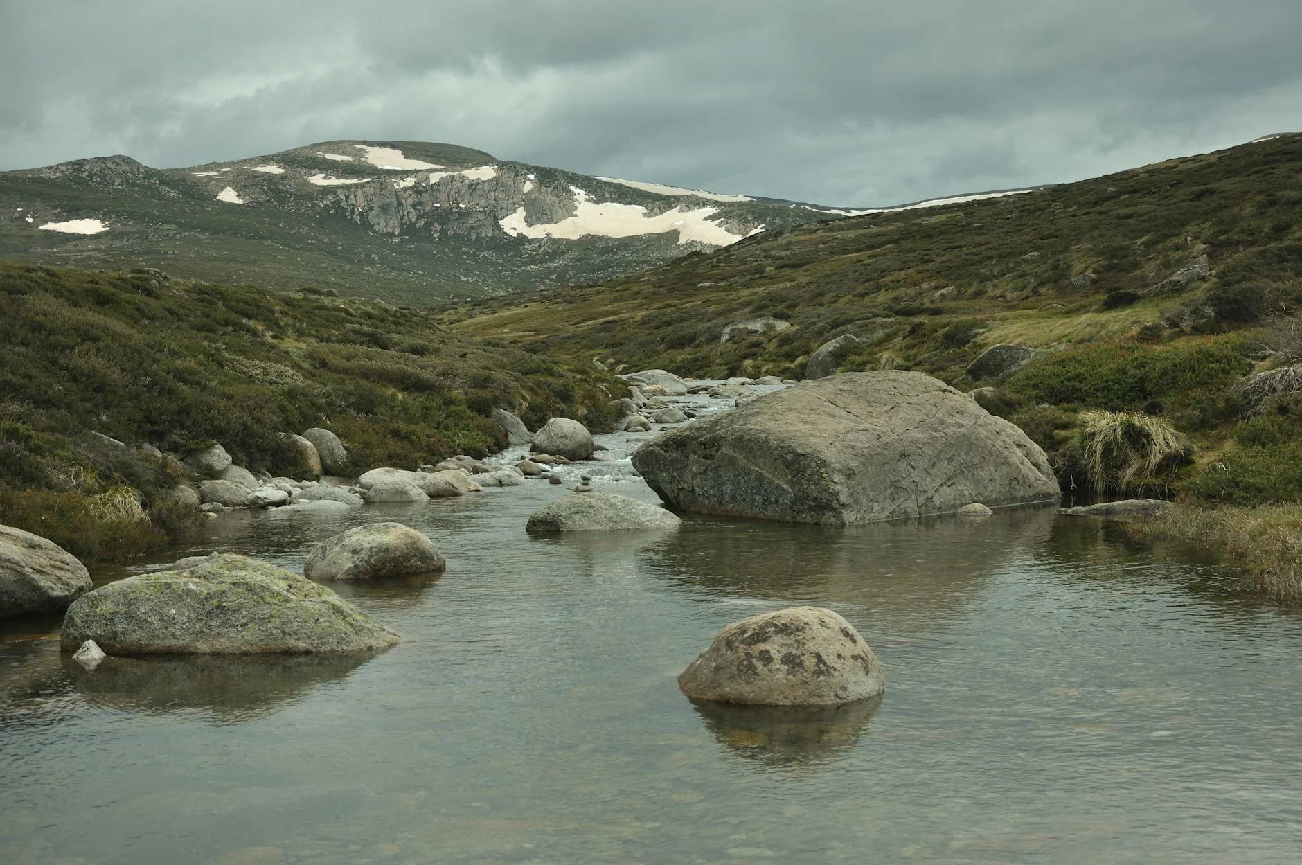
These are not rally stages. No event has ever closed Dead Horse Gap - it is simply one of the best short drives in Australia. The 8-kilometre route climbs from Thredbo Village through snowgum woodland to the gap at 1,580 metres where the Alpine Way crosses the Main Range and the Great Dividing Range. The road was built to service the ski resorts and is maintained to a higher standard than most alpine roads in the country. The snowgum woodland above 1,400 metres is open and beautiful - twisted grey trunks, golden grass, and the sound of wind through the grass when the car is stopped. The gap itself is the watershed between the Thredbo/Snowy system and the Murray River - it looks south into Victoria on one side and north into the Snowy Mountains National Park on the other.
Why this road
The region
Dead Horse Gap sits at 1,580 metres on the Alpine Way between Thredbo and the Victorian border. The gap is one of the main crossings of the Main Divide in the Australian Alps. The surrounding country is Kosciuszko National Park - no fencing, no development, and the alpine landscape uninterrupted in all directions.
Before you go
Fuel in Thredbo Village. The road is open November to April and can close with snow at any time of year. Check conditions before departure. No services at the gap. The wind can be severe at the summit.
See a routing error?
Flag itWorth stopping for
Thredbo Village
Ski resort village with good food and accommodation. The logical base for the Snowy circuit.
Dead Horse Gap walk
Short walk from the gap into the alpine heath country above the road - open landscape above the treeline.
Route
Start
Thredbo Village
End
Dead Horse Gap
Gallery

More roads like this