Simpson Desert WAA Line
640 km
distance
96h
Contour time
2.3
avg score
Unsealed
surface
Scenery
South Australia
The Simpson Desert covers 176,500 square kilometres across South Australia, Queensland and the Northern Territory. It...
Road quality
2.3 RQS
Every segment scored on 40+ data signals.
Accessibility
Fully sealed
Best in 4WD modified. Peak season: May-September.
7-day forecast
Modified 4WD with long-range fuel tank, snorkel and full recovery kit. The WAA Line features double-crested dunes that are harder than the French Line or QAA Line alternatives. This is expedition-grade 4WD touring - vehicle failure in the desert interior is a survival situation.
Scored 2.3/10 by Contour's road quality algorithm across curviness, surface, elevation and traffic. Best suited for 4wd modified drivers.
The road
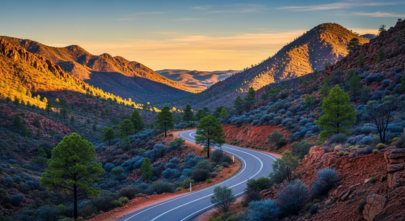
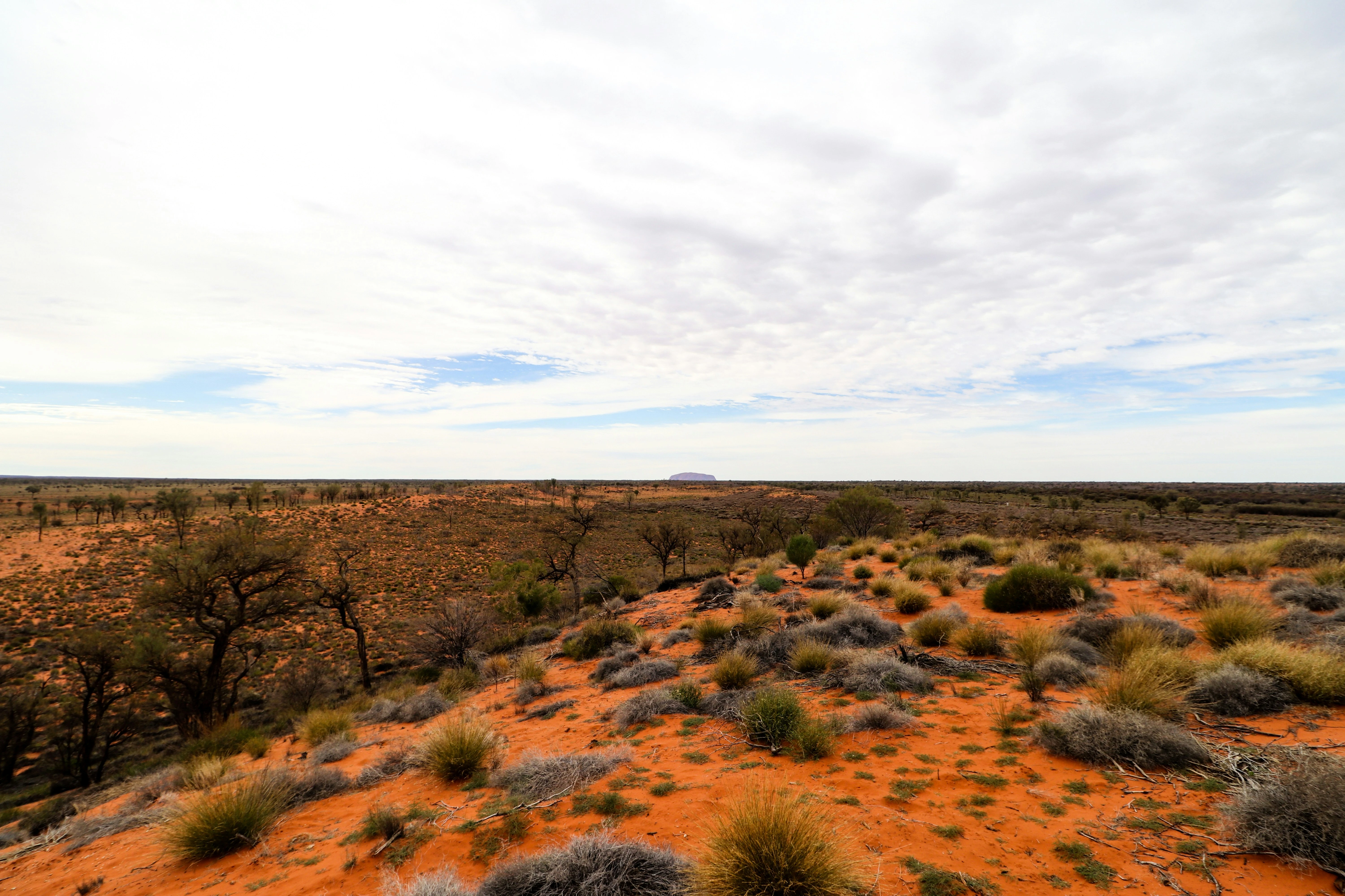
The Simpson Desert crossing on the WAA Line is one of Australia's great expedition 4WD routes. The 640-kilometre route runs from Dalhousie Springs on the western edge of the desert to Birdsville on the eastern edge, crossing more than 1,000 parallel sand dunes that run north-south across the desert interior. The WAA Line is considered harder than the more popular French Line because its dunes feature double crests - two ridges per dune rather than one, requiring two momentum runs per crossing. The desert is starkly beautiful. Between the dunes the valleys are flat, firm and surprisingly vegetated in a good season - spinifex, desert oaks and wildflowers after rain. The dune crests are bare red sand, sculpted by wind into shapes that change with each storm. Navigation follows the survey line markers placed during seismic exploration for oil and gas. Without GPS these markers would be the only navigation aid. Poeppel Corner marks the intersection of the South Australian, Queensland and Northern Territory borders - a survey marker in the middle of the desert that has become a pilgrimage point for desert crossers. Dalhousie Springs at the western end is a natural artesian hot spring on the edge of the Simpson, and one of the best camping spots in the Australian outback - warm water in a desert setting. Big Red, the tallest dune at the Birdsville end, is the traditional finish line. The crossing takes four to six days depending on conditions and there is no assistance available between the start and finish points.
The Simpson Desert crossing on the WAA Line is one of Australia's great expedition 4WD routes.
Why this road
The region
The Simpson Desert covers 176,500 square kilometres across South Australia, Queensland and the Northern Territory. It is the world's largest sand dune desert, with over 1,100 parallel dunes running north-south. The desert is part of the Lake Eyre Basin and floods after exceptional rain events, though this is rare. The surrounding country is gibber desert and pastoral land. Access points are Dalhousie Springs (west), Birdsville (east) and Mount Dare (southwest). The desert is managed jointly by South Australia, Queensland and the Northern Territory, each with their own permit and access requirements.

Before you go
A Desert Parks Pass is required. Register your trip with SA Police before entering. Carry minimum 40 litres of extra water and 40 litres of extra fuel beyond your vehicle's tank capacity. A satellite communicator and EPIRB are not optional. Two full-size spare tyres minimum. The crossing is strictly May to September - summer temperatures exceed 50 degrees in the desert interior and are fatal for stranded travellers. Travel in convoy with at least one other vehicle. Allow four to six days. Fuel at Dalhousie Springs homestead (limited, expensive) and Birdsville. No other fuel on the route.
See a routing error?
Flag itWorth stopping for
Dalhousie Springs
Natural artesian hot springs on the western edge of the Simpson. Warm water in a desert oasis. One of the best bush camps in Australia.
Mount Dare Hotel
The last pub before the desert, southwest of Dalhousie. Cold beer, fuel, mechanical advice and stories from other desert crossers.
Route
Start
Dalhousie Springs
End
Birdsville QLD
Gallery

More roads like this