Oodnadatta Track
614 km
distance
16h
Contour time
4.1
avg score
Unsealed
surface
Scenery
South Australia
The country between Marree and Marla is the arid heart of South Australia. The landscape is dominated by gibber desert...
Road quality
4.1 RQS
Every segment scored on 40+ data signals.
Accessibility
Fully sealed
Best in 4WD. Peak season: May-September.
7-day forecast
Accessible to any stock 4WD with decent clearance and good tyres. The road is mostly graded gibber and dirt, occasionally corrugated. The challenge is distance and isolation, not terrain. Two spare tyres recommended for the sharp gibber stones.
Scored 4.1/10 by Contour's road quality algorithm across curviness, surface, elevation and traffic. Best suited for 4wd drivers.
The road
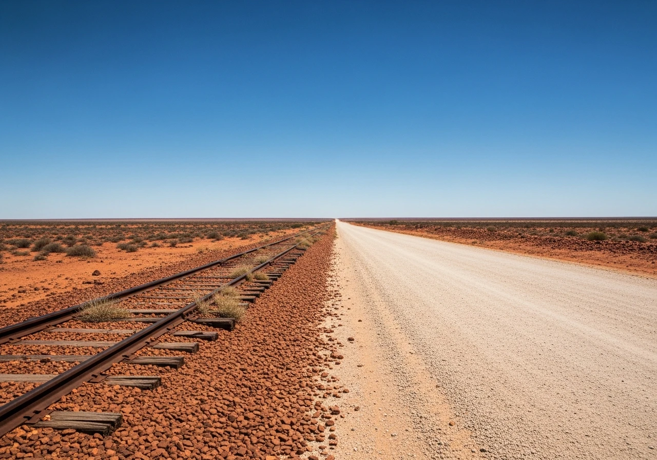
The Oodnadatta Track runs 614 kilometres through the South Australian outback from Marree to Marla, following the alignment of the original Ghan Railway that connected Adelaide to Alice Springs until 1980. The track is one of Australia's iconic outback routes and it earns the status through landscape rather than difficulty. The terrain is flat gibber desert, salt lake margins and red sand country that stretches to the horizon in every direction. The first section from Marree crosses the gibber plains - flat, stony desert where the sharp stones can shred tyres that are underinflated or worn. The artesian mound springs at Coward Springs and Wabma Kadarbu are the natural highlights. These springs bubble up through the Great Artesian Basin, creating small oases of green in the surrounding desert. Some have been developed for camping with basic facilities. William Creek sits roughly at the midpoint and holds the title of South Australia's smallest town - population around 10, with a pub that serves as the social, commercial and logistical centre of an area larger than some European countries. The walls of the William Creek Hotel are covered in notes, hats and memorabilia left by passing travellers over decades. Beyond William Creek the track passes through Coober Pedy-adjacent country before reaching Marla on the Stuart Highway. The old Ghan Railway ruins are visible at intervals - abandoned sidings, collapsed water tanks and rusted rail still sitting on the sleepers. The railway was relocated to a new western alignment in 1980 because the original route flooded regularly at Lake Eyre.
Why this road
The region
The country between Marree and Marla is the arid heart of South Australia. The landscape is dominated by gibber desert - flat plains of wind-polished stones sitting on red clay - broken by salt lakes, sand dunes and the occasional artesian spring. Annual rainfall averages under 150mm and summer temperatures exceed 45 degrees. The pastoral stations out here run cattle and sheep across properties that cover thousands of square kilometres. Marree is the southern gateway, a small outback town where the Oodnadatta Track and the Birdsville Track diverge.

Before you go
Fuel at Marree, William Creek and Oodnadatta. Carry at least 20 litres of extra water and enough fuel to cover the longest gap between stops (roughly 200 km). Two full-size spare tyres recommended - the gibber stones are sharp and punctures are common. The track can close after rain - check conditions with the South Australian outback roads report before departing. Mobile coverage is absent for most of the route. The track is best driven May to September. Summer temperatures exceed 45 degrees and are dangerous for vehicle and occupant.
See a routing error?
Flag itWorth stopping for
William Creek Hotel
A genuine outback pub in a town of 10 people. Cold beer, basic meals and the best collection of traveller memorabilia on any wall in Australia.
Coward Springs campground
An artesian spring with a bush camping area and a warm spring-fed pool. One of the best free camps in the outback.
Route
Start
Marree
End
Marla
Gallery

More roads like this