Marree to William Creek / Lake Eyre
385 km
distance
6h
Contour time
1.5
difficulty
Unsealed
surface
Scenery
South Australia
The country around Lake Eyre is the lowest and driest in Australia. The lake sits in a depression in the Great Artesian...
Road quality
Grade 1.5
Every segment scored on 40+ data signals.
Accessibility
Fully sealed
Best in 4WD. Peak season: May-September.
7-day forecast
Stock 4WD with good clearance. The Oodnadatta Track section to William Creek is well-graded. The Lake Eyre access track is rougher - corrugated and sandy in places. Desert Parks Pass required for the Lake Eyre section.
Recommended gear: Spare tyre (full size), Tyre repair kit, Extra water (20L+), Extra fuel.
The road
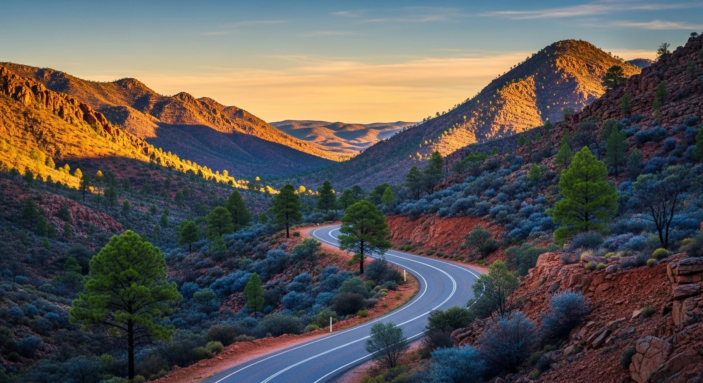
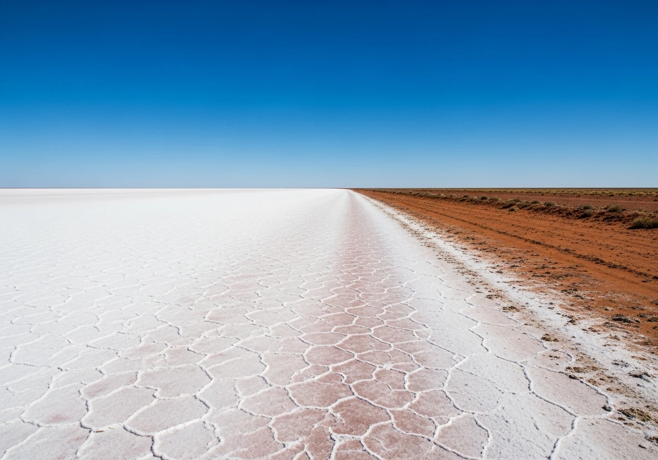
This route combines the first section of the Oodnadatta Track with the Lake Eyre access track to reach Halligan Bay on the shore of Australia's largest salt lake. The 204 kilometres from Marree to William Creek follows the Oodnadatta Track across gibber desert and past artesian mound springs. William Creek sits at the midpoint and is the staging point for the Lake Eyre detour. The town has a permanent population of around 10 people, a pub that covers an implausible amount of wall space with traveller memorabilia, and an airstrip that offers scenic flights over Lake Eyre. The Lake Eyre access track runs 60 kilometres from William Creek to Halligan Bay on the southern shore. This track is rougher than the Oodnadatta and requires more clearance - corrugated sections, sandy stretches and the final approach across the lake margin, which can be soft. A Desert Parks Pass is required for the Lake Eyre National Park section. Lake Eyre (Kati Thanda) is 9,690 square kilometres of salt pan that sits 15 metres below sea level, making it the lowest point in Australia. For most years the lake is dry - a vast white salt crust that extends beyond the visible horizon. When floods from Queensland's Channel Country reach the lake after exceptional rain events, it fills partially and becomes a breeding ground for pelicans, banded stilts and other waterbirds. The filled lake is one of the great natural spectacles in Australia. Anna Creek Station, which the track crosses, is the world's largest cattle station at 23,677 square kilometres - larger than Israel.
This route combines the first section of the Oodnadatta Track with the Lake Eyre access track to reach Halligan Bay on the shore of Australia's largest salt lake.
Why this road
The region
The country around Lake Eyre is the lowest and driest in Australia. The lake sits in a depression in the Great Artesian Basin, below sea level. The pastoral stations surrounding it - Anna Creek, Stuart Creek, Muloorina - run cattle across enormous areas of sparse gibber and saltbush country. Marree is the gateway town, sitting at the junction of the Oodnadatta Track and the Birdsville Track. The lake's Aboriginal name, Kati Thanda, was formally co-recognised in 2012.

Before you go
Fuel at Marree and William Creek (limited supply, premium price). A Desert Parks Pass is required for the Lake Eyre National Park section - purchase online or at the Port Augusta visitor centre before departure. Carry 20 litres of extra water and sufficient fuel for 300 km. The Lake Eyre access track can close after rain. Check conditions before departing William Creek. Scenic flights over the lake operate from William Creek airstrip - book ahead in peak season. Summer temperatures exceed 45 degrees. Best visited May to September.
See a routing error?
Flag itWorth stopping for
William Creek scenic flights
Light aircraft flights over Lake Eyre from the William Creek airstrip. The only way to see the full scale of the lake. Best when partially flooded.
Coward Springs
An artesian mound spring with bush camping and a warm pool, on the Oodnadatta Track between Marree and William Creek.
Route
Start
Marree
End
Halligan Bay, Lake Eyre
Gallery

More roads like this