Birdsville Track
517 km
distance
10h
Contour time
7.9
avg score
Unsealed
surface
Scenery
South Australia
The country between Marree and Birdsville straddles the border of South Australia and Queensland across some of the...
Road quality
7.9 RQS
Strong. Above average on most quality signals.
Accessibility
Fully sealed
Best in 4WD. Peak season: May-September.
7-day forecast
Stock 4WD with good ground clearance. The track is well-graded for most of its length and is the easiest of the classic outback routes. The challenge is distance and heat, not terrain. Two spare tyres recommended for the gibber sections.
Scored 7.9/10 by Contour's road quality algorithm across curviness, surface, elevation and traffic. Best suited for 4wd drivers.
The road
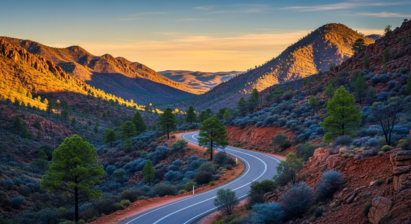
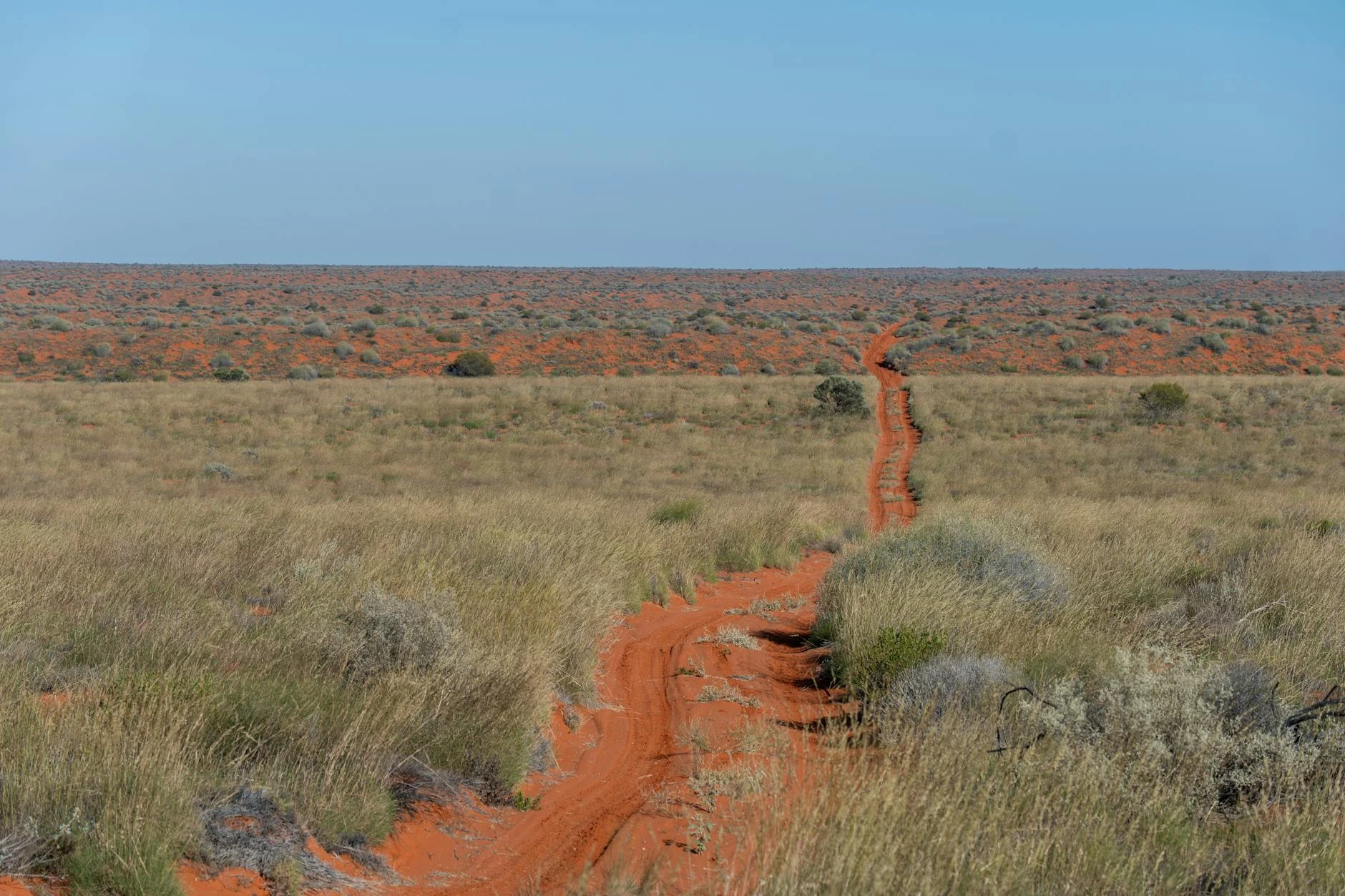
The Birdsville Track runs 517 kilometres from Marree in South Australia to Birdsville in southwest Queensland, following the route of the great cattle drives that moved stock from the Channel Country to the railhead at Marree. For over a century this was one of the busiest stock routes in Australia - drovers walked tens of thousands of cattle south along this track every year, relying on a chain of artesian bores drilled in the 1890s to water the stock at intervals. The track today is well-graded and accessible to any 4WD, but the landscape remains as vast and empty as it was during the droving era. The first section from Marree crosses gibber desert - the same flat stony country as the Oodnadatta Track. North of Lake Harry the landscape transitions to red sand country with low dunes and sparse mulga. The Diamantina River crossing near Birdsville marks the boundary between the stony country and the Channel Country, where the rivers spread across vast floodplains after rain. Birdsville itself is a town of around 100 people that swells to 7,000 for the annual Birdsville Races in September. The Birdsville Hotel is one of Australia's most famous outback pubs. Big Red, the tallest sand dune on the edge of the Simpson Desert, sits 35 km west of town and is the traditional starting point for Simpson Desert crossings. The Birdsville Track is often the first outback route attempted by 4WD tourers because the grading is reliable and the distances between fuel stops are manageable.
Why this road
The region
The country between Marree and Birdsville straddles the border of South Australia and Queensland across some of the most arid landscape on the continent. The gibber desert in the south gives way to red sand dunes and finally the Channel Country, where the Diamantina and Cooper Creek systems spread floodwaters across hundreds of kilometres after heavy rain in Queensland. This periodic flooding supports a pastoral industry based on opportunistic grazing - cattle stations that cover millions of hectares run stock when the country is green and destock when it dries out.

Before you go
Fuel at Marree, Mungerannie Roadhouse (halfway) and Birdsville. The Mungerannie gap is roughly 200 km from Marree - carry enough fuel for your vehicle's consumption plus a margin. Twenty litres of extra water minimum. Two spare tyres recommended. The track closes after rain and can remain closed for days - check with the SA and QLD road condition reports before departing. Summer driving is not recommended - temperatures exceed 45 degrees and vehicle breakdowns become survival situations. Best driven May to September.
See a routing error?
Flag itWorth stopping for
Birdsville Hotel
One of Australia's most iconic outback pubs. Cold beer, good food and a verandah overlooking the main street of a town that exists primarily because of the pub.
Big Red
The tallest sand dune on the eastern edge of the Simpson Desert, 35 km west of Birdsville. Accessible by 4WD. The traditional start line for Simpson crossings.
Route
Start
Marree
End
Birdsville QLD
Gallery

More roads like this