Old Telegraph Track
72 km
distance
10h
Contour time
7.8
avg score
Unsealed
surface
Scenery
Queensland
Cape York Peninsula north of Bramwell Junction is some of the most remote country in Australia accessible by vehicle....
Road quality
7.8 RQS
Strong. Above average on most quality signals.
Accessibility
Fully sealed
Best in 4WD modified. Peak season: June-October.
7-day forecast
The Old Telegraph Track is the concentrated essence of Cape York's creek crossings. Gunshot Creek has a near-vertical entry that drops 3 metres into a sandy creek bed. Nolan's Brook is the widest crossing - 40 metres of water up to bonnet depth. Palm Creek, Cockatoo Creek and Canal Creek are all genuine obstacles. A snorkel and winch are essential. Travel in convoy.
Scored 7.8/10 by Contour's road quality algorithm across curviness, surface, elevation and traffic. Best suited for 4wd modified drivers.
The road
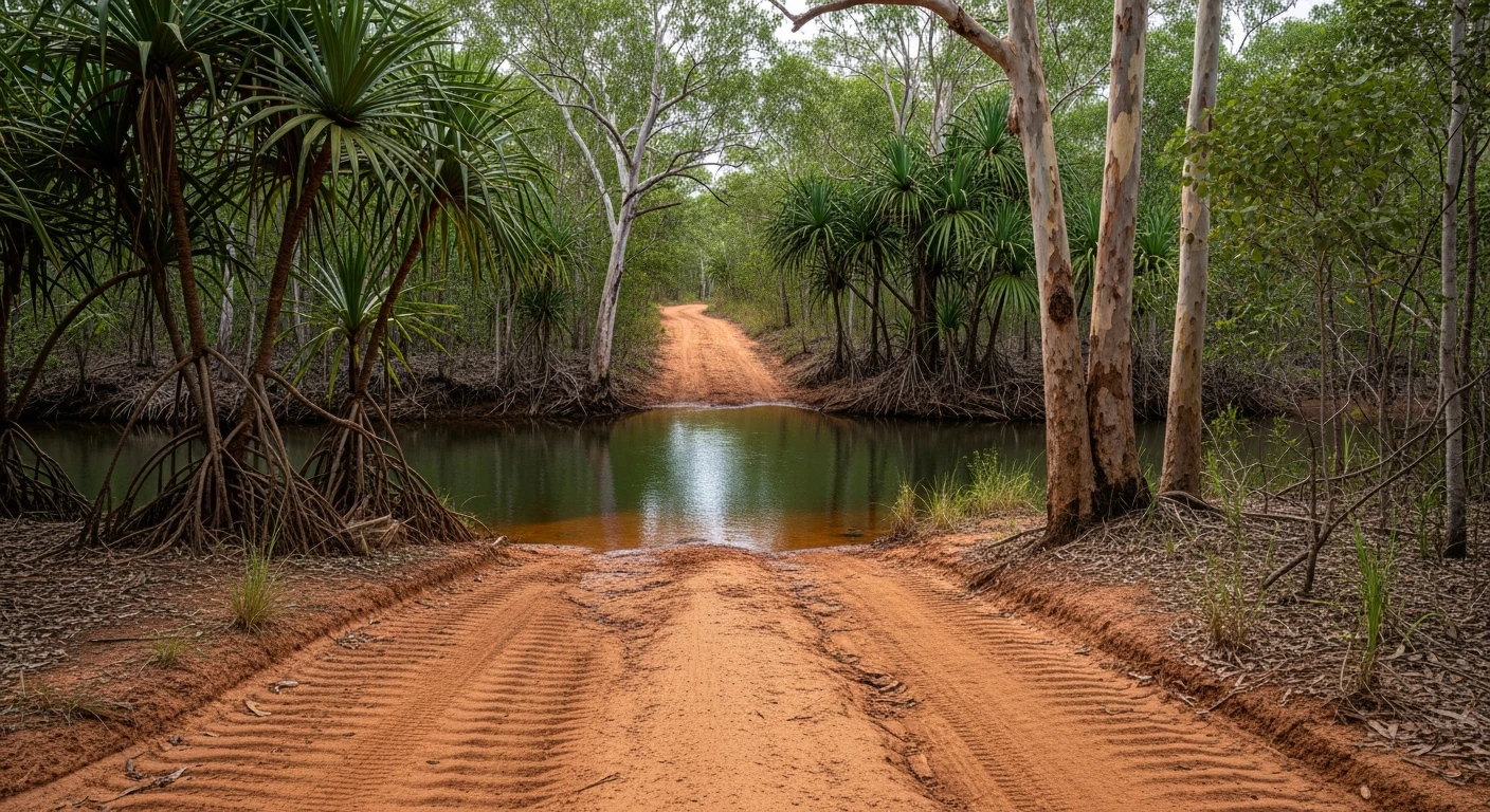
The Old Telegraph Track is 72 kilometres of the most famous creek crossings in Australian 4WD culture. It branches off the Peninsula Development Road at Bramwell Junction, roughly 200 kilometres south of the tip of Cape York, and follows the original 1886 telegraph line north to the Jardine River. The PDR bypass road runs parallel and gets you to the same place on graded gravel - but nobody drives to Cape York for graded gravel. Gunshot Creek is the crossing that defines the track. The entry is a near-vertical 3-metre drop off a clay bank into a sandy creek bed. Vehicles queue here. People film each other. Panels get dented, bumpers get ripped off, and occasionally a vehicle rolls. The smart approach is to walk it first, pick your line and commit. After Gunshot the crossings come in quick succession - Cockatoo Creek, Sailor Creek, Canal Creek, Nolan's Brook and Palm Creek all present their own challenges. Nolan's Brook is the widest - a 40-metre crossing through water that can reach bonnet height in the early dry season. The country between crossings is flat tropical savannah on sandy red soil with paper-bark woodland and termite mounds. The landscape is ancient and unchanged. Crocodiles are present in every waterway - freshwater crocs in most, saltwater crocs in some. Do not wade to check depth. Use a long stick from the bank. The Jardine River at the northern end is crossed by ferry - the only way across, as the river is deep, wide and home to large saltwater crocodiles. The OTT is the heart of any Cape York trip. People plan entire expeditions around these 72 kilometres.
The Old Telegraph Track is 72 kilometres of the most famous creek crossings in Australian 4WD culture.
Why this road
The region
Cape York Peninsula north of Bramwell Junction is some of the most remote country in Australia accessible by vehicle. The landscape is flat tropical savannah broken by creek systems that drain from the peninsula's central ridge to the coast. The indigenous communities of Bamaga, Seisia and Injinoo sit near the tip. Bamaga has a supermarket and fuel. The Jardine River National Park surrounds the northern section of the track. Wet season flooding closes the track entirely from November to May and the creeks remain dangerously high into June in a big wet year.

Before you go
Fuel at Bramwell Junction Roadhouse and Bamaga (after the Jardine River ferry). No fuel on the track. The Jardine River ferry operates dry season only and requires a fee. Carry satellite communicator - there is no mobile coverage north of Bramwell. Travel in convoy of minimum two vehicles. Walk every crossing before driving it. Crocodiles are present - never enter the water on foot. Allow two full days for the 72 kilometres if you are attempting every crossing without bypasses. The bypasses around Gunshot and Nolan's Brook exist but are not necessarily easier - they are longer and have their own mud holes and obstacles.
See a routing error?
Flag itWorth stopping for
Tip of Australia
The northernmost point of the Australian mainland, reached via a further 40km track from Bamaga. The monument at the tip is the reason most people drive to Cape York.
Fruit Bat Falls
A clean swimming waterfall in the Jardine River National Park - one of the few confirmed croc-free swimming spots in the area. Worth a half-day stop.
Route
Start
Bramwell Junction
End
Jardine River
Gallery

More roads like this