Telegraph Track
580 km
distance
40h
Contour time
3.9
avg score
Unsealed
surface
Scenery
Queensland
Cape York Peninsula is the largest mostly-intact tropical wilderness in Australia. It extends 800km north from Cooktown...
Road quality
3.9 RQS
Every segment scored on 40+ data signals.
Accessibility
Fully sealed
Best in 4WD modified. Peak season: May-October.
7-day forecast
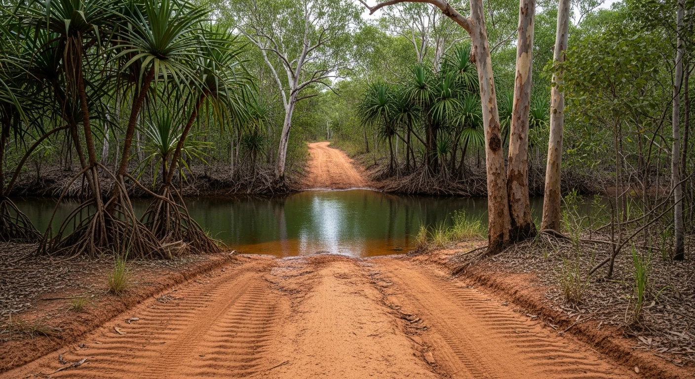
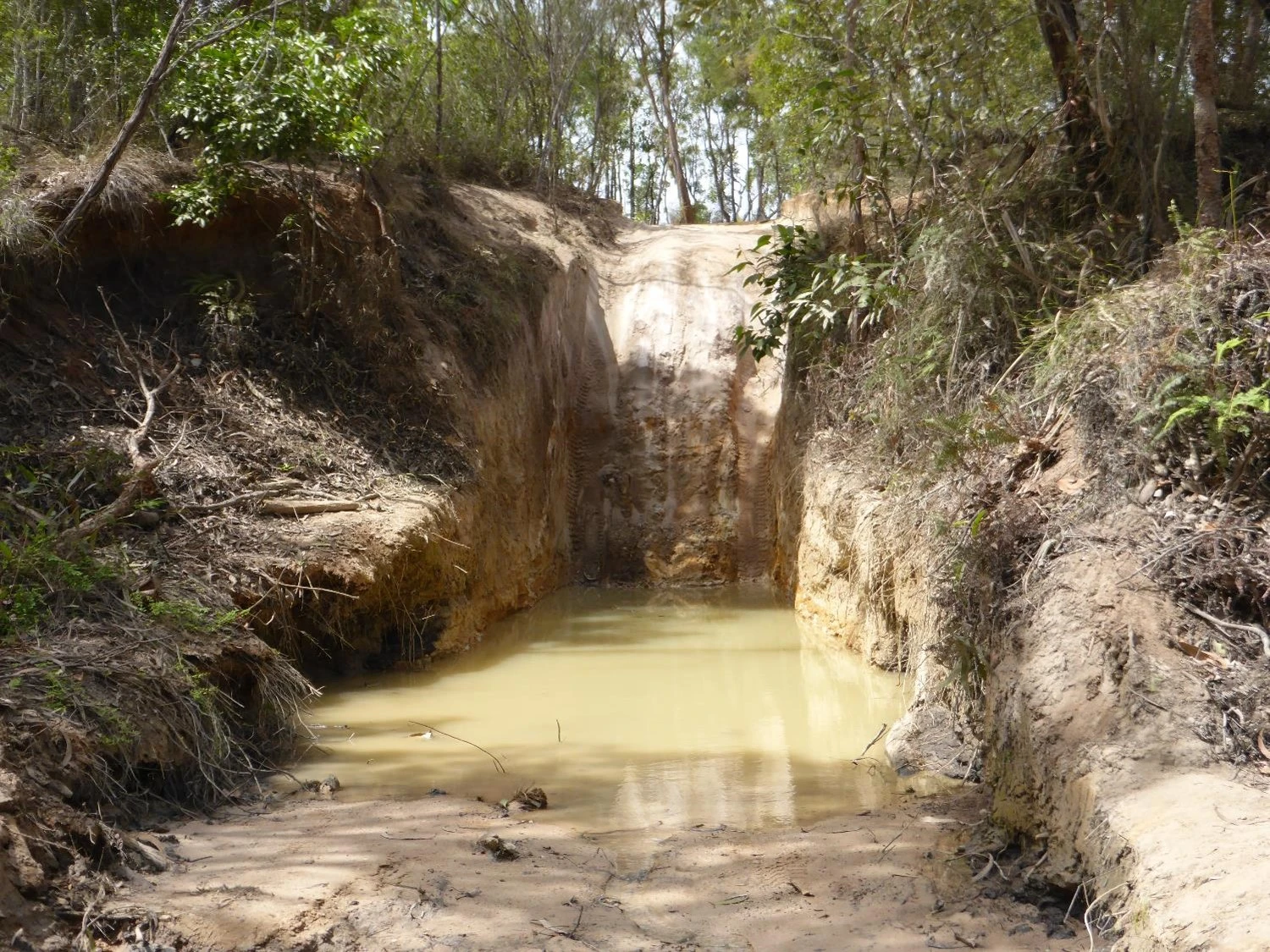
The original Telegraph Track requires a snorkel for the major crossings - Gunshot Creek and Nolan's Brook can be chest-deep in the wet season and remain deep for weeks after. In dry season they drop to 600mm-1m. A modified 4WD is strongly preferred. The bypass tracks around Gunshot and the creek crossings are available but are harder in their own ways.
Scored 3.9/10 by Contour's road quality algorithm across curviness, surface, elevation and traffic. Best suited for 4wd modified drivers.
The road
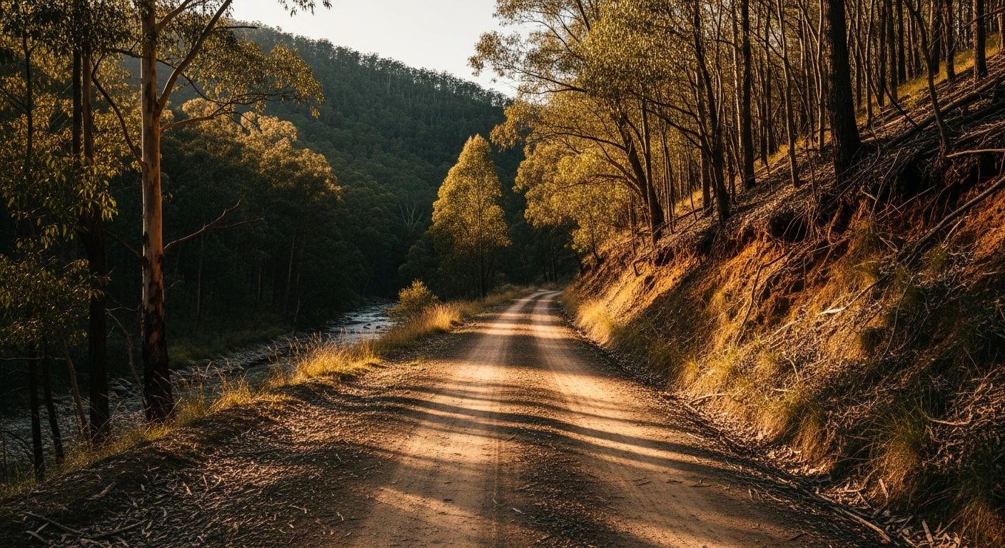
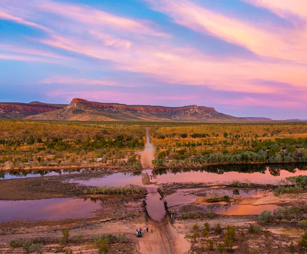
The Telegraph Track is what 4WD touring in Australia is measured against. The 580-kilometre run from Musgrave Roadhouse to Bamaga follows the route of the 1880s overland telegraph line up the spine of Cape York Peninsula - the last great wilderness track on the continent. The track is corrugated red dirt through open savannah woodland for most of its length, interrupted by the river crossings that define the trip: Bertie Creek, Kimba Creek, Nolan's Brook and, most famously, Gunshot Creek. Gunshot is a near-vertical entry into a sandy creek bed and a near-vertical exit on the far side - the kind of obstacle where vehicle damage is common and crowding around it is the social centre of any Cape trip. The creek is 600mm to 1m deep in the heart of the dry season. Deeper, more dangerous, and inaccessible earlier in the season. Each river crossing has a bypass track that avoids the main entry, but the bypasses are not easier - they are longer and have their own hazards. The landscape above the crossings is ancient, flat, red and silent. The wetlands around the Wenlock River are crocodile habitat. The scrub at the northern end thickens into tropical rainforest. Bamaga at the tip is a small community, not a tourist town - the endpoint is the monument at the Tip of Australia, reached via a further 40km of track from town.
The Telegraph Track is what 4WD touring in Australia is measured against.
Why this road
The region
Cape York Peninsula is the largest mostly-intact tropical wilderness in Australia. It extends 800km north from Cooktown to the Torres Strait. The Peninsula Development Road (PDR) provides the sealed alternative to the Telegraph Track, but the two run roughly parallel and intersect several times, allowing crews to use the PDR for fuel and services while driving the track between. Fuel at Musgrave, Moreton Telegraph Station, Archer River Roadhouse, Coen and Weipa (via detour). The communities of Coen and Laura are the main service points. The Wet season (November to April) closes the track entirely. The crossing at the Wenlock River has washed away caravans and drowned vehicles - treat it with serious respect.

History
The track follows the 1886 overland telegraph line built to connect Australia's eastern colonies with the Torres Strait Islands. The line was operational until the 1980s. Many of the creek crossings used by 4WD vehicles today are the same crossings used by the telegraph linemen's horses and the Cape York cattle drives of the early 20th century.
Before you go
Drive only in the dry season - May to October. Wet season flooding makes the track impassable and dangerous. Fuel: Musgrave, Archer River Roadhouse, Coen, Weipa (detour). No Telstra coverage for most of the run - satellite communicator is not optional. EPIRB or PLB required for solo travel. Carry minimum 20 litres extra water. Vehicle minimum: capable 4WD with a snorkel, full recovery kit, two spare tyres. Tyre punctures are common on the corrugated rocky sections near the creek approaches. Budget 5-7 days for the full track from Musgrave to Bamaga without rushing the crossings.
See a routing error?
Flag itWorth stopping for
Lakefield National Park
Queensland's largest national park, accessible from the PDR south of Musgrave. Prolific birdlife and wetlands with crocodile spotting.
Thursday Island
Ferry from Seisia near Bamaga - a worthwhile overnight add-on for anyone who has made it to the tip.
Route
Start
Musgrave Roadhouse
End
Bamaga
Gallery

More roads like this