Great Alpine Road
110 km
distance
2h
Contour time
8.2
avg score
Sealed
surface
1750m
max elevation
+1430m
total climb
Scenery
1750m elevation
The Victorian Alps sit at the eastern end of the Great Dividing Range and reach just under 2,000 metres. The high...
Road quality
8.2 RQS
Strong. Above average on most quality signals.
Accessibility
Fully sealed
Best in Sports car. Peak season: Spring-Autumn.
7-day forecast
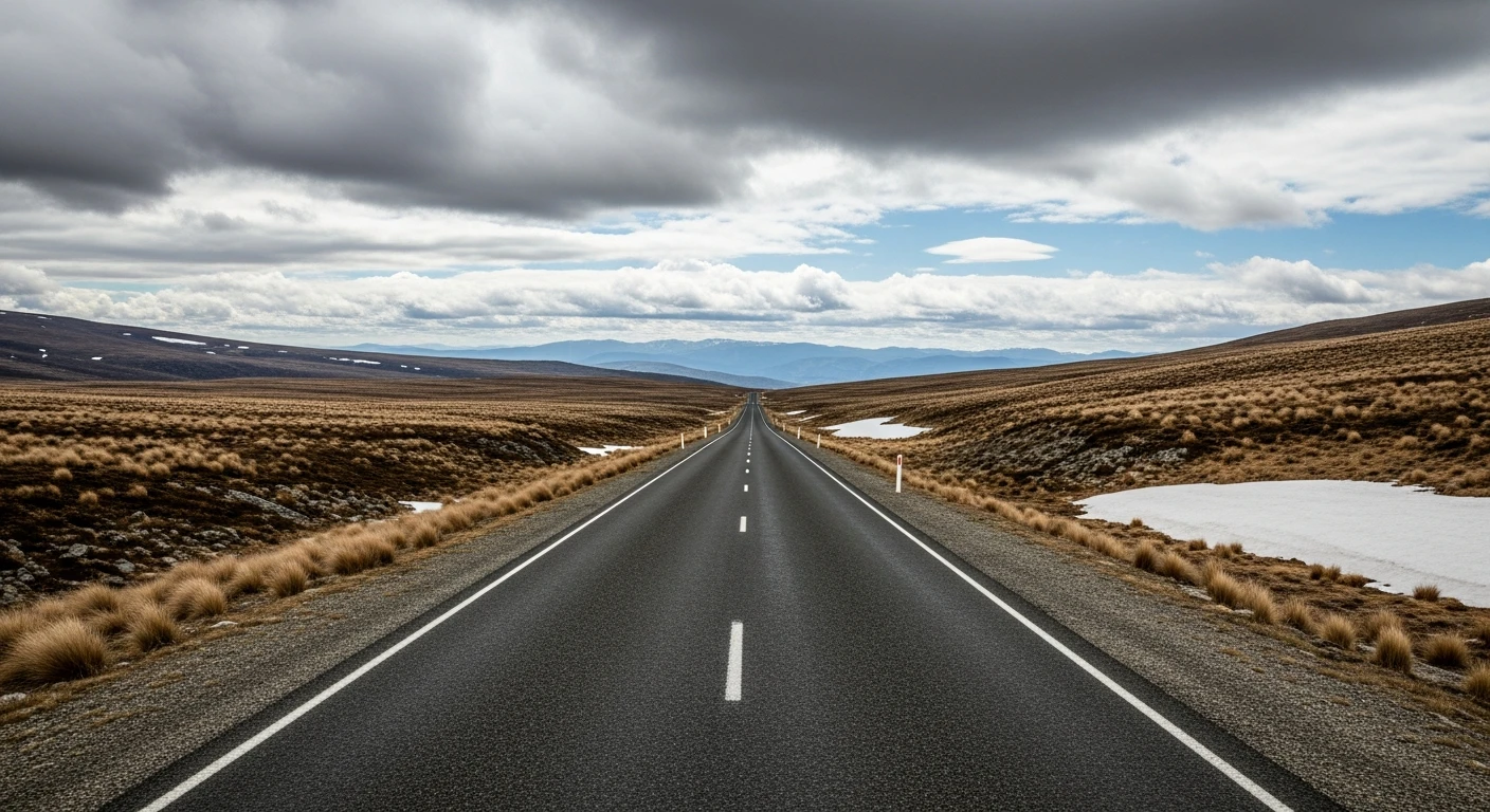
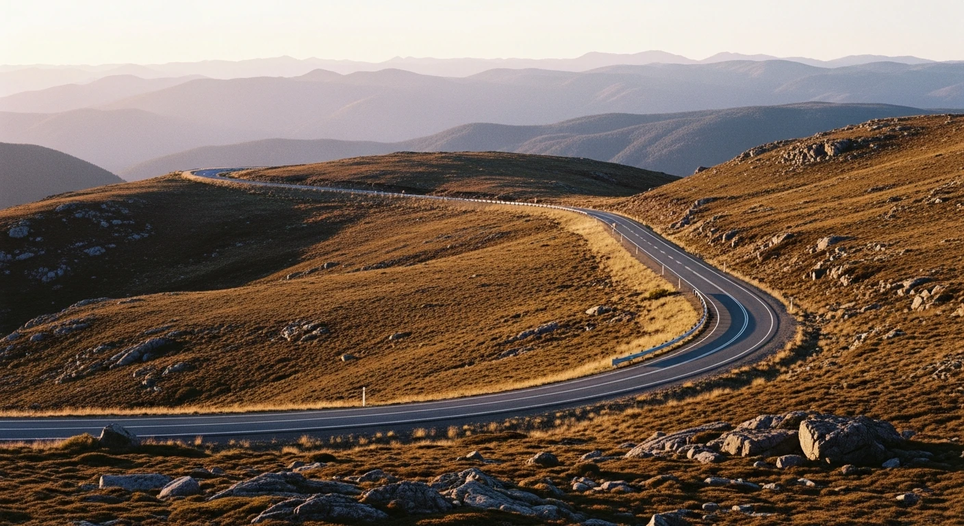
Big elevation changes and wide sweeping bends through Victorian high country. Some sections close above the snowline in winter.
Scored 8.2/10 by Contour's road quality algorithm across curviness, surface, elevation and traffic. Best suited for sports car drivers.
The road
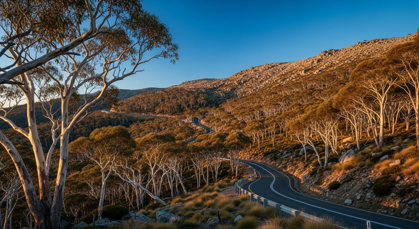
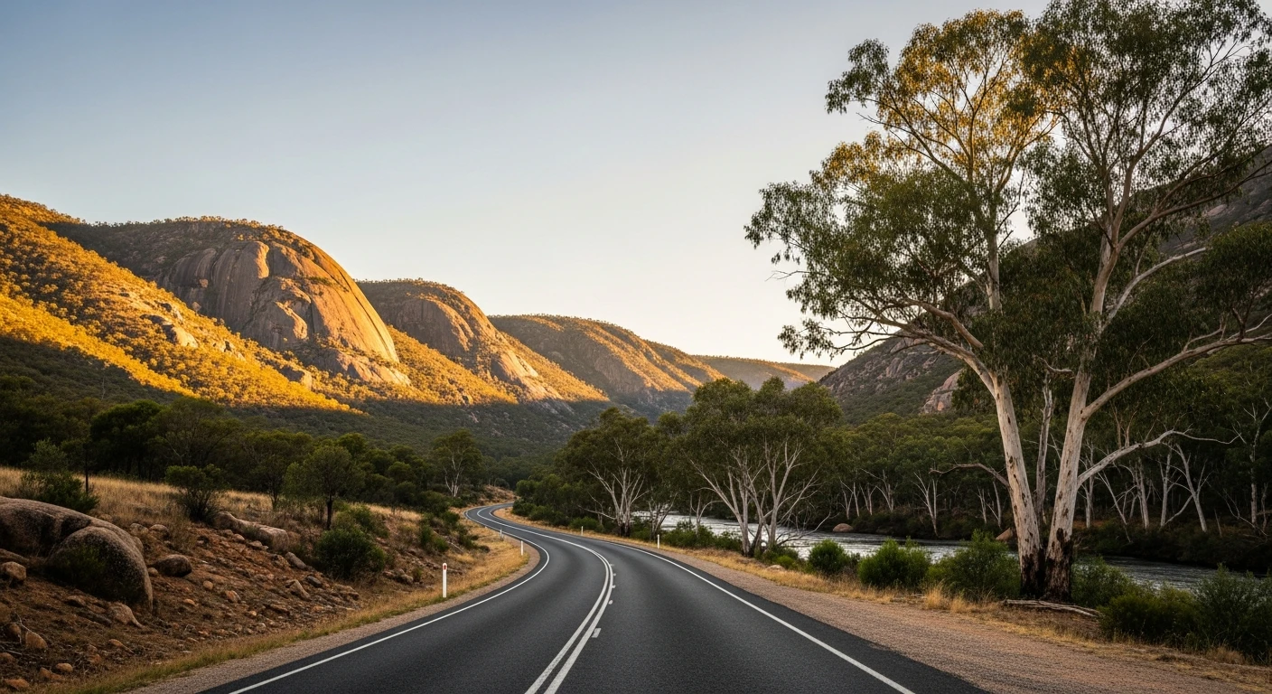
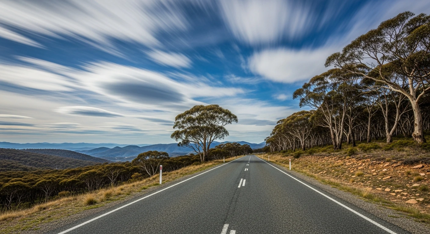
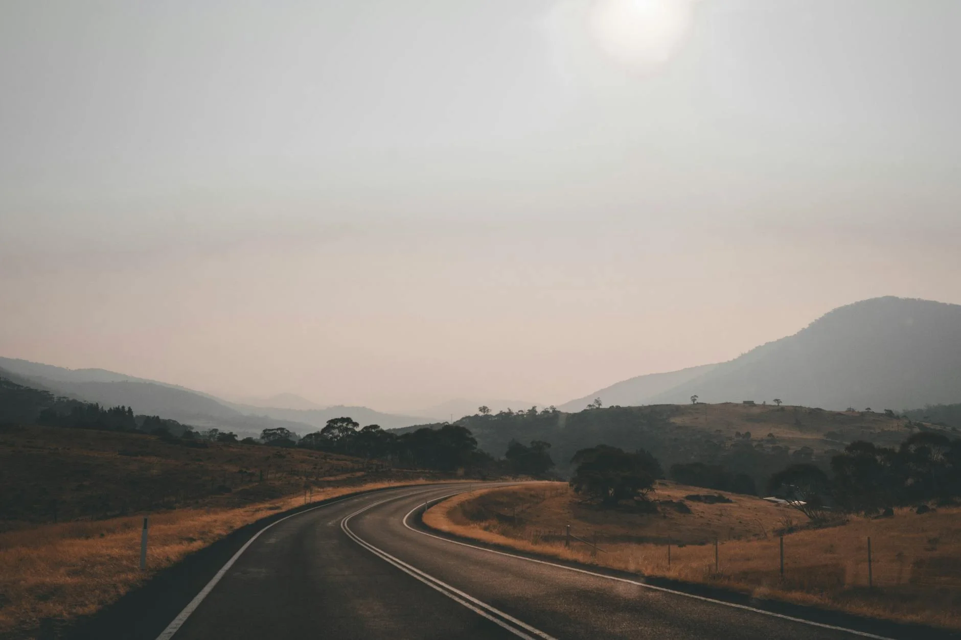
The Great Alpine Road is Victoria's high-country spine - a sealed road that forms part of the B500, crossing the Victorian Alps at their highest driveable point. The 110-kilometre section from Bright to Omeo is the one drivers come for. It climbs from the Ovens River valley at 320 metres to the Mount Hotham plateau at 1,750 metres, then drops through snowgum woodland and alpine ash into the Omeo Valley. The elevation change is relentless and the bends are wide and sweeping rather than tight, which suits sports cars and touring bikes better than supermotards. The views from the plateau are remarkable - on clear days you can see the coast. In autumn, the turning poplar and beech plantations around Bright make the valley section one of the most photographed drives in Australia. Above the snowline the road becomes exposed - there are no barriers on sections and the drops are serious. It demands respect and full attention throughout.
The Great Alpine Road is Victoria's high-country spine - a sealed road that forms part of the B500, crossing the Victorian Alps at their highest driveable point.
Why this road
The region
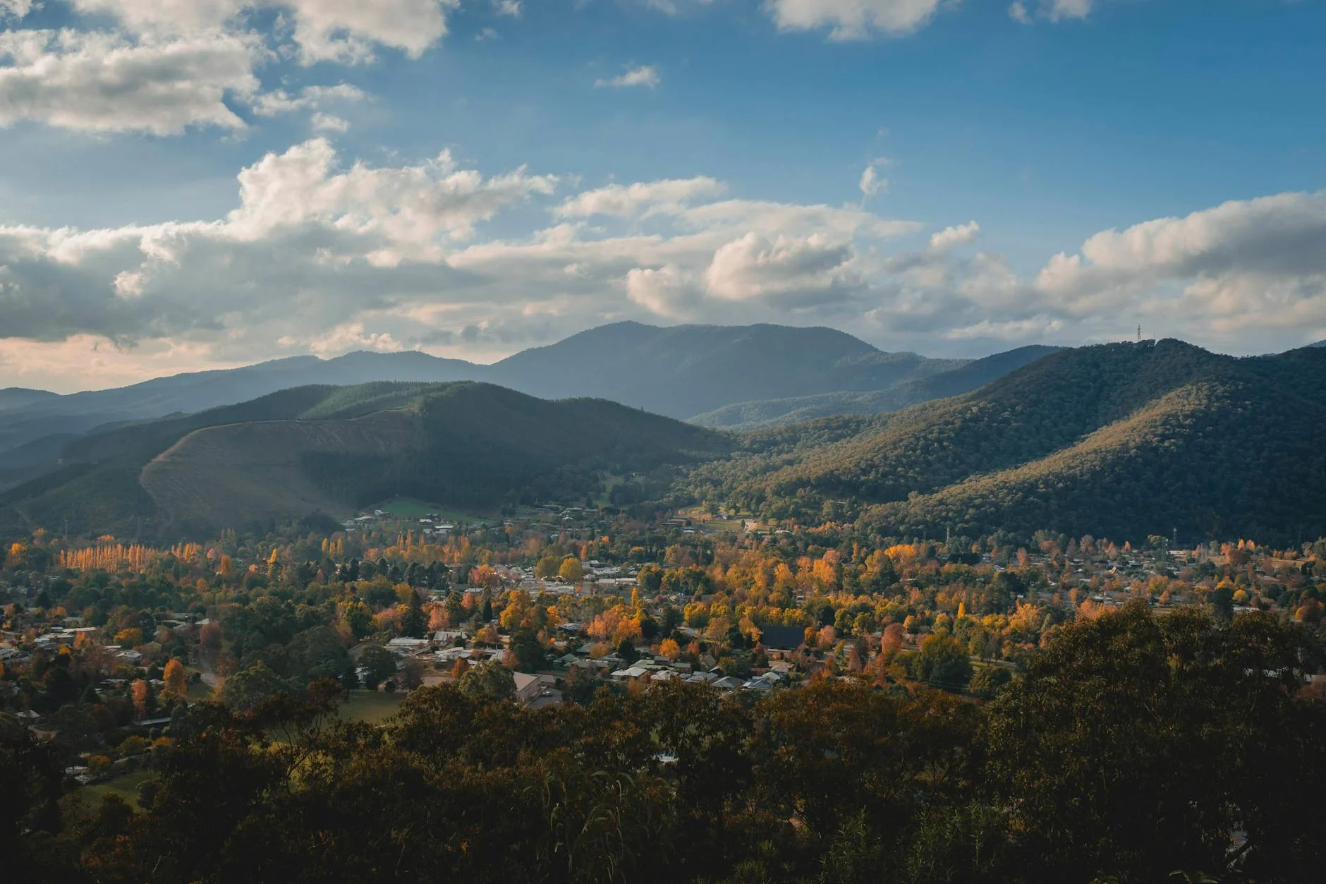
The Victorian Alps sit at the eastern end of the Great Dividing Range and reach just under 2,000 metres. The high country around Bright, Hotham and Omeo is one of the few genuinely alpine environments accessible by sealed road in Australia. Bright is a year-round destination - skiing in winter, autumn foliage in April-May, fly fishing in spring. The Ovens Valley was settled during the gold rush and the pastoral valleys between Bright and Omeo retain their 19th-century farming character. Omeo sits in a wide valley at 690 metres and is the last proper town before the Gippsland plains.
History
The alpine section from Harrietville to Hotham was first built as a winter access road to the ski fields in the 1930s. Before that the only route between Bright and Omeo was the Cobungra Gap track, a rough stock route used since the 1850s gold rush.
Before you go
Fuel at Bright, Harrietville and Omeo. The road above 1,300 metres closes when snow is forecast - check VicRoads conditions before going between June and September. Harrietville is the last fuel before the climb and the next fuel is Omeo on the far side. The descent from Hotham to Omeo is long and requires brake management in a heavy car. No overtaking on most of the mountain sections - plan for slow traffic on weekends.
See a routing error?
Flag itWorth stopping for
Bright Autumn Festival
In late April and early May the poplar plantations in the Ovens Valley turn gold and orange, making Bright one of Australia's most visited regional towns - book accommodation months ahead.
Mount Beauty
A small town at the base of the Bogong High Plains, 20 minutes from Bright, with access to another set of alpine roads and the Kiewa Valley.
Route
Start
Bright
End
Omeo
Gallery
More roads like this