Bogong High Plains
32 km
distance
1h 5m
Contour time
5.0
avg score
Sealed
surface
1780m
max elevation
+1100m
total climb
Scenery
1780m elevation
The Kiewa Valley is one of Victoria's least-visited alpine valleys despite being within 4 hours of Melbourne. Mount...
Road quality
5.0 RQS
Every segment scored on 40+ data signals.
Accessibility
Fully sealed
Best in Electric. Peak season: Summer-Autumn.
7-day forecast
Strong regen on the descent back to Mount Beauty. Alpine road - closed or icy in winter.
Scored 5.0/10 by Contour's road quality algorithm across curviness, surface, elevation and traffic. Best suited for electric drivers.
The road
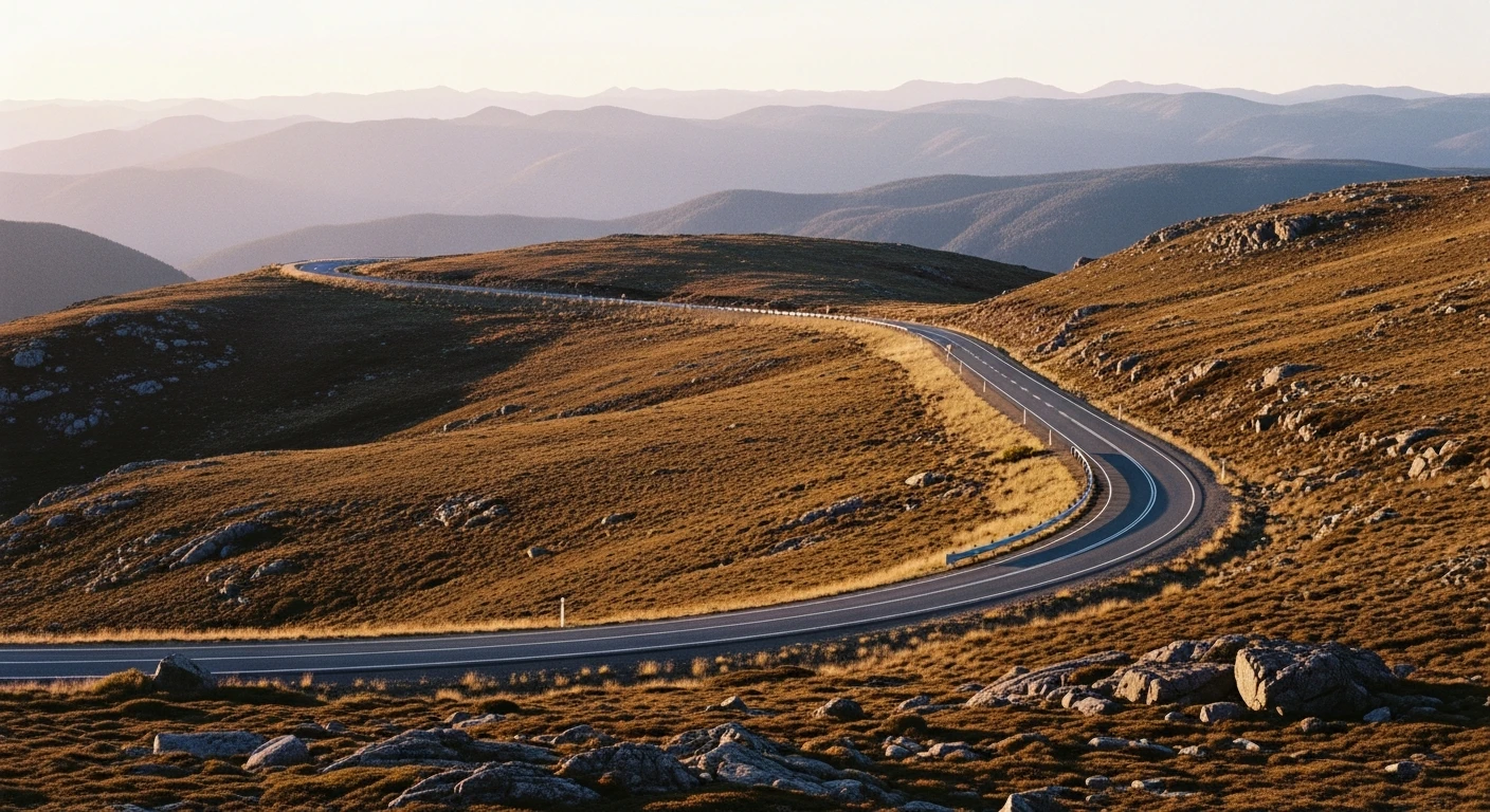
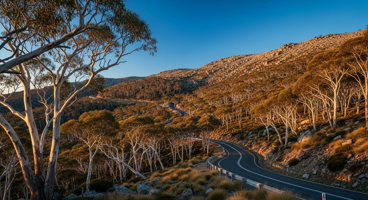
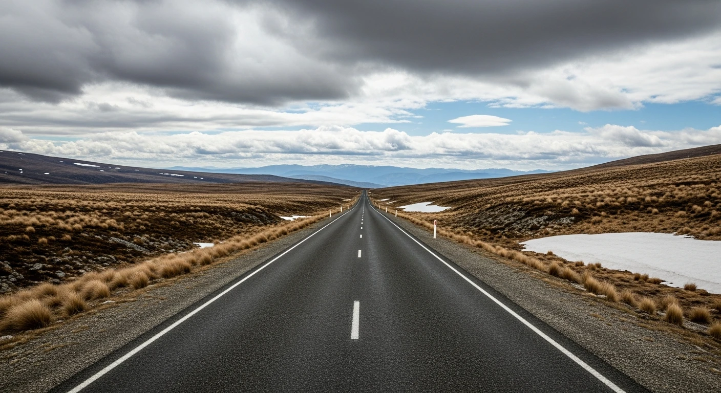
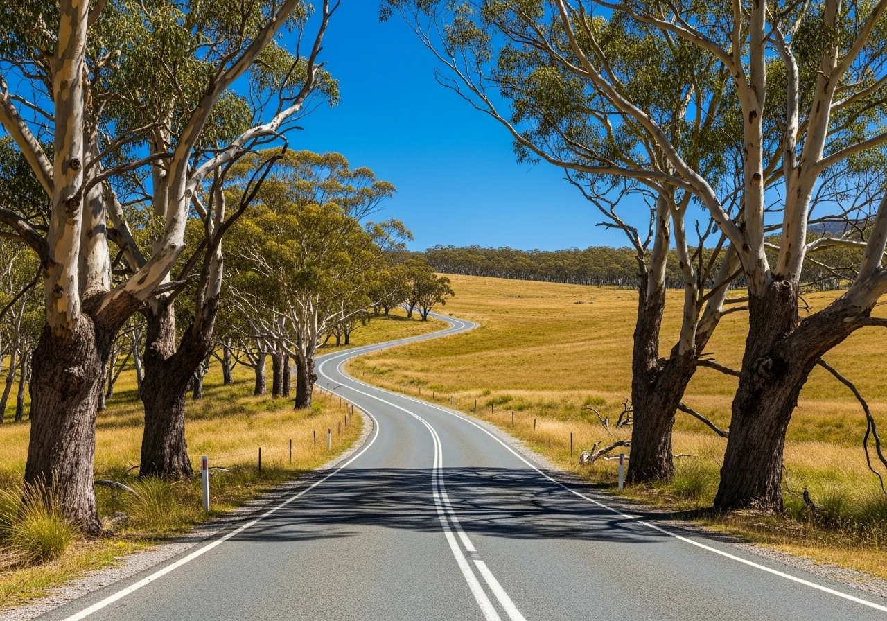
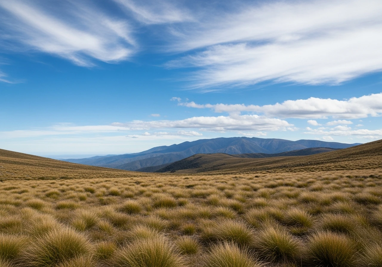
The Bogong High Plains Road is 32 kilometres of sealed alpine road that climbs 1,100 metres from the Kiewa Valley floor to the Falls Creek ski resort. It is the only road in Victoria that gives you a full alpine experience without the length commitment of the Great Alpine Road - every metre of the climb is engaged and the plateau at the top feels genuinely remote. The lower section through Mountain Creek follows the creek bed and the road is sheltered and tight. Above the treeline the character changes completely - snowgum woodland gives way to open buttongrass plains, the wind picks up, and the views extend to the Mount Bogong massif to the north. Falls Creek itself is a ski resort for six months and a hiking and mountain biking destination in summer. The payoff for electric vehicles is the descent: a full 1,100-metre drop over 32 kilometres gives serious regeneration. In an EV with reasonable efficiency the round trip is achievable from a starting charge of 80 per cent without anxiety. The road closes when snow is forecast - check conditions before going between May and October.
The Bogong High Plains Road is 32 kilometres of sealed alpine road that climbs 1,100 metres from the Kiewa Valley floor to the Falls Creek ski resort.
Why this road
The region
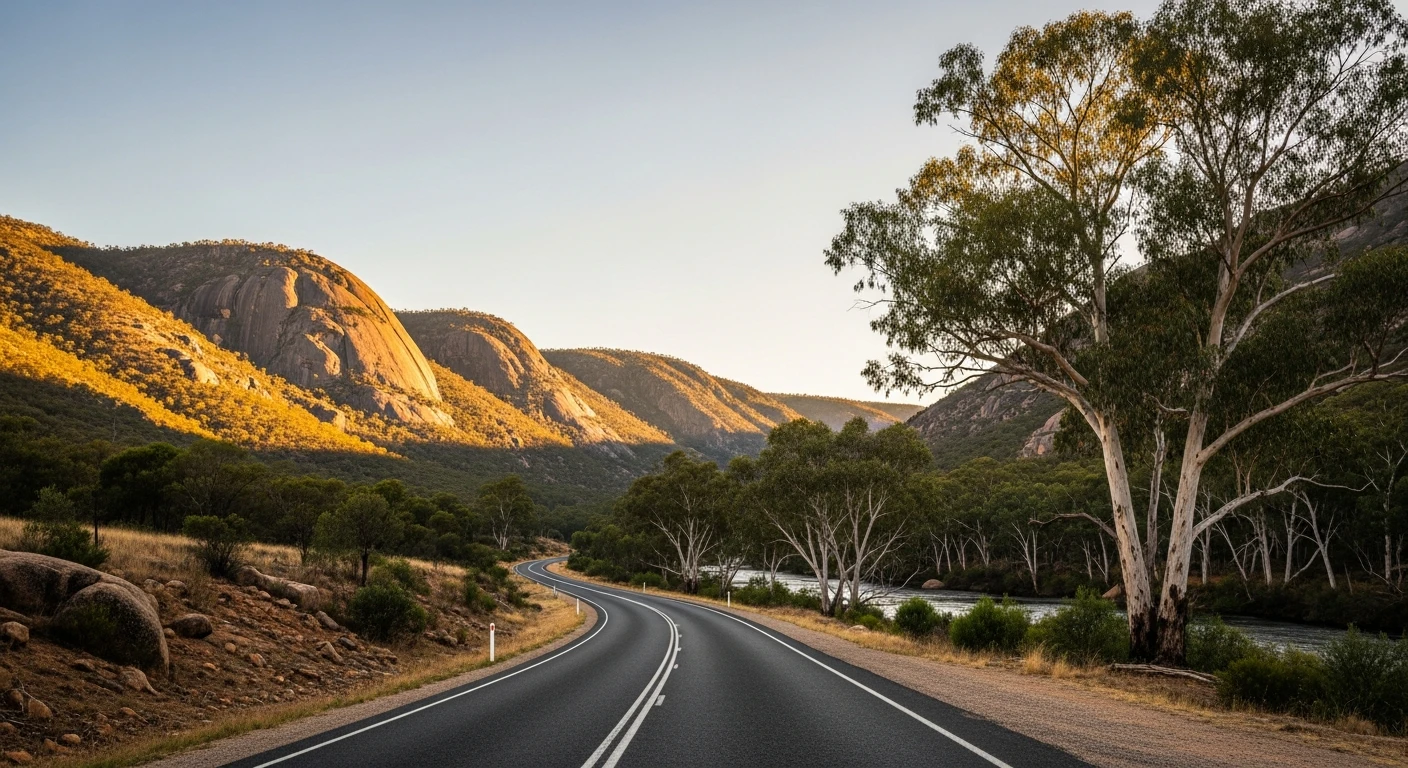
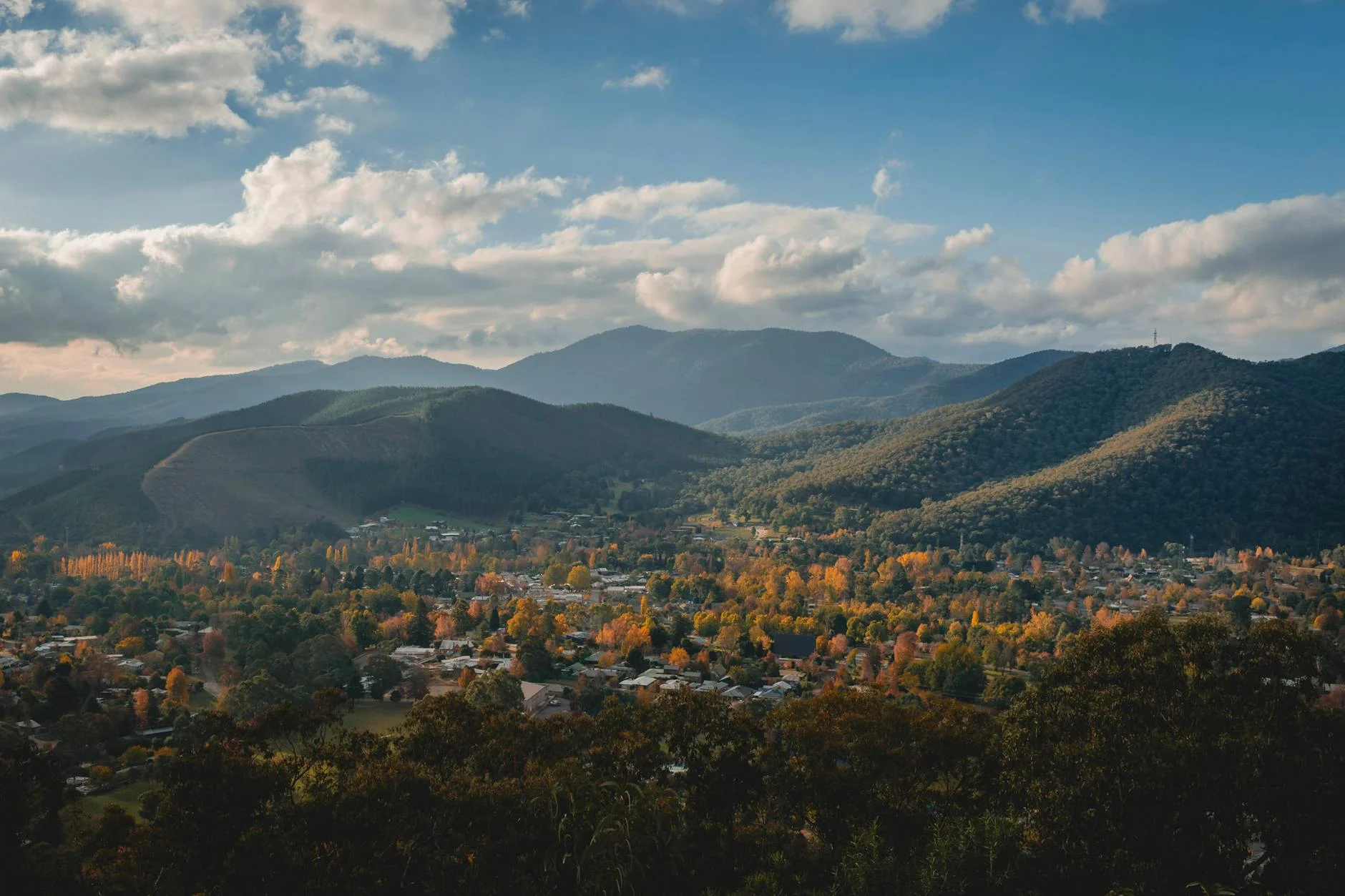
The Kiewa Valley is one of Victoria's least-visited alpine valleys despite being within 4 hours of Melbourne. Mount Beauty is a planned town built in the 1940s by the State Electricity Commission to house workers on the Kiewa hydroelectric scheme. It has a well-preserved post-war character, good coffee and an unexpectedly good bakery. The Kiewa River flows through the valley below and is one of Victoria's best trout fishing streams. Mount Bogong to the north at 1,986 metres is Victoria's highest peak and accessible by foot track from the valley.
Before you go
Fuel at Mount Beauty. Falls Creek has fuel during the ski season but it is not guaranteed in summer - top up at Mount Beauty before the climb. The road closes when snow is forecast, typically June to September. An alpine resort entry fee applies in winter. In summer the road is toll-free. The descent requires brake management in a petrol car - use engine braking. EV regen is excellent but monitor battery temperature on the descent.
See a routing error?
Flag itWorth stopping for
Mount Beauty township
A planned 1940s hydro-scheme town with a genuine post-war character, good coffee and the best bakery in the Victorian alps.
Kiewa River trout fishing
One of Victoria's best fly fishing streams runs through the valley below the road - enquire locally about access points and seasons.
Route
Start
Mount Beauty
End
Falls Creek
Gallery
More roads like this