Gary Highway
1,300 km
distance
210h
Contour time
2.4
avg score
Unsealed
surface
Scenery
Western Australia
The Gibson Desert and the Great Sandy Desert between them cover over 500,000 square kilometres of central Western...
Road quality
2.4 RQS
Every segment scored on 40+ data signals.
Accessibility
Fully sealed
Best in 4WD modified. Peak season: May-September.
7-day forecast
Modified 4WD with long-range fuel tank, winch and full expedition setup. The Gary Highway is one of the most remote and least-trafficked routes in Australia. Vehicle failure in the desert interior without satellite communication is a survival emergency. This is not a track for inexperienced drivers or unprepared vehicles.
Scored 2.4/10 by Contour's road quality algorithm across curviness, surface, elevation and traffic. Best suited for 4wd modified drivers.
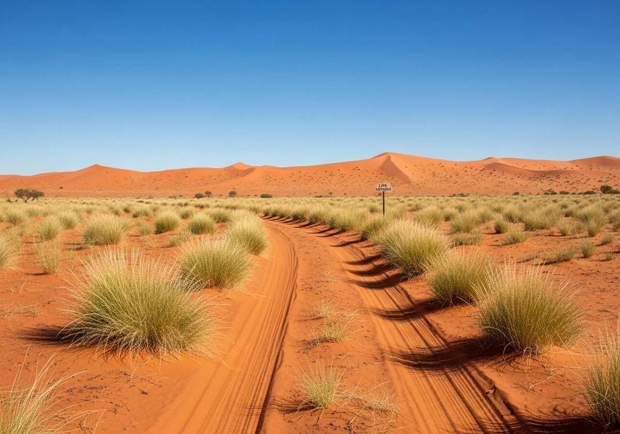
The road
The Gary Highway is one of the most remote routes on the Australian continent. Built by Len Beadell in 1958 as part of the weapons testing road network, it runs 1,300 kilometres from Well 33 on the Canning Stock Route through the Gibson Desert and the Great Sandy Desert to the Tanami Track. The road was named by Beadell after his son. In the decades since construction, the desert has been reclaiming the road. Some sections are still discernible as a cleared track, others have been swallowed by spinifex and sand dunes. Navigation requires GPS and the Beadell marker posts, which survive at intervals and provide the only confirmation that you are on the correct line. The surface is sand, corrugations, spinifex and rock, with no grading or maintenance. Sand dune crossings are frequent and require momentum driving at reduced tyre pressures. The Gibson Desert section is flat, red and relentlessly uniform. The Great Sandy Desert section introduces bigger dunes and harder crossings. The entire route has no settlements, no fuel, no water and no reliable phone coverage. You carry everything you need or you do not go. The distance between the Canning Stock Route and the Tanami Track - roughly 1,300 km of unmaintained desert road - makes this one of the longest gaps between services anywhere on the Australian road network. Traffic is measured in vehicles per month, not per day. Some months nobody drives it at all. The reward is absolute isolation in one of the world's great desert landscapes, following the tracks of Beadell and the handful of explorers who preceded him.
The Gary Highway is one of the most remote routes on the Australian continent.
Why this road
The region
The Gibson Desert and the Great Sandy Desert between them cover over 500,000 square kilometres of central Western Australia and the Northern Territory. The country is sand dunes, spinifex grassland, desert oak and red earth. It is Aboriginal land - the traditional country of several language groups including the Pintupi, who had their last uncontacted encounter with European Australians in 1984. The nearest settlements are Kintore (NT) and Balgo Hills (WA), both Aboriginal communities that are not equipped for tourist services. The Canning Stock Route and the Tanami Track at either end are themselves remote 4WD routes.

Before you go
Aboriginal land transit permits are required from multiple land councils - apply months in advance. No fuel, water or services for the entire 1,300 km. No natural reliable water sources on the entire route - all water must be carried. Carry minimum 120 litres of extra fuel and 60 litres of water. Two full-size spare tyres minimum. Satellite communicator and EPIRB are essential. The track is partially reclaimed by desert in many sections. GPS track files from previous crossings are essential - the road does not exist as a continuous visible track for much of its length. Travel in convoy with at least two other vehicles. Allow 10-14 days. Drive only May to September. Register with WA and NT police. This is expedition-grade touring - mechanical self-sufficiency is mandatory. Solo crossings are strongly advised against.
See a routing error?
Flag itWorth stopping for
Canning Stock Route
The track begins at Well 33 on the Canning. Australia's most famous 4WD expedition route and the logical pairing with the Gary Highway for serious desert tourers.
Tanami Track
The finishing point connects to the Tanami Track, which runs 1,000 km from Alice Springs to Halls Creek. A comparatively civilised route after the Gary.
Route
Start
Canning Stock Route Well 33
End
Tanami Track junction
Gallery

More roads like this