Anne Beadell Highway
1,375 km
distance
168h
Contour time
3.9
avg score
Unsealed
surface
Scenery
Western Australia
The Great Victoria Desert spans the border of Western Australia and South Australia, covering an area larger than the...
Road quality
3.9 RQS
Every segment scored on 40+ data signals.
Accessibility
Fully sealed
Best in 4WD modified. Peak season: May-September.
7-day forecast
Modified 4WD with long-range fuel tank required. The Anne Beadell is one of the most remote routes in Australia - 779 km without a settlement between Laverton and the Tjuntjuntjara community. Expedition-grade vehicle preparation and self-sufficiency are mandatory.
Scored 3.9/10 by Contour's road quality algorithm across curviness, surface, elevation and traffic. Best suited for 4wd modified drivers.
The road
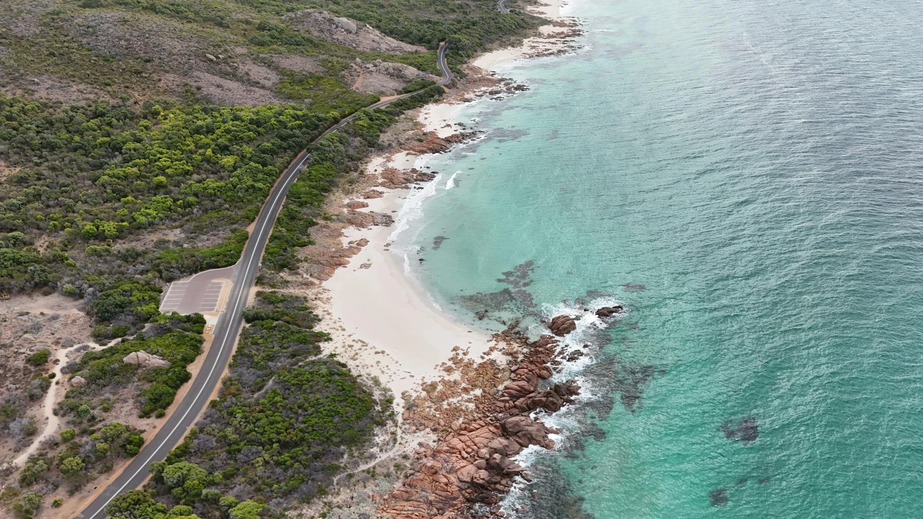
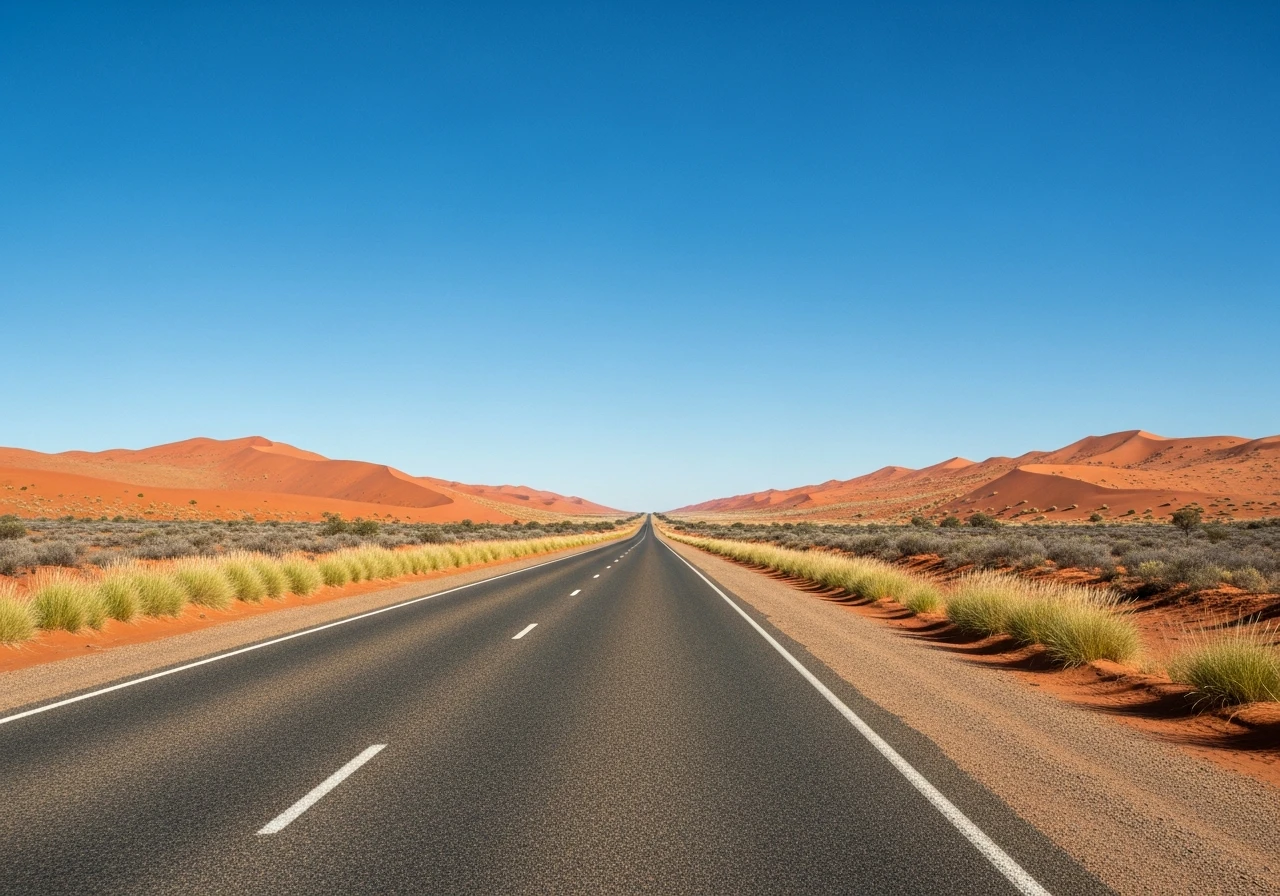
The Anne Beadell Highway is named after the wife of Len Beadell, the surveyor who built most of the desert roads in central Australia during the 1950s and 1960s weapons testing programme. The 1,375-kilometre route runs from Laverton in Western Australia's Eastern Goldfields to Coober Pedy in South Australia, crossing the Great Victoria Desert on what is arguably Australia's most remote maintained road. The defining statistic is 779 kilometres without a settlement between Laverton and the Tjuntjuntjara Aboriginal community. No fuel, no water, no services, no phone coverage and very few other vehicles. The route was built to connect Woomera with the Emu Field nuclear test site, where the British conducted two atomic weapons tests in 1953. The test site is still marked and slightly radioactive, though the levels are low enough for a brief visit. The road surface is variable - some sections are reasonable graded gravel, others are deep sand, corrugated washboard and spinifex-choked stretches where the road has been partially reclaimed by the desert. The Great Victoria Desert is the largest desert in Australia, covering 424,400 square kilometres of sand dunes, spinifex grassland and mulga woodland. The landscape is genuinely beautiful in a minimalist way - red sand, grey-green spinifex, pale blue sky and nothing else for hundreds of kilometres. The isolation is the point. There is nothing between the start and finish except desert, and the experience of crossing it under your own power with everything you need carried on your vehicle is one of the most satisfying things you can do in a 4WD.
The Anne Beadell Highway is named after the wife of Len Beadell, the surveyor who built most of the desert roads in central Australia during the 1950s and 1960s weapons testing programme.
Why this road
The region
The Great Victoria Desert spans the border of Western Australia and South Australia, covering an area larger than the United Kingdom. It is the least-visited of Australia's deserts and the most uniform - parallel sand dunes running east-west, covered in spinifex, with occasional mulga woodland in the swales between dunes. Laverton at the western end is a small mining town with basic services. Coober Pedy at the eastern end is the opal capital of Australia, famous for its underground homes dug into the hillside to escape the heat. The Aboriginal community of Tjuntjuntjara lies roughly midway and is the only settlement on the route.

Before you go
Aboriginal land transit permits are required - apply through the relevant land councils well in advance. Fuel at Laverton and Coober Pedy only. Carry minimum 100 litres of extra fuel and 40 litres of water. Two full-size spare tyres minimum. A satellite communicator and EPIRB are essential. Allow 7-14 days. Drive only May to September. Travel in convoy with at least two other vehicles - solo crossings are not recommended. Register with WA and SA police before entering. The Emu Field nuclear test site can be visited briefly but do not camp there.
See a routing error?
Flag itWorth stopping for
Coober Pedy underground homes
The opal mining town at the eastern end is famous for its underground homes, churches and hotels, all dug into the hillside. Worth a night underground.
Emu Field
The site of two British nuclear weapons tests in 1953. Marked with a plaque. Low-level residual radiation - visit briefly, do not camp.
Route
Start
Laverton WA
End
Coober Pedy SA
Gallery

More roads like this