Canning Stock Route
1850 km
distance
160h
Contour time
2.5
difficulty
Unsealed
surface
Scenery
Western Australia
The CSR passes through Birriliburu, Ngurrararngku and Martu Indigenous Protected Areas. Much of the route is on...
Road quality
Grade 2.5
Every segment scored on 40+ data signals.
Accessibility
Fully sealed
Best in 4WD modified. Peak season: June-August.
7-day forecast
The CSR is not an adventure drive - it is an expedition. It requires a minimum of two capable modified vehicles, a complete communications plan, thorough desert experience, and more spare parts and water than you think you need. No route in Australia has a higher consequence-of-failure. Solo travel is genuinely dangerous and documented fatalities have occurred from vehicle breakdowns and inadequate water.
Recommended gear: PLB (mandatory), Satellite communicator, Hi-lift jack, Multiple recovery boards, High-lift air jack, Dual spare tyres, Fuel for 1200km between supply points, Water for 7+ days.
The road
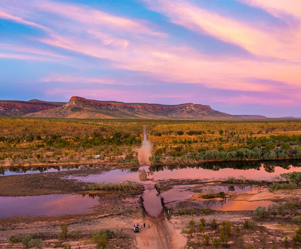
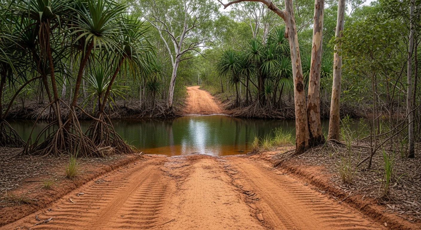
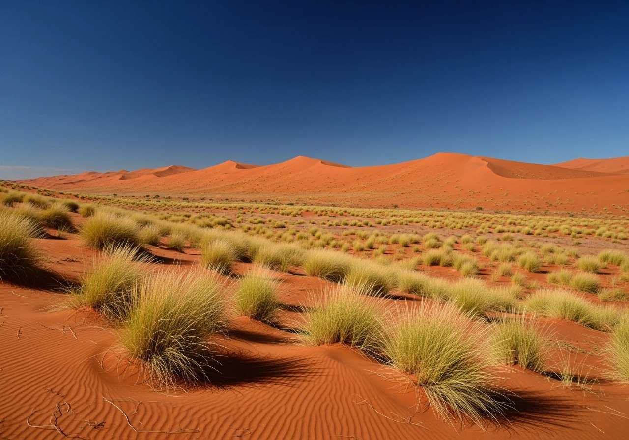
The Canning Stock Route is what the word remote means in Australia. The 1,850-kilometre track was surveyed and built between 1906 and 1910 by Alfred Canning to allow Western Australian cattle to be walked from the Kimberley to the Murchison goldfields without using the cattle routes in the South. It crosses the Gibson Desert and Great Sandy Desert, passes 51 wells (of which a handful still function), and sees fewer than 500 vehicle transits per year. The track itself is the least interesting part of the experience. The landscape - parallel red sand dunes, ancient lake beds, mulga scrub, spinifex plains - is the overwhelming constant. The wells are historical artefacts as much as water sources: stone-lined shafts with hand-carved casings from the Canning survey, the work of a 90-person expedition in extreme heat. Carnage Creek, Well 23 and the Wolf Creek Crater detour to the east are reference points in a journey where you stop counting days. The northern section near Halls Creek is lower difficulty; the central and southern sections through the dune fields are harder, particularly after any wind event that fills the tracks with sand.
The Canning Stock Route is what the word remote means in Australia.
Why this road
The region
The CSR passes through Birriliburu, Ngurrararngku and Martu Indigenous Protected Areas. Much of the route is on Aboriginal land and requires a permit from the relevant land councils. The track crosses no public sealed roads between Well 9 (near Wiluna) and the northern exit near Halls Creek. There are no towns, no fuel, no services. Emergency access from RFDS is possible to a handful of points but air access is limited by the condition of the dirt airstrips.

History
Alfred Canning led two survey expeditions to establish the route. The 1907-08 survey is now considered one of the most difficult overland expeditions in Australian history. The wells were maintained for only three decades before the road made the stock route economically irrelevant. Canning died in 1936 having never received adequate recognition for the feat.
Before you go
Permits required: contact Central Land Council, Birriliburu Aboriginal Corporation and Martu Rangers well in advance. Fuel carrying capacity must cover at least 1,200km between reliable supply. The only mid-route fuel possibility is the Kunawarritji (Well 33) community store - diesel and unleaded are sometimes available but supply is irregular and cannot be relied upon. Contact the community in advance to confirm availability. Do not plan your fuel strategy around Kunawarritji. Water minimum 15 litres per person per day. June to August only - heat in September rises above 40C. A Personal Locator Beacon is mandatory and is the absolute minimum communication standard. Most travellers also carry a satellite phone. File a detailed trip plan with police and a trusted contact before departure.
See a routing error?
Flag itWorth stopping for
Wolf Creek Meteorite Crater
A 50km detour east of the CSR near Well 51. Australia's largest meteorite impact crater, visible in full from the crater rim. A significant landmark.
Halls Creek
The northern terminus - refuel, restock, rest. The Kimberley begins here.
Route
Start
Wiluna
End
Halls Creek
Gallery

More roads like this