Dargo High Plains
83 km
distance
2h 10m
Contour time
5.7
avg score
Unsealed
surface
Scenery
Victoria
Dargo is a small High Country town in the Mitchell River valley. It is 70km from Bairnsdale on the Princes Highway. The...
Road quality
5.7 RQS
Every segment scored on 40+ data signals.
Accessibility
Fully sealed
Best in 4WD. Peak season: November-April.
7-day forecast
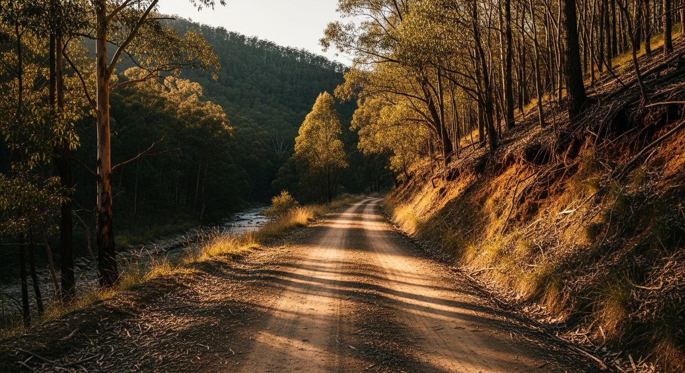
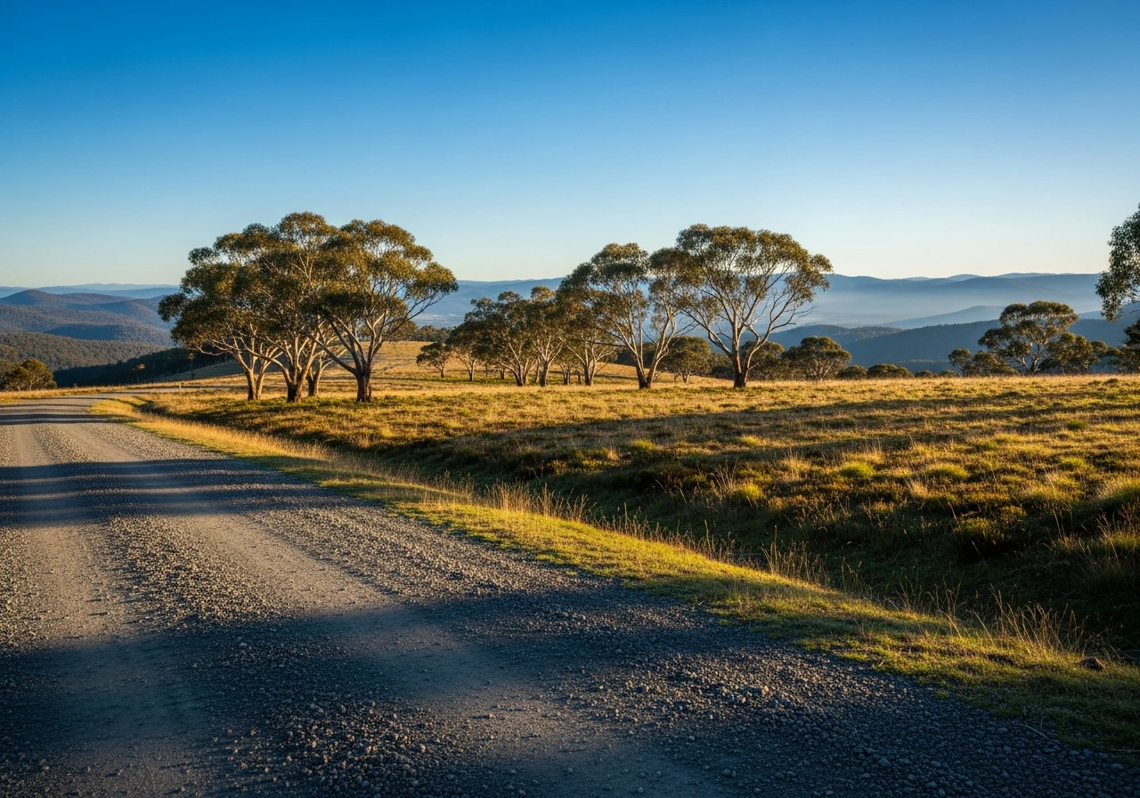
A winding gravel track that climbs over 1,000m from the Dargo valley floor to the alpine plateau. Accessible to most 4WDs with reasonable clearance in dry conditions. Some rocky sections on the climb. Closed by snow June to October.
Scored 5.7/10 by Contour's road quality algorithm across curviness, surface, elevation and traffic. Best suited for 4wd drivers.
The road
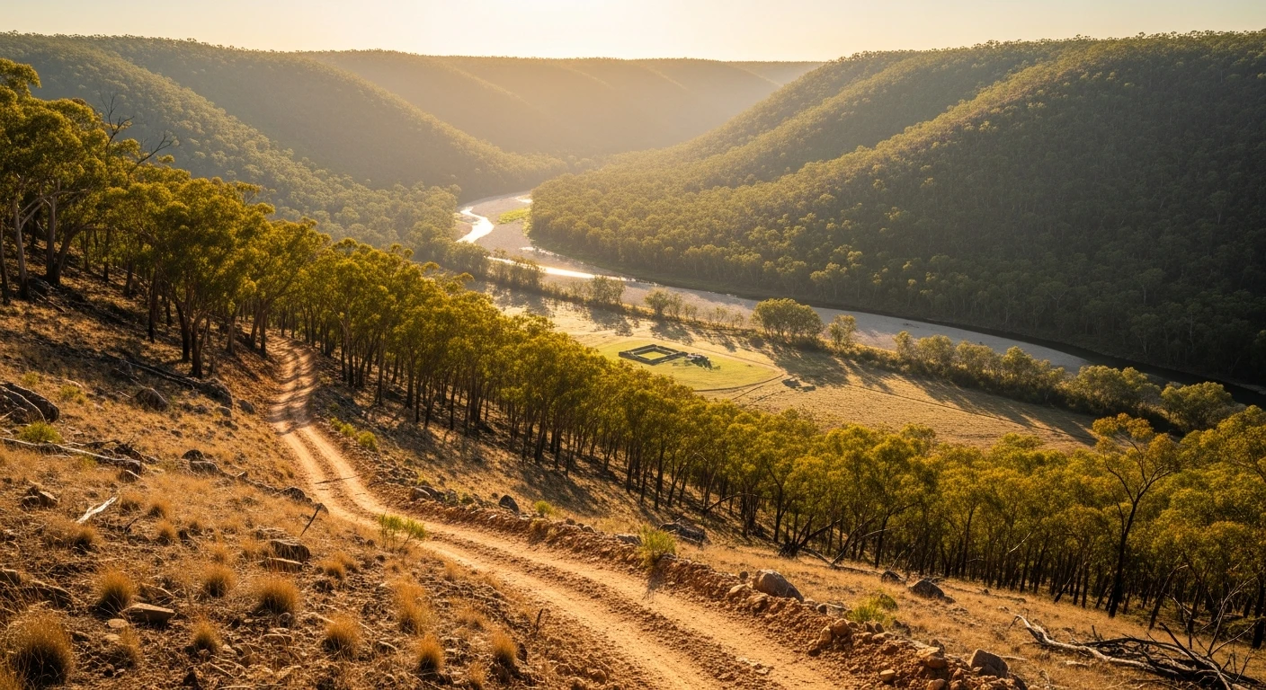
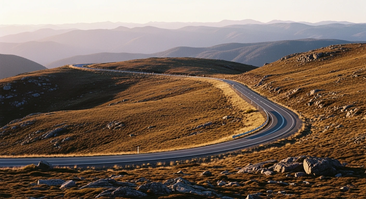
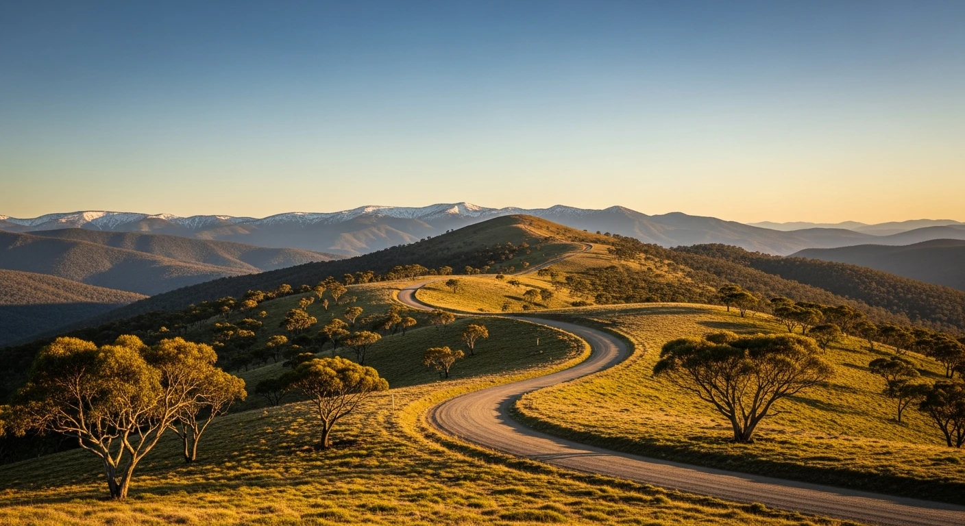
The Dargo High Plains Road is one of the quieter ways into the Victorian Alps. The 55km climb from the small town of Dargo winds up through mountain ash into the subalpine zone and eventually onto the open snowgum plateau at 1,600m. On a clear day the plateau stretches from the Mitchell River headwaters to the south slopes of the Bogong High Plains in the north. The road surface is graded gravel for most of its length, with some rocky exposed sections near the crest. It connects with the sealed Mount Hotham Road at the top, making it a natural one-way exit or entry for high country loops. The descent back to Dargo goes through increasingly dense eucalypt forest. The upper plateau sections are above the treeline and exposed to weather change - carry warm clothing even in summer. The snowgum woodland on the plateau has an eerie quality in fog.
The Dargo High Plains Road is one of the quieter ways into the Victorian Alps.
Why this road
The region
Dargo is a small High Country town in the Mitchell River valley. It is 70km from Bairnsdale on the Princes Highway. The town has a general store, a pub and a small population of locals who work the cattle leases on the surrounding mountain country. The Mitchell River National Park downstream from Dargo is one of the most undervisited parks in Victoria.

Before you go
Fuel in Dargo. The road is closed when snow falls - typically June to October. Check VicRoads conditions before travel. No phone coverage above the mountain ash zone. The road is single lane in many sections with limited passing opportunities. The gravel surface can be soft after rain - high clearance is more important than 4WD for most conditions.
See a routing error?
Flag itWorth stopping for
Dargo Hotel
One of Victoria's most authentic high country pubs - cold beer and meals in a working farming community.
Mitchell River National Park
The Mitchell River gorge downstream from Dargo is accessible only by foot or boat - spectacular but requires overnight camping.
Route
Start
Dargo
End
Hotham Heights Road junction
Gallery

More roads like this