Danbulla Forest Road
19 km
distance
22 min
Contour time
5.2
avg score
Sealed
surface
Scenery
Queensland
Danbulla Forest Road runs through the rainforest above Lake Tinaroo on the Atherton Tablelands. Lake Tinaroo was...
Road quality
5.2 RQS
Every segment scored on 40+ data signals.
Accessibility
Fully sealed
Best in Sports car. Peak season: April-November.
7-day forecast
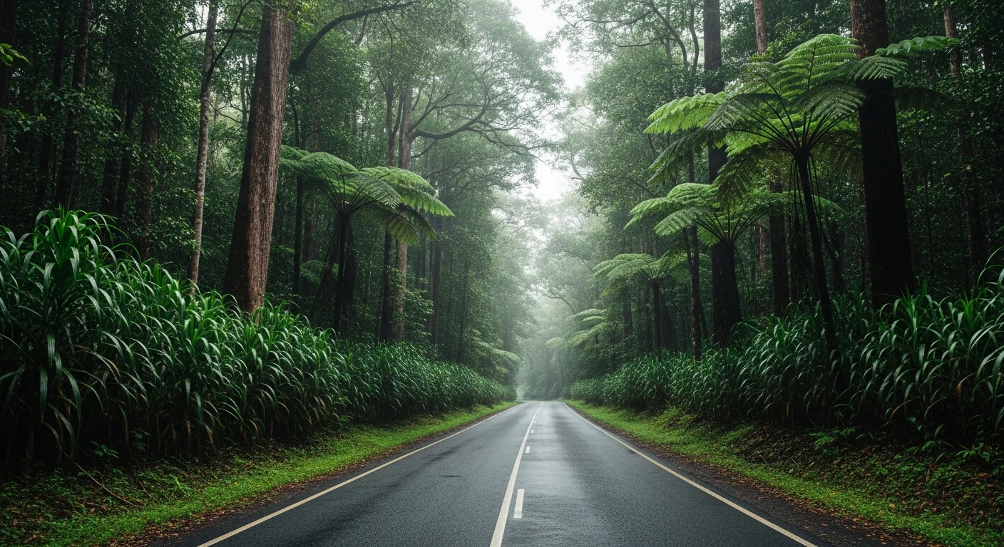
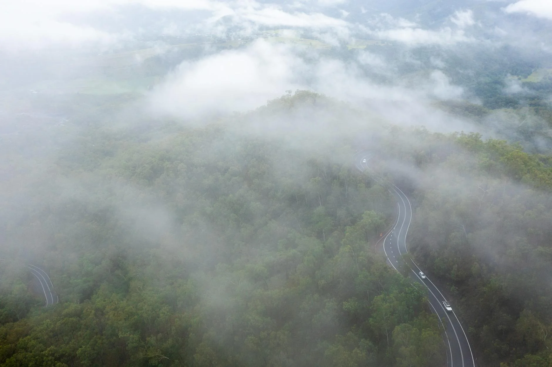
Winding sealed road through Danbulla State Forest with constant canopy and some impressive old-growth sections. Sports car or motorbike both work well. The surface is good year-round but damp sections are common from rainforest moisture.
Scored 5.2/10 by Contour's road quality algorithm across curviness, surface, elevation and traffic. Best suited for sports car drivers.
The road
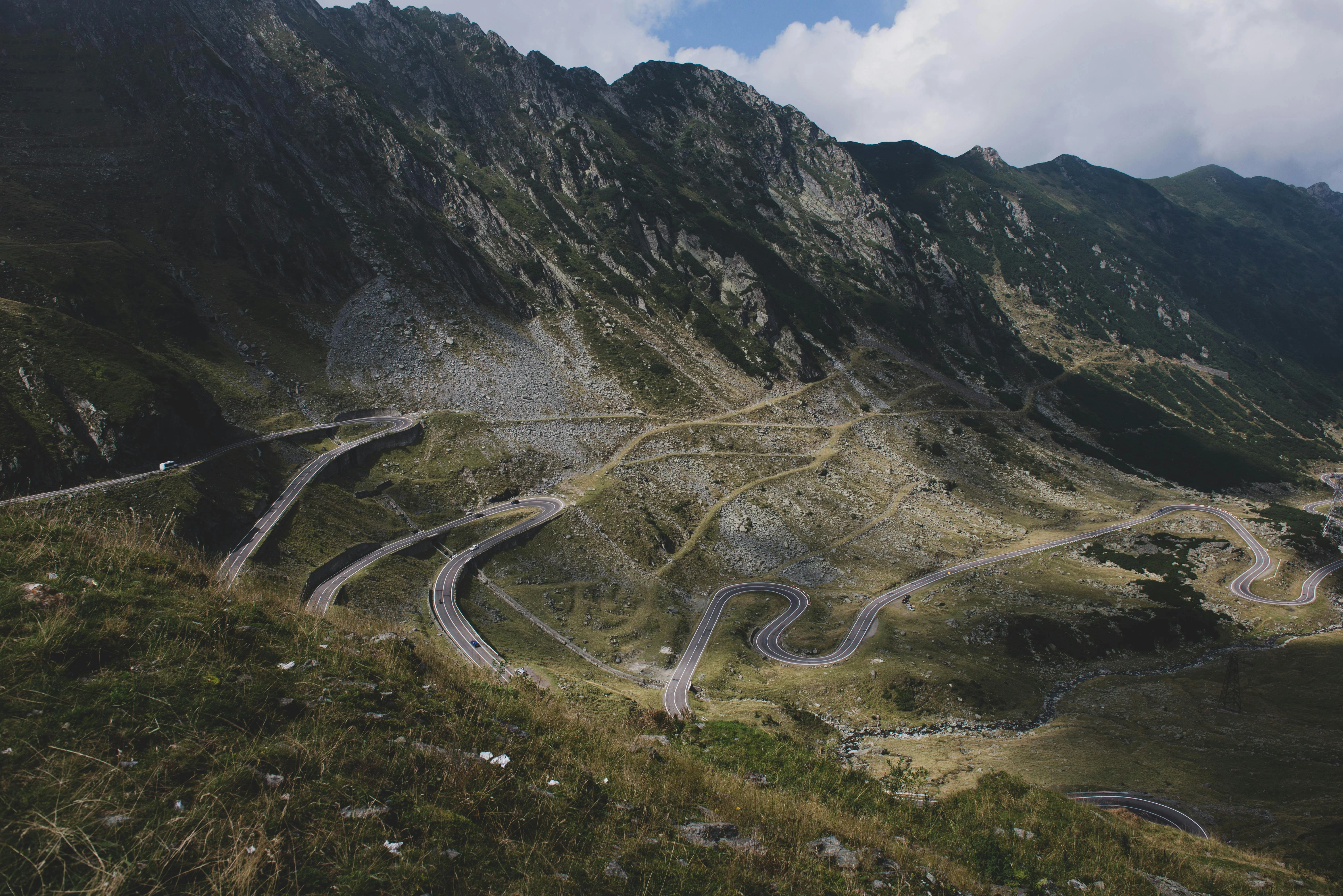
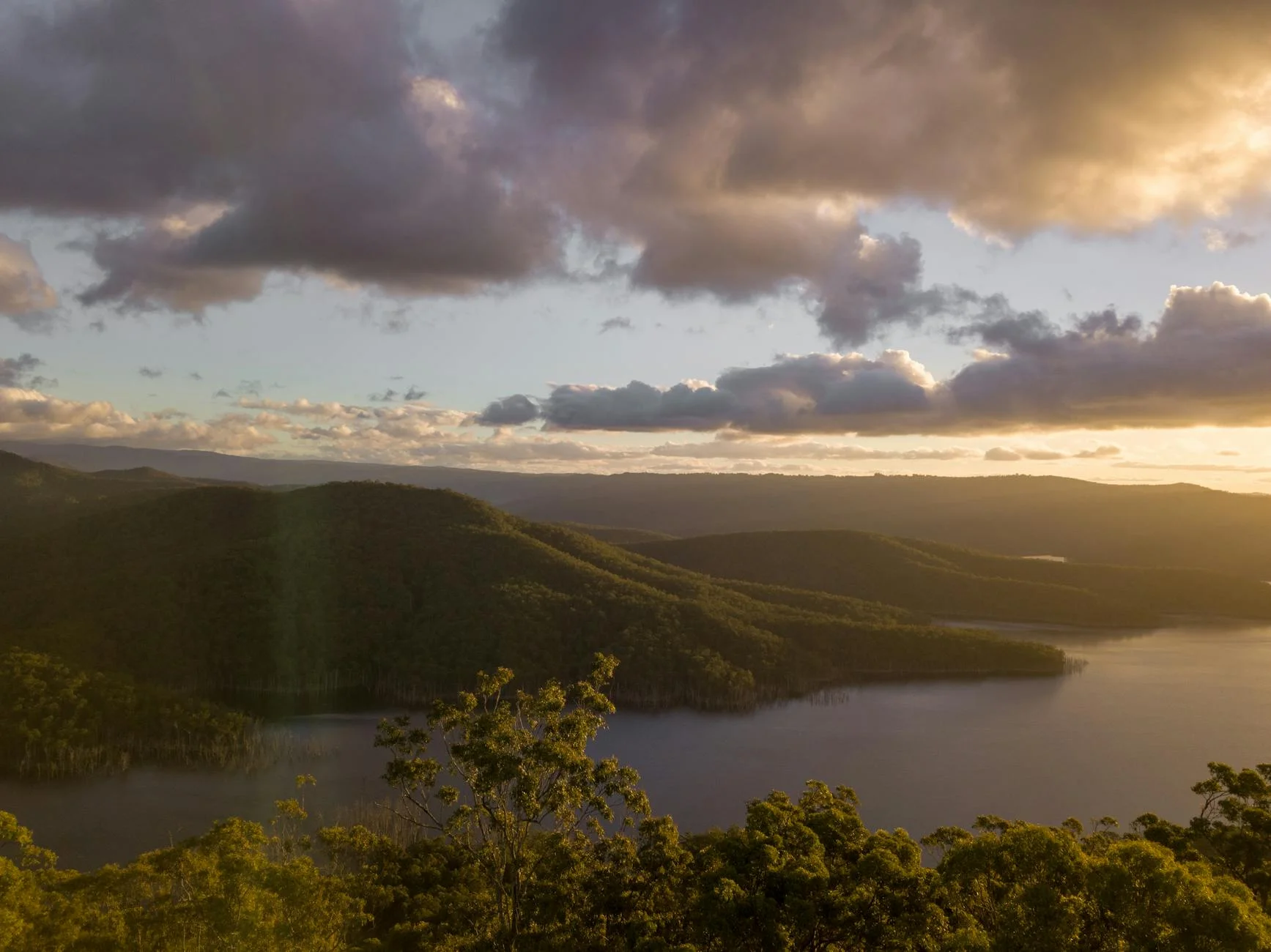
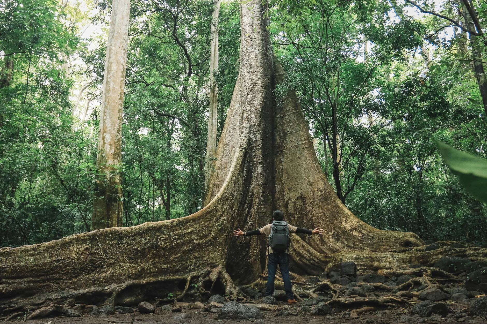
Danbulla Forest Road is a sealed drive through Wet Tropics World Heritage rainforest above Lake Tinaroo on the Atherton Tablelands. The 19-kilometre road winds through Danbulla State Forest with the canopy closing overhead for most of the route. The road passes some of the most accessible old-growth rainforest in the region, including the Cathedral Fig Tree - a strangler fig of genuinely staggering scale that is accessible from a short walk off the road. Lake Tinaroo itself was created in 1958 by damming the Barron River, and when the lake level drops the drowned road infrastructure of the original Danbulla township becomes visible. The surface is good year-round though canopy moisture keeps sections damp. Traffic is light - the road serves the lake camping areas and a few residents. The combination of World Heritage rainforest, a drowned town and a cathedral fig is unusual for a road this accessible.
Danbulla Forest Road is a sealed drive through Wet Tropics World Heritage rainforest above Lake Tinaroo on the Atherton Tablelands.
Why this road
The region
Danbulla Forest Road runs through the rainforest above Lake Tinaroo on the Atherton Tablelands. Lake Tinaroo was created in 1958 by damming the Barron River, flooding the original Danbulla township. The drowned road infrastructure is still visible when the lake level drops. The Danbulla State Forest contains some of the most accessible Wet Tropics World Heritage rainforest in the region.
Before you go
Fuel at Mareeba or Atherton before departure. Road is sealed and open year-round. The canopy keeps sections damp - allow for reduced grip. Some large fig trees overhang the road in sections. Light traffic year-round. The Lake Tinaroo camping areas are accessible from the road.
See a routing error?
Flag itWorth stopping for
Cathedral Fig Tree
One of the largest strangler figs in Queensland - a short walk from the road gives access to a tree that is genuinely staggering in scale.
Lake Tinaroo
Barramundi fishing and camping on the Atherton Tablelands' main reservoir - the drowned original township is visible when water levels drop.
Route
Start
Tinaroo
End
Danbulla
Gallery
More roads like this