Gillies Range Road
43 km
distance
50 min
Contour time
8.0
avg score
Sealed
surface
700m
max elevation
+700m
total climb
Scenery
700m elevation
The Atherton Tablelands sit at 700-900 metres above the Cairns coastal plain, separated by the Great Dividing Range...
Road quality
8.0 RQS
Strong. Above average on most quality signals.
Accessibility
Fully sealed
Best in Sports car. Peak season: Year-round.
7-day forecast
Every corner is tight on the way up to the Tablelands. Coastal views through the rainforest. Worth doing both directions.
Scored 8.0/10 by Contour's road quality algorithm across curviness, surface, elevation and traffic. Best suited for sports car drivers.
The road
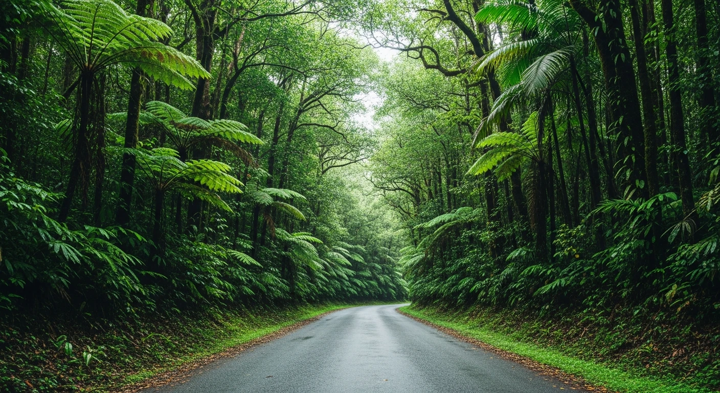
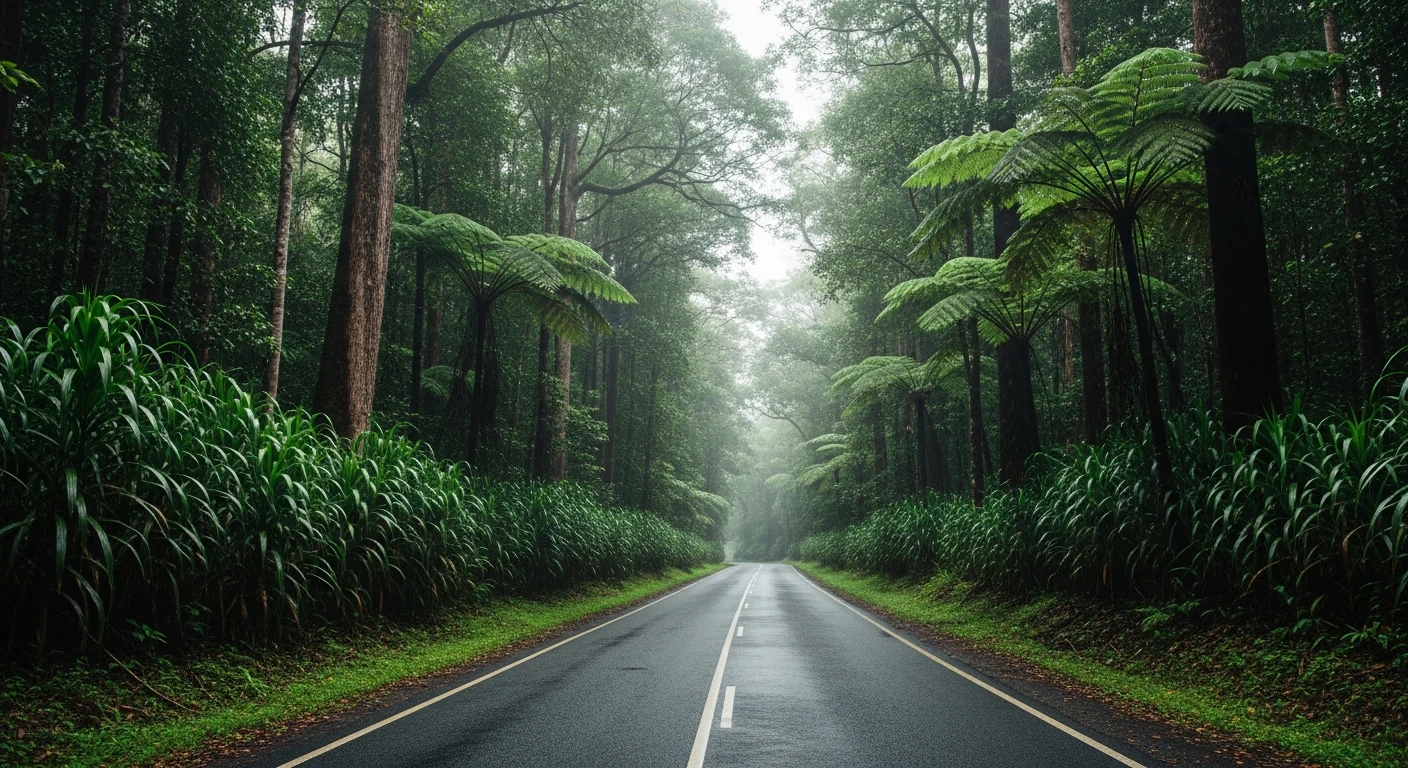
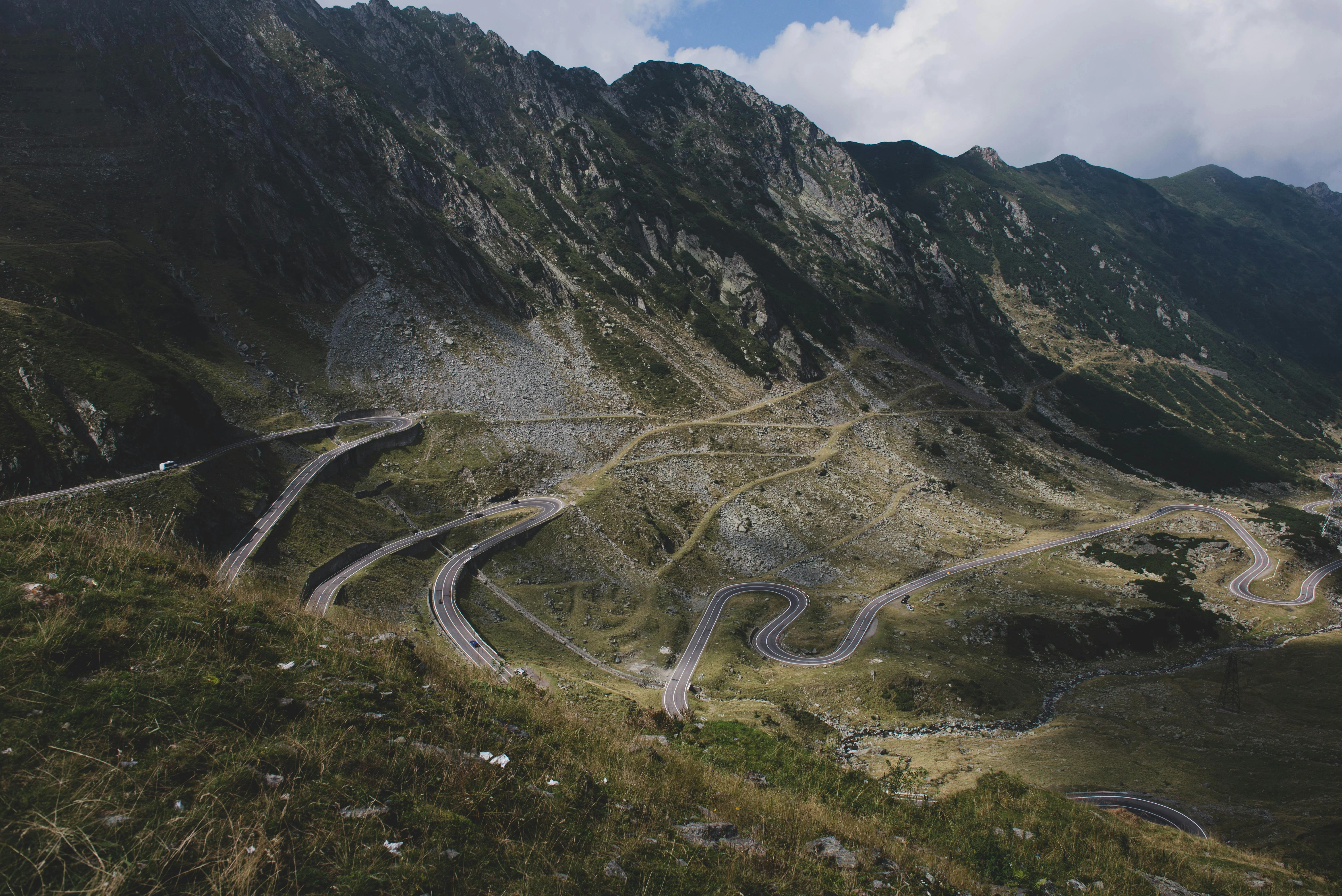
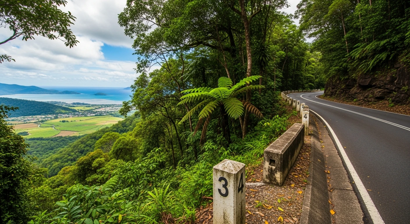
The Gillies Range Road is the fastest way from the Cairns coast to the Atherton Tablelands and also the most entertaining. The 43-kilometre route from Gordonvale to Yungaburra gains 700 metres of altitude in a hurry through 263 numbered corners - most of them tight, many of them blind, all of them on a smooth surface through tropical rainforest. The quality of this road is in the relentlessness of it. There are very few recovery straights between corner sequences and the gradient is steep enough that the car always has something to say. The rainforest canopy is thick enough on the upper sections to create a genuine tunnel effect. The coastal views looking back towards Cairns on the lower sections are worth stopping for. The descent back to Gordonvale is the more technically interesting direction - less time to think, more speed to manage. Yungaburra is a small Tablelands town with a platypus-inhabited creek, good coffee and a farmers market that draws the whole region on weekends.
The Gillies Range Road is the fastest way from the Cairns coast to the Atherton Tablelands and also the most entertaining.
Why this road
The region
The Atherton Tablelands sit at 700-900 metres above the Cairns coastal plain, separated by the Great Dividing Range escarpment that the Gillies Range Road climbs. The Tablelands are remarkably fertile - red volcanic soils, reliable rainfall and a temperature significantly lower than the coast have made the area a major producer of dairy, coffee, tropical fruit and macadamia nuts. Gordonvale at the base of the range is a small cane-farming town on the Mulgrave River. The Tablelands town of Yungaburra is the social and agricultural centre of the range.
History
The Gillies Range Road was first formed in the 1920s to provide access to the Atherton Tablelands from the coast. The current road alignment follows much of the original route, which was engineered to manage the extreme gradient with tight switchbacks rather than a more gradual climb.
Before you go
Fuel at Gordonvale and Yungaburra. The road is open year-round and fully sealed. The wet season (November to April) brings heavy rain but the road drains well and stays open. Large vehicles and caravans use the alternative Kennedy Highway route - the Gillies Range is not suitable for vehicles over 9 metres. The 263-corner count is genuinely numbered on the roadside.
See a routing error?
Flag itWorth stopping for
Yungaburra Creek platypus
Platypus are regularly seen in Peterson Creek running through Yungaburra - best viewed at dawn or dusk from the bridge on the main road.
Lake Barrine and Lake Eacham
Two crater lakes on the Tablelands formed by volcanic activity, with walking tracks through remaining old-growth rainforest - each about 20 minutes from Yungaburra.
Route
Start
Gordonvale
End
Yungaburra
More roads like this