Mount Glorious Road
18 km
distance
30 min
Contour time
7.6
avg score
Sealed
surface
680m
max elevation
+600m
total climb
Scenery
680m elevation
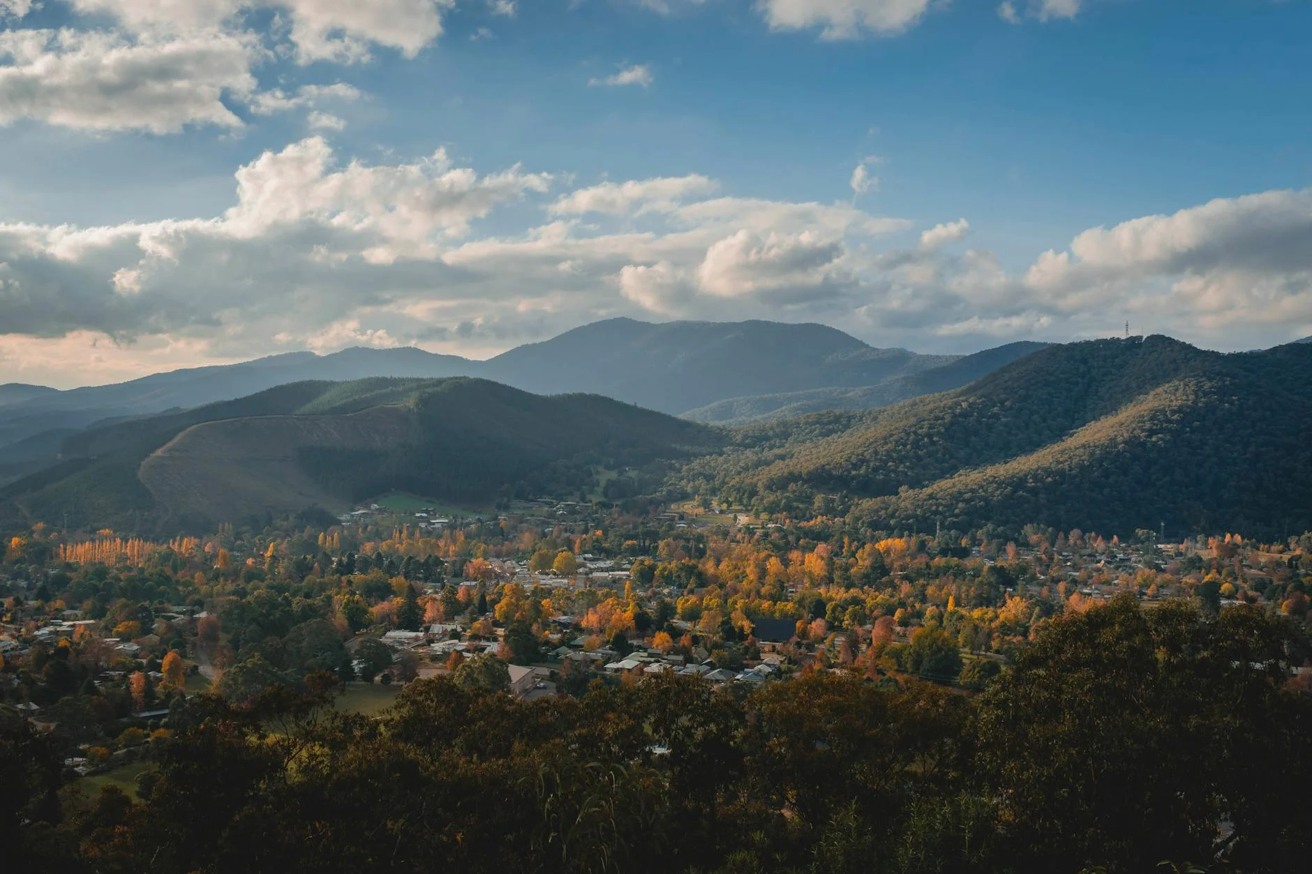
The D'Aguilar Range forms the western backdrop to Brisbane's northern suburbs and the Samford Valley sits at its foot -...
Road quality
7.6 RQS
Strong. Above average on most quality signals.
Accessibility
Fully sealed
Best in Sports car. Peak season: Year-round.
7-day forecast
Tight rainforest roads with constant corner loading and steep elevation. One of the best short drives from Brisbane.
Scored 7.6/10 by Contour's road quality algorithm across curviness, surface, elevation and traffic. Best suited for sports car drivers.
The road
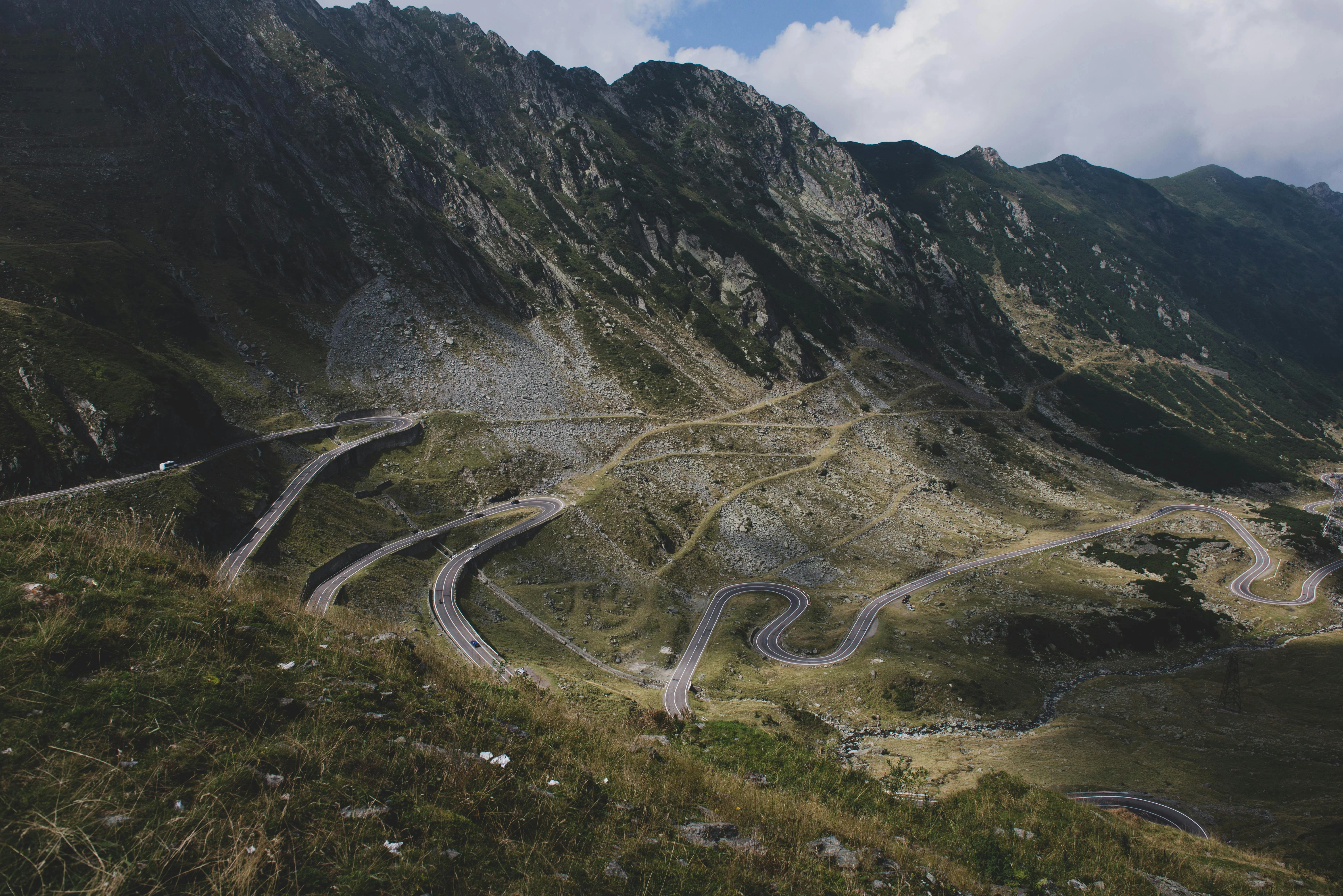
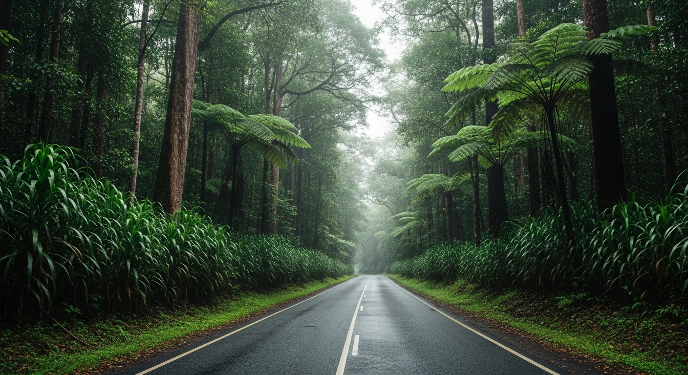
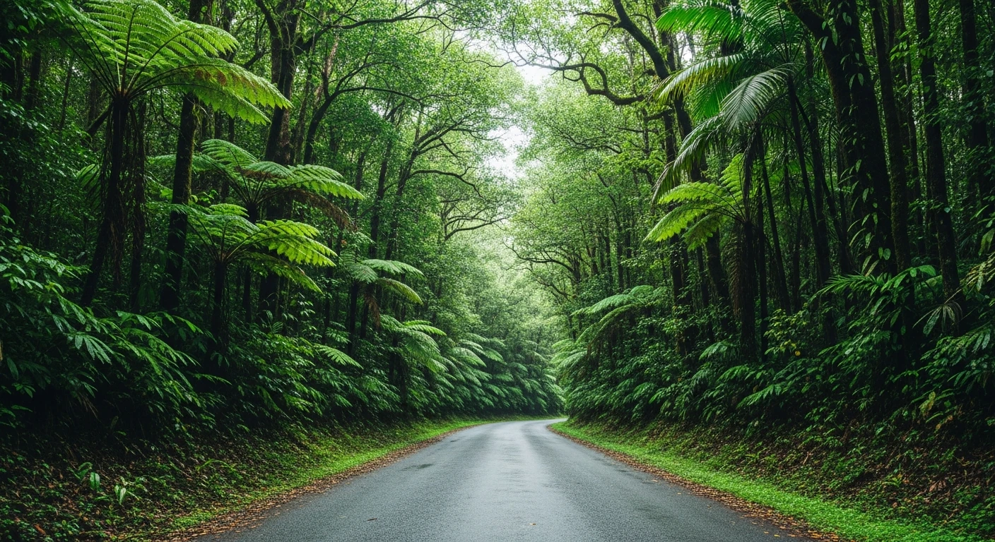
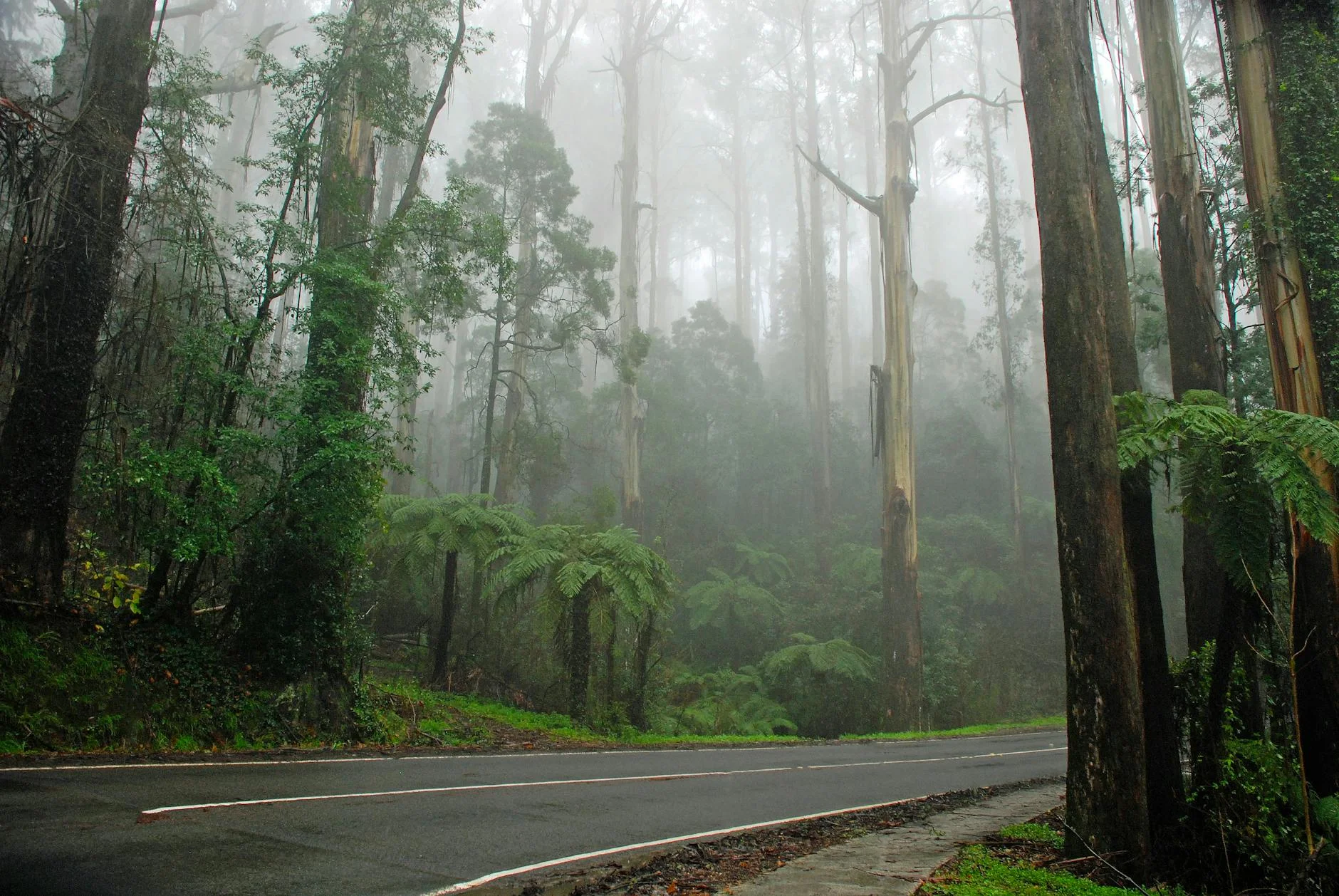
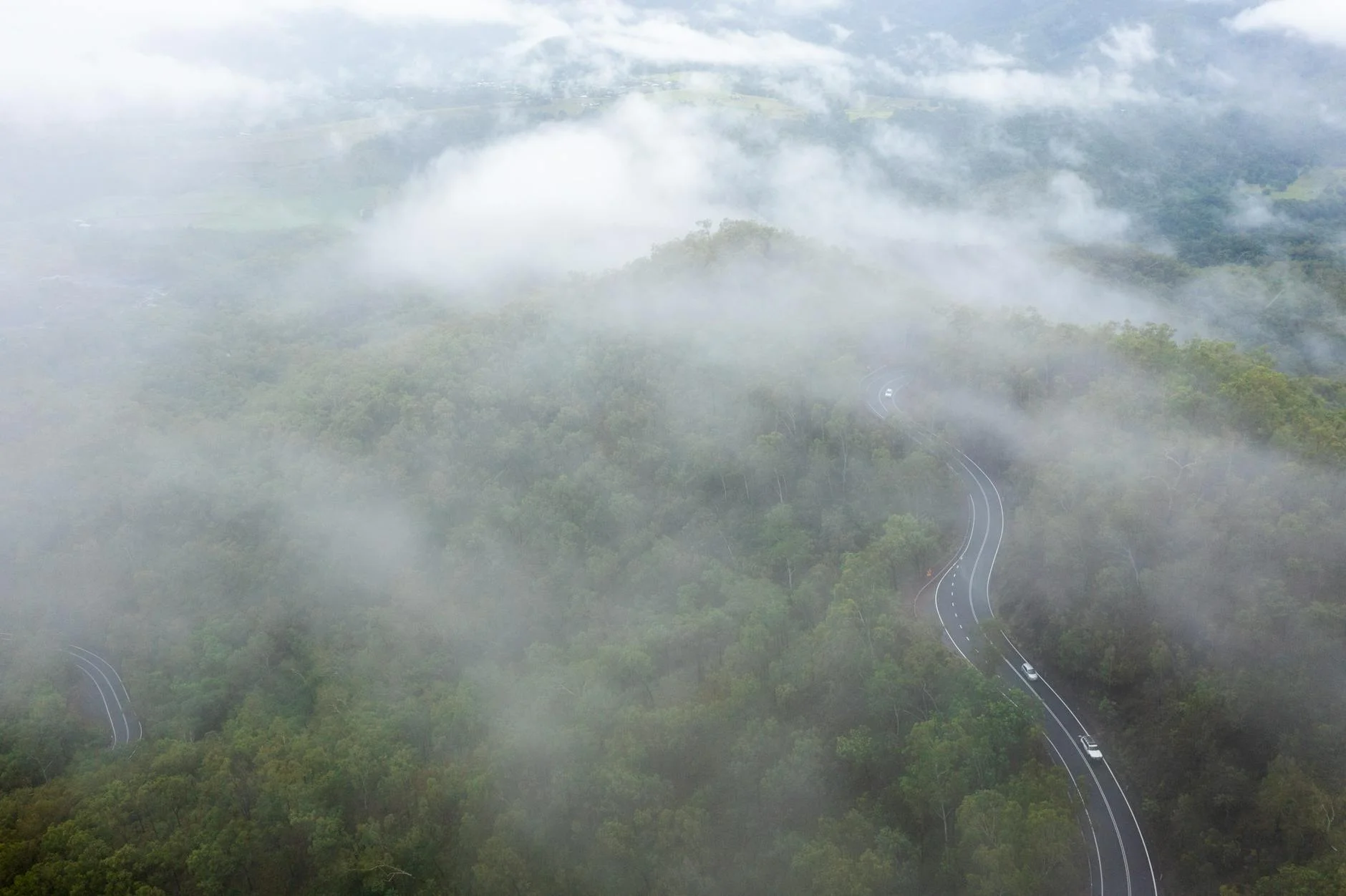
Mount Glorious Road is an 18-kilometre sealed climb from the Samford Valley into the D'Aguilar Range that delivers more driving per kilometre than anything else within an hour of Brisbane. The climb starts in dry eucalypt scrub and transitions through subtropical rainforest to the wet sclerophyll forest of the range top. The corners are tight, the elevation change is genuine - about 600 metres - and the surface is well-maintained on a road that carries mostly locals and the occasional touring motorcyclist. The village of Mount Glorious at the top is little more than a handful of houses, a cafe and a general store, but the road to get there is the point. The return descent is equally satisfying. This is the Brisbane driver's equivalent of the Black Spur - the road that experienced locals use to check whether a car or tyre really does what the manufacturer claims. On a weekday morning it is quiet enough to set your own pace; on Sunday it fills with cyclists and motorbikes. Go before 9am.
Mount Glorious Road is an 18-kilometre sealed climb from the Samford Valley into the D'Aguilar Range that delivers more driving per kilometre than anything else within an hour of Brisbane.
Why this road
The region
The D'Aguilar Range forms the western backdrop to Brisbane's northern suburbs and the Samford Valley sits at its foot - a rural valley of horse properties, hobby farms and the last proper country before the range. Samford is a well-kept small town with a strong community character and several good cafes. The D'Aguilar National Park covers most of the range above Mount Glorious and extends north to the Sunshine Coast hinterland. The rainforest sections on the upper range hold some of the best remaining subtropical rainforest in south-east Queensland.
Before you go
Fuel in Samford. The Mount Glorious village store sometimes has fuel but do not rely on it. The road is fully sealed and open year-round. Wet season rain (November to March) can leave the road surface slippery for days - the canopy shade keeps moisture on the bitumen. The approach to Mount Glorious village narrows significantly - follow the road rather than GPS shortcuts through the range.
See a routing error?
Flag itWorth stopping for
Maiala picnic area, D'Aguilar National Park
A rainforest picnic area at the summit with walking tracks into the wet sclerophyll forest - worth a short walk before the descent.
Samford Valley
The valley below the range has good cafes and a weekend produce market - a good start or finish to the drive.
Route
Start
Samford
End
Mount Glorious
Gallery
More roads like this