Arkaroola Ridgetop Track
130 km self-drive network
distance
8h
Contour time
3.0
difficulty
Unsealed
surface
Scenery
South Australia
The northern Flinders Ranges are the most rugged and remote section of the range system that runs 430 km from the...
Road quality
Grade 2.95588235294118
Every segment scored on 40+ data signals.
Accessibility
Fully sealed
Best in 4WD. Peak season: April-October.
7-day forecast
Stock 4WD with good clearance. The self-drive tracks are well-maintained and signed. Some sections are rocky and steep but nothing that a stock vehicle cannot handle. The famous Ridgetop Tour is a separate guided-only experience using Arkaroola's own vehicles.
Recommended gear: Snatch strap, Recovery boards, Extra water.
The road
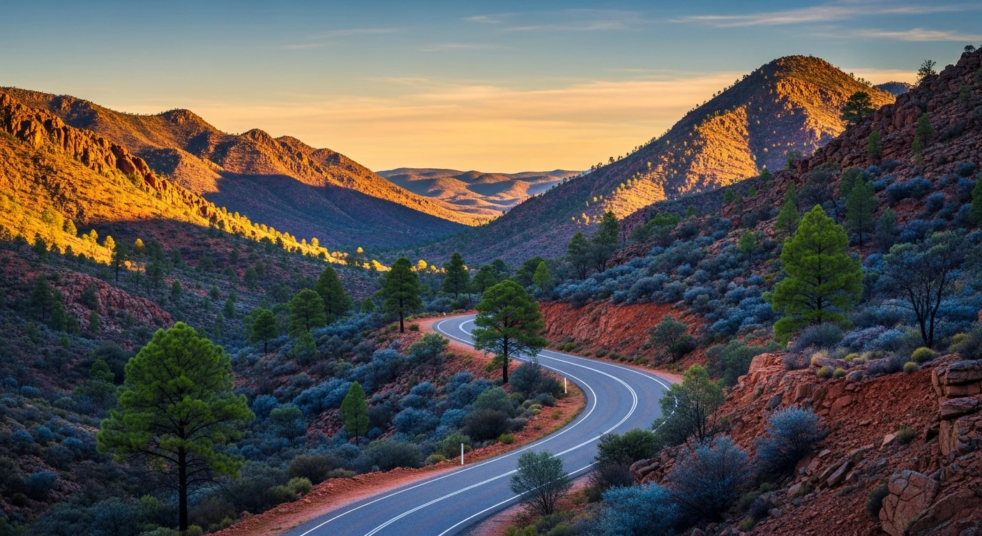
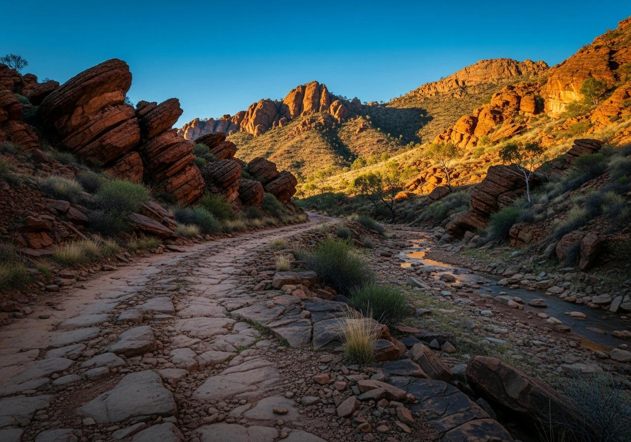
Arkaroola Wilderness Sanctuary sits at the northern end of the Flinders Ranges, where the folded sedimentary ranges give way to the ancient granite and gneiss of the Mount Painter Province - some of the oldest exposed rock on earth at 1.6 billion years, with the surrounding sediments dating to 600 million years. The self-drive 4WD tracks cover roughly 130 kilometres within the sanctuary, radiating out from the Arkaroola Village hub. The Echo Camp Backtrack is the most popular self-drive loop, winding through creek beds and over ridges with views across the Gammon Ranges. The track to the Bolla Bollana copper smelter ruins follows a creek system to the remains of a 19th-century smelter that processed copper ore from the surrounding hills. The stone walls and chimney stack are still standing and the setting - red rock, dry creek, blue sky - is one of the most photogenic in the Flinders. Sillers Lookout, accessible via a short walk from a vehicle track, provides a panorama over the Arkaroola basin that explains the geology better than any textbook. The rock here is visibly folded, faulted and eroded into shapes that reveal the forces that created the ranges. The famous Ridgetop Tour is a separate, guided-only four-hour drive in Arkaroola's modified vehicles along ridgeline tracks too narrow and exposed for private vehicles. It is consistently rated as one of the best 4WD experiences in Australia, but the self-drive network is the accessible version and it is genuinely excellent in its own right. The sanctuary is privately managed and has been since the 1960s when Reg Sprigg, a geologist who discovered the Ediacaran fossils, purchased the property to protect it.
Why this road
The region
The northern Flinders Ranges are the most rugged and remote section of the range system that runs 430 km from the mid-north of South Australia to the edge of the outback. The Gammon Ranges National Park lies to the south of Arkaroola and the country beyond to the north is flat gibber desert stretching to the Strzelecki Track. The nearest town with full services is Copley, 130 km south. The geology here is globally significant - the Ediacaran fossils found in this region changed the understanding of early life on earth.

Before you go
Fuel at Arkaroola Village (limited supply, premium price). Fill up at Copley or Leigh Creek before arriving. The sanctuary charges an entry fee and camping fees. Book accommodation or camping in advance during school holidays. The self-drive tracks are open year-round but summer temperatures exceed 40 degrees - April to October is the best window. Mobile coverage is available at the village but drops out on the tracks. The Ridgetop Tour must be booked in advance and runs on set days.
See a routing error?
Flag itWorth stopping for
Arkaroola Ridgetop Tour
The famous four-hour guided 4WD tour along exposed ridgeline tracks. Must be booked in advance. Not accessible in private vehicles.
Gammon Ranges National Park
Adjacent to Arkaroola with walking tracks through gorge country. The Italowie Gorge walk is the standout.
Route
Start
Arkaroola Village
End
Sillers Lookout approach
Gallery

More roads like this