Wootton Way
21 km
distance
25 min
Contour time
5.7
avg score
Sealed
surface
Scenery
New South Wales
Wootton Way connects Bulahdelah to the Wootton district in the hinterland of Myall Lakes. Bulahdelah sits at the...
Road quality
5.7 RQS
Every segment scored on 40+ data signals.
Accessibility
Fully sealed
Best in Sports car. Peak season: Year-round.
7-day forecast
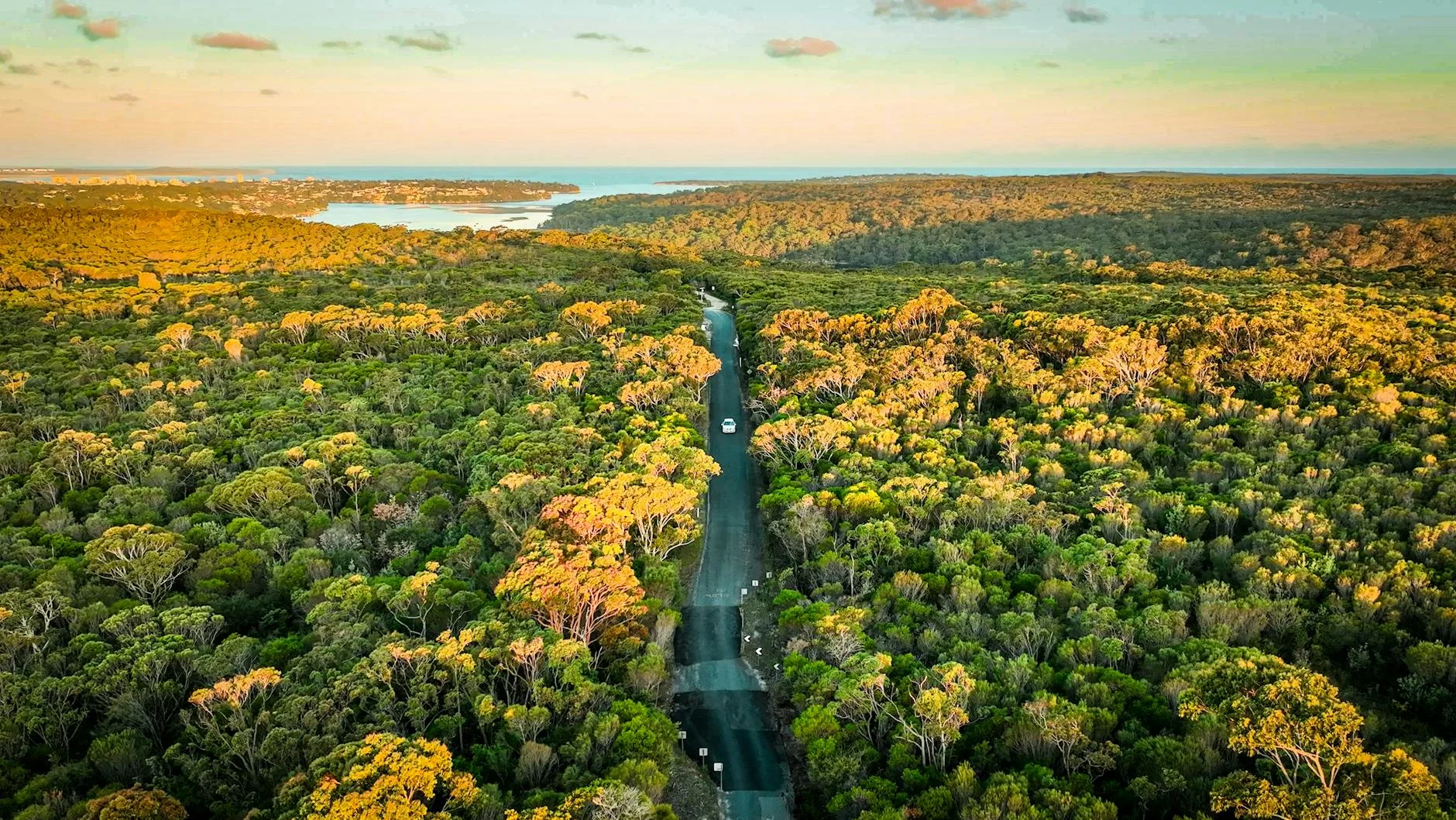
Good sealed surface through the mid-north coast hinterland with consistent corners and very little traffic. Sports car or motorbike ideal. The road runs through state forest for much of its length - canopy closes overhead in the denser sections.
Scored 5.7/10 by Contour's road quality algorithm across curviness, surface, elevation and traffic. Best suited for sports car drivers.
The road
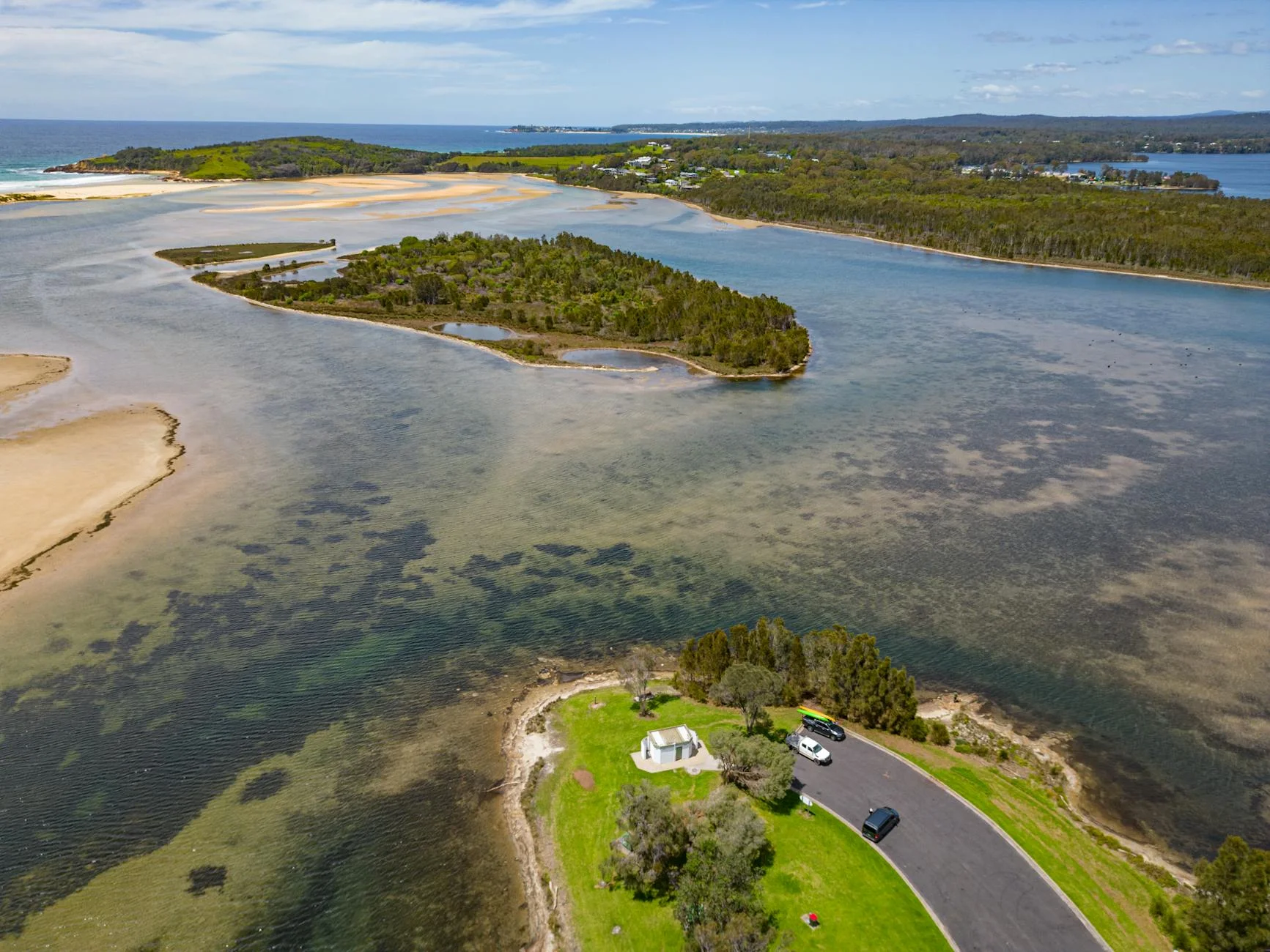
Wootton Way is a 21-kilometre sealed back road through the mid-north coast hinterland that bypasses the Pacific Highway entirely and delivers the kind of forested driving that the main road has lost to its motorway upgrade. The road connects Bulahdelah to the Wootton district through state forest and farming country on the western side of the coastal ranges. The canopy closes overhead in the denser forest sections and the surface is good throughout. Traffic is virtually non-existent - this road exists because the timber industry needed it, and now that the timber has been logged the road serves a handful of farms and the people who know about it. Bulahdelah sits at the gateway to Myall Lakes National Park - one of the largest coastal lake systems in NSW - and the combination of the Wootton drive and a detour to the Bombah Broadwater crossing by cable ferry makes a genuine day trip from Sydney or Newcastle.
Why this road
The region
Wootton Way connects Bulahdelah to the Wootton district in the hinterland of Myall Lakes. Bulahdelah sits at the gateway to Myall Lakes National Park - one of the largest coastal lakes in NSW. The road runs through a mix of state forest and farming country on the western side of the coastal ranges.
Before you go
Fuel in Bulahdelah. Road is sealed throughout and open year-round. Very light traffic. Good surface condition. Logging trucks are rare but possible during the week. Allow 25-30 minutes end to end.
See a routing error?
Flag itWorth stopping for
Myall Lakes National Park
The largest coastal lake system in NSW - good for kayaking, camping and the scenic Bombah Broadwater crossing by cable ferry.
Bulahdelah Mountain Lookout
Short walking track from the town to a sandstone lookout above the valley - worth 20 minutes for the view back over the Myall country.
Route
Start
Bulahdelah
End
Wootton
Gallery
More roads like this
