Woolpack Trail
5 km
distance
50 min
Contour time
2.9
difficulty
Unsealed
surface
Scenery
Australian Capital Territory
Woolpack Trail sits in the Orroral Valley, one of the quieter southern arms of Namadgi National Park. The Orroral...
Road quality
Grade 2.91666666666667
Every segment scored on 40+ data signals.
Accessibility
Fully sealed
Best in 4WD. Peak season: Autumn-Spring.
7-day forecast
Compact and rocky. Needs a standard high-clearance 4WD. The track is short but doesn't ease up - approach carefully in a single vehicle. Great introduction to technical 4WD without committing to a remote route.
Recommended gear: Recovery boards, Snatch strap, Tyre repair kit.
The road
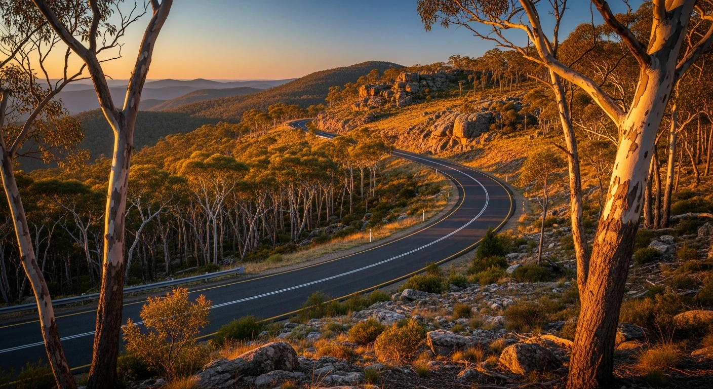
Woolpack Trail is a compact fire trail in northern Namadgi National Park that delivers a satisfying 4WD experience within 30 minutes of Canberra's suburbs. The trail runs through dry sclerophyll forest with granite outcrops and occasional valley views toward the Murrumbidgee. Despite the proximity to the city, the trail stays genuinely quiet. It connects into the broader Namadgi fire trail network but sees little recreational 4WD use. The terrain is moderate - rocky sections with reasonable surface drainage. A well-prepared stock 4WD handles it comfortably in dry conditions. Summer fire danger periods can close the trail. The Tidbinbilla Nature Reserve 25 minutes east is the ACT's best wildlife sanctuary - the wetland boardwalk is reliable for platypus sightings at dawn.
Woolpack Trail is a compact fire trail in northern Namadgi National Park that delivers a satisfying 4WD experience within 30 minutes of Canberra's suburbs.
Why this road

The region
Woolpack Trail sits in the Orroral Valley, one of the quieter southern arms of Namadgi National Park. The Orroral Valley itself is best known to astronomers - the old Orroral Valley Space Tracking Station operated here from 1965 to 1985 and tracked Apollo, Skylab and several deep space missions. The valley is open grassland flanked by Brindabella ridgelines and is now used by hikers, mountain bikers and the occasional 4WD. Wildlife is abundant: kangaroos and wallabies graze the valley flats, wedge-tail eagles are a constant presence overhead.

Before you go
Access via Boboyan Road from the ACT side. Fuel and supplies in Tharwa or Canberra before departure. No services on route. The track is inside Namadgi National Park - check NPWS conditions and closures before visiting. Recovery gear recommended. Avoid after significant rain - the surface becomes very slippery in wet conditions.
See a routing error?
Flag itWorth stopping for
Orroral Valley Tracking Station ruins
The original NASA tracking station site with concrete remnants and interpretive signage - one of Australia's most significant Cold War science sites, 10 minutes from the trail.
Tidbinbilla Nature Reserve
20 minutes north - native wildlife sanctuary with platypus, koalas and echidnas in a protected enclosure setting.
Route
Start
Orroral Valley
End
Woolpack Ridgeline
Gallery

More roads like this