Boboyan Road
19 km
distance
26 min
Contour time
5.3
avg score
Sealed
surface
Scenery
Australian Capital Territory
Boboyan Road runs through the most remote corner of Namadgi National Park, connecting the ACT's southern edge to the...
Road quality
5.3 RQS
Every segment scored on 40+ data signals.
Accessibility
Fully sealed
Best in Sports car. Peak season: Spring-Autumn.
7-day forecast
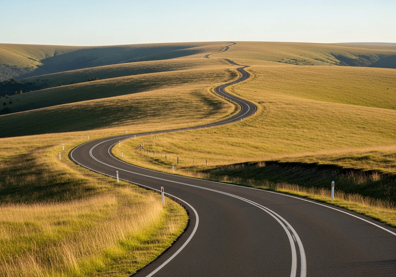
Open paved road through southern Namadgi with good visibility and long sightlines. The elevation change is substantial - 351m per km in sections. Sports car handles this well. Watch for kangaroos and wombats at dawn and dusk throughout.
Scored 5.3/10 by Contour's road quality algorithm across curviness, surface, elevation and traffic. Best suited for sports car drivers.
The road
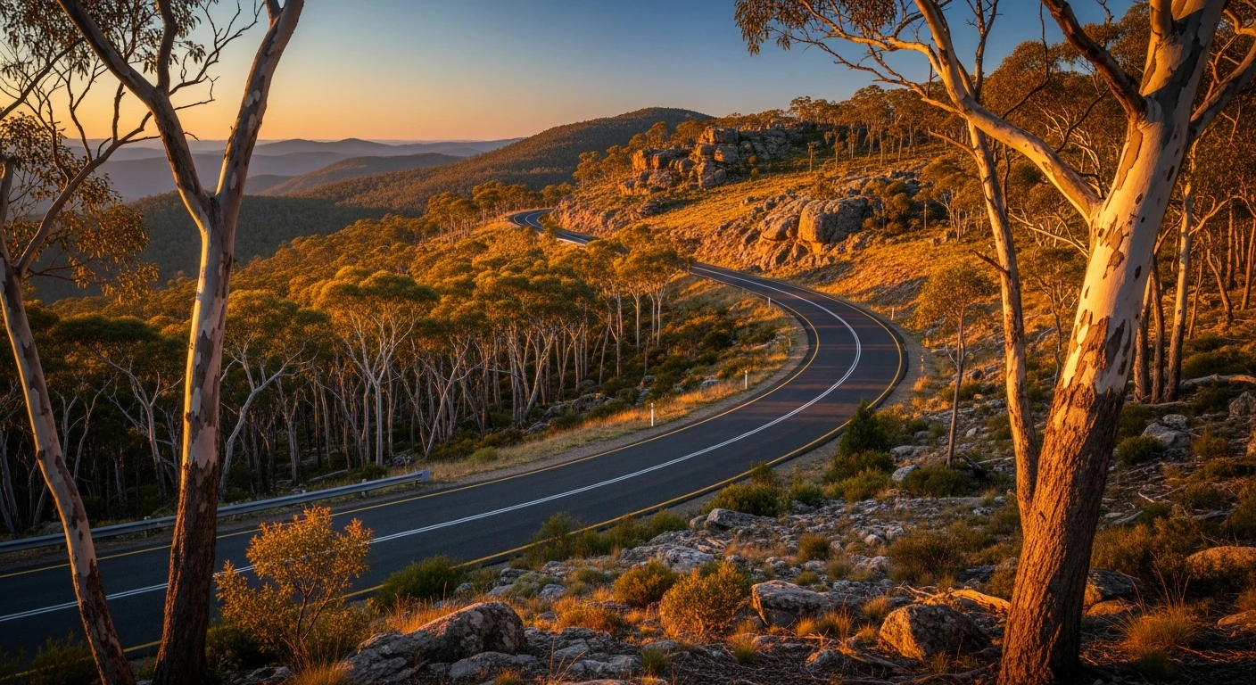
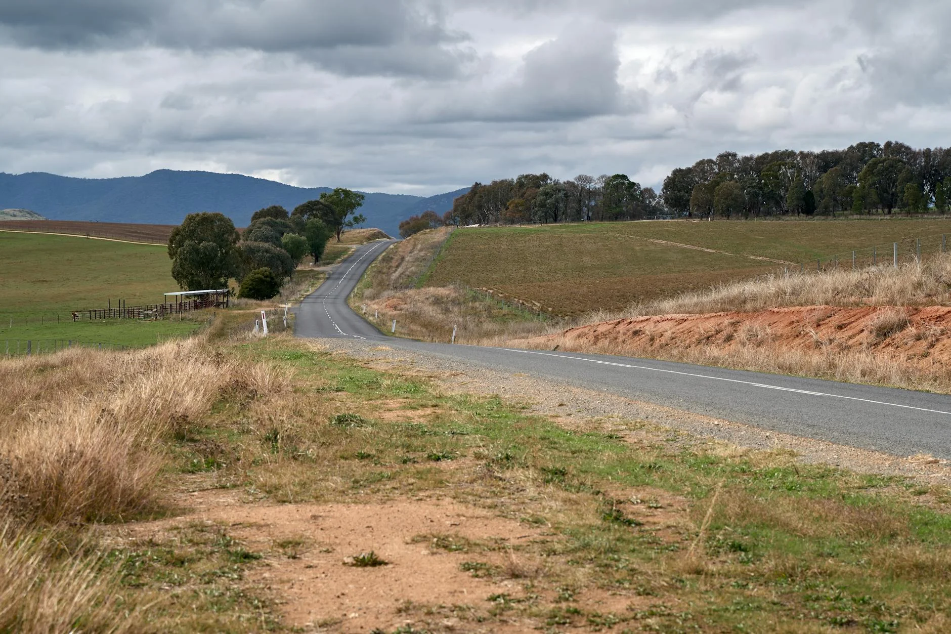
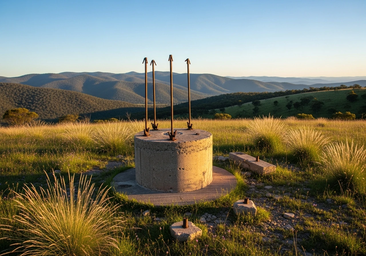
Boboyan Road runs through the most remote corner of Namadgi National Park - the part of the ACT that most Canberrans have never driven. The 19-kilometre sealed road from Boboyan to the Orroral Valley crosses subalpine country at the edge of the Australian Alps system. The landscape here is open grassy plains between ranges, with the Orroral Valley's former NASA tracking station ruins adding an unexpected historical layer. The tracking station at Orroral operated from 1965 to 1985, tracking Gemini and Apollo missions from this subalpine grassland - the antenna mount is still standing on a short walk from the road. The elevation tops 1,300 metres in places and the open plateau has a wide, exposed quality unlike the forested roads elsewhere in the ACT. Kangaroos and wombats are numerous on the road at dawn and dusk. Black ice is a genuine risk from June to August on the higher sections. The Orroral Valley campsite at the end provides an overnight option in one of the quietest accessible locations near any Australian capital.
Boboyan Road runs through the most remote corner of Namadgi National Park - the part of the ACT that most Canberrans have never driven.
Why this road
The region
Boboyan Road runs through the most remote corner of Namadgi National Park, connecting the ACT's southern edge to the Orroral Valley. This is subalpine country at its edge - open grassy plains between ranges, with the Orroral Valley's former NASA tracking station ruins adding an unexpected landmark. Elevation tops 1,300 metres in places.
Before you go
Fuel in Canberra. Road is sealed and open year-round but exposed to ice and snow in winter. Black ice is a genuine risk June to August. Kangaroos are numerous on the road at dawn and dusk - drive carefully. Very little traffic. The Orroral Valley campsite provides an overnight option.
See a routing error?
Flag itWorth stopping for
Orroral Tracking Station ruins
Former NASA Minitrack station that tracked Gemini and Apollo missions - the antenna mount is still standing on a short walk from the road.
Honeysuckle Creek
Another former NASA tracking station site, 30 minutes north - received Apollo 11 TV signal before Parkes.
Route
Start
Boboyan
End
Orroral Valley
Gallery
More roads like this