Corin Road
22 km
distance
28 min
Contour time
9.1
avg score
Sealed
surface
Scenery
Australian Capital Territory
Corin Road runs through Namadgi National Park on the ACT's western fringe, climbing toward the Brindabella Range. The...
Road quality
9.1 RQS
Exceptional. Consistently high curviness, surface, and low traffic.
Accessibility
Fully sealed
Best in Sports car. Peak season: Year-round.
7-day forecast
Tight sealed corners through dense Brindabella eucalypt. Sports car and motorbike both reward the technical rhythm. Some frost on the upper sections in winter.
Scored 9.1/10 by Contour's road quality algorithm across curviness, surface, elevation and traffic. Best suited for sports car drivers.
The road
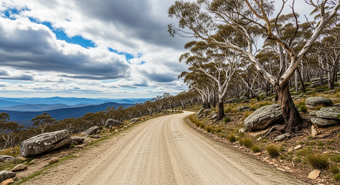
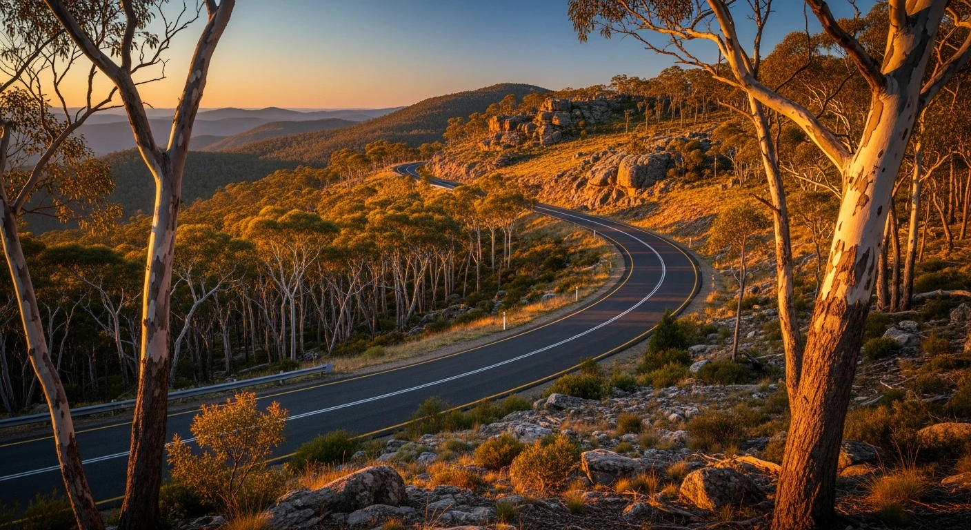
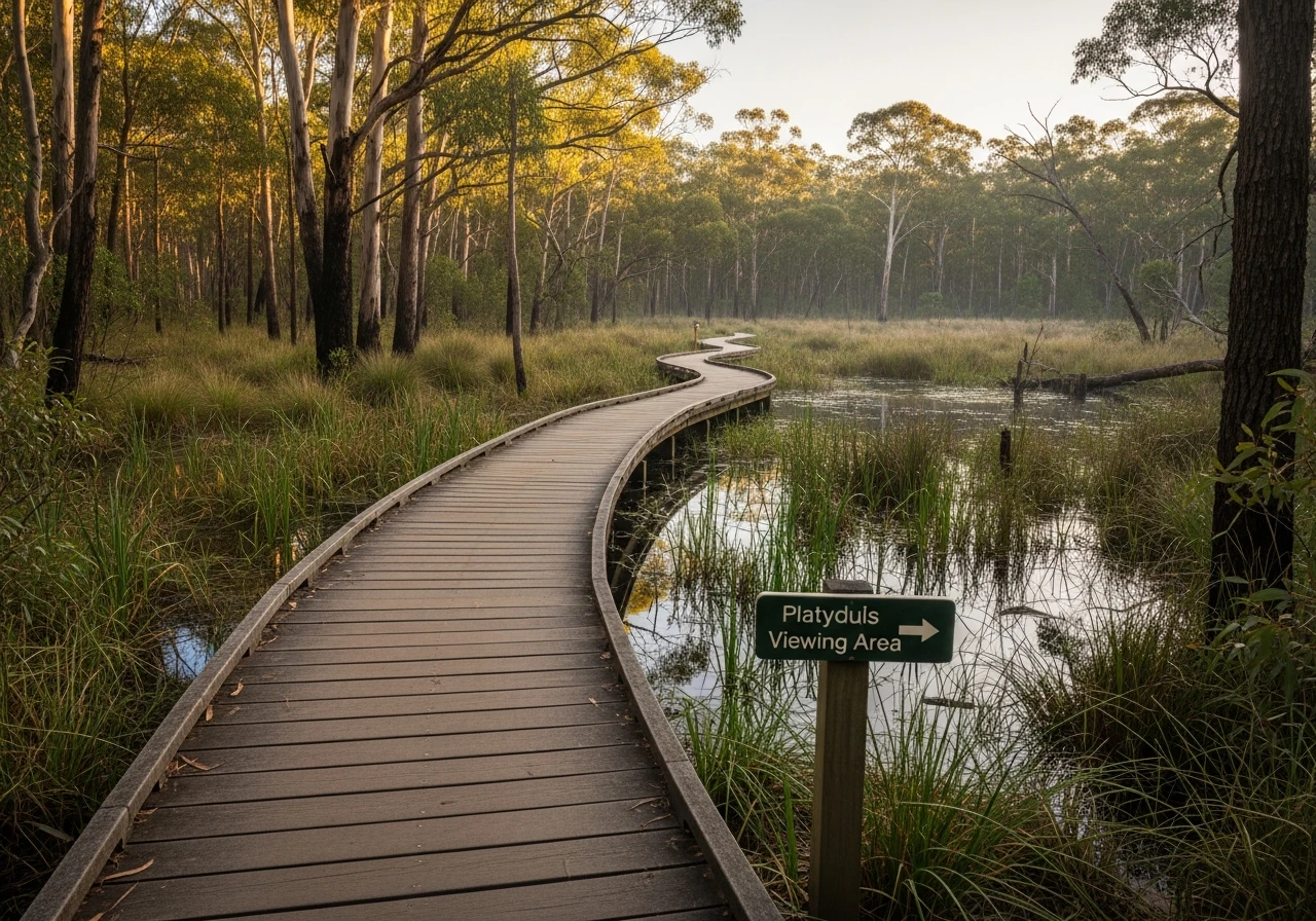
Corin Road is one of those roads that Canberra drivers keep to themselves. The 22-kilometre sealed climb from Tharwa into the Brindabella Range foothills gains elevation through dense dry sclerophyll that transitions to tall eucalypt as the road climbs. The corners are tight and constant - the kind of rhythm driving where each bend leads directly into the next with barely a straight between them. The bush presses close on both sides and the canopy is thick enough that the road feels enclosed even on bright days. Traffic is almost non-existent. The Corin Forest area and dam at the top see far fewer visitors than the Tidbinbilla Valley next door, which means the road serves mostly the people who specifically want to drive it. RQS 9.07 across matched segments makes this one of the highest-scoring sealed roads in the ACT. Black ice on the upper sections from June to August is the main hazard - the elevation gain is real and the shaded corners hold frost well into the morning. The Tidbinbilla Nature Reserve 10 minutes east has reliable platypus sightings at dawn on the wetland boardwalk.
Corin Road is one of those roads that Canberra drivers keep to themselves.
Why this road
The region
Corin Road runs through Namadgi National Park on the ACT's western fringe, climbing toward the Brindabella Range. The Corin Forest and dam area see far less traffic than the Tidbinbilla Valley next door. The bush is dry sclerophyll on the lower slopes, transitioning to tall eucalypt as the road climbs.
Before you go
Fuel in Tharwa or Canberra before departure. Road is sealed throughout and open year-round. Black ice possible on upper sections June to August. Very light traffic on weekdays. No fuel or services along the route.
See a routing error?
Flag itWorth stopping for
Tidbinbilla Nature Reserve
10 minutes east - one of the better wildlife sanctuaries near Canberra, with platypus, koalas and eastern bettongs.
Canberra Space Centre
30 minutes away, the Honeysuckle Creek tracking station that received the Apollo 11 moonwalk signal.
Route
Start
Tharwa
End
Corin Dam
Gallery
More roads like this