Wombat Flats Track
9 km
distance
1h 5m
Contour time
3.0
difficulty
Unsealed
surface
Scenery
Tasmania
The Tarkine in northwest Tasmania is Australia's largest cool temperate rainforest wilderness - 477,000 hectares of...
Road quality
Grade 3
Every segment scored on 40+ data signals.
Accessibility
Fully sealed
Best in 4WD. Peak season: Summer (Dec-Mar).
7-day forecast
Moderate difficulty in a highly remote and challenging environment. The elevated RRI reflects the Tarkine's characteristic isolation - help is very far away. A prepared stock 4WD handles the surface but the remoteness demands proper equipment.
Recommended gear: Recovery boards, Snatch strap, Tyre repair kit, Waterproof gear, Satellite comms.
The road
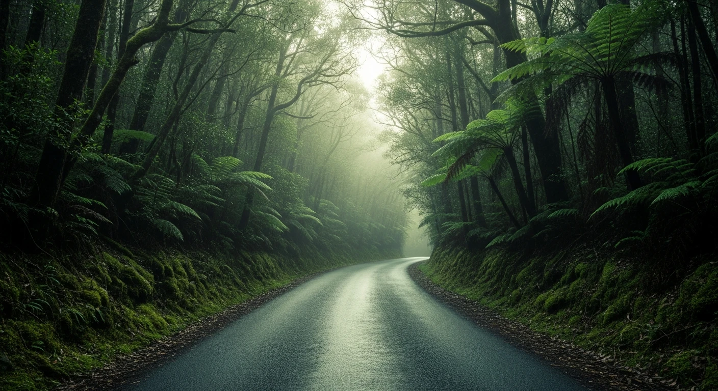
Wombat Flats Track runs through the Tarkine buffer zone around the Savage River - the transition from mine-disturbed country to the old-growth rainforest of Australia's largest temperate forest wilderness. The 9-kilometre track follows the Savage River drainage through dense myrtle beech and leatherwood. The RRI of 5.97 reflects the Tarkine's characteristic isolation - help is very far away. The track itself is manageable for a capable stock 4WD, but the remoteness demands proper preparation including satellite communication. Wombat Flats itself is a buttongrass opening in the forest - one of the clearings that give the Tarkine its distinctive mix of dense forest and open highland meadow. The Tarkine wilderness surrounds this area and extends to the coast where the Arthur River runs one of the cleanest waterways in the world.
Why this road

The region
The Tarkine in northwest Tasmania is Australia's largest cool temperate rainforest wilderness - 477,000 hectares of myrtle beech, leatherwood, Huon pine and ancient vegetation communities that have existed since Gondwana. The Savage River area on the Tarkine's eastern edge was the site of iron ore mining and dam works in the 1960s and 70s; the surrounding forest is recovering and the track passes through the transition from disturbed mining fringe to old-growth.

Before you go
Fuel in Burnie or Queenstown before departure. Satellite comms recommended - the Tarkine is one of the most remote accessible regions in Tasmania. Summer only for comfortable conditions - the Tarkine receives extraordinary rainfall. Wombat Flats itself is a button grass opening in the forest.
See a routing error?
Flag itWorth stopping for
Tarkine Drive (C249)
The main Tarkine road from Smithton to the Arthur River offers sealed access to the forest edges with several excellent viewpoints and the extraordinary Philosophers Falls walk.
Arthur River township
At the edge of the Tarkine wilderness coast - the River Cruise on the Arthur and Frankland rivers is the best way to see the riverside rainforest without a 4WD.
Route
Start
Tarkine/Savage River area
End
Wombat Flats
Gallery

More roads like this