Coldstream Track
8 km
distance
1h 20m
Contour time
3.0
difficulty
Unsealed
surface
Scenery
Tasmania
The Coldstream drainage is in the heart of the Tarkine buffer zone around the Savage River. The forest here transitions...
Road quality
Grade 3
Every segment scored on 40+ data signals.
Accessibility
Fully sealed
Best in 4WD modified. Peak season: Summer (Dec-Mar).
7-day forecast
Highest difficulty in the Savage River area track network. Wet dolerite and root surfaces require an experienced driver and a capable 4WD. The RRI is elevated by the remote Tarkine location. Summer is the only practical window and even then the track is challenging.
Recommended gear: Recovery boards, Snatch strap, Hi-lift jack, Satellite comms, Tyre repair kit, Waterproof gear (essential).
The road
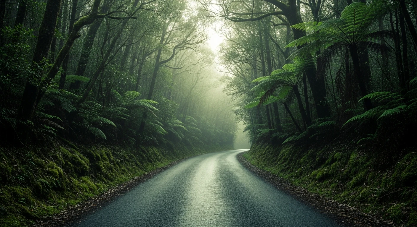
Coldstream Track is the highest-difficulty route in the Savage River area 4WD network and one of the most demanding in Tasmania. The 8-kilometre track follows the Coldstream drainage through dense myrtle beech and Huon pine country in the heart of the Tarkine buffer zone. The surface combines wet dolerite, exposed roots and deep mud holes that require an experienced driver and a capable 4WD with all-terrain tyres. The RRI of 6.06 reflects both the difficulty and the extreme remoteness. The Coldstream itself is a clear tea-coloured river characteristic of all west coast Tasmanian streams - the tannin staining comes from the surrounding leatherwood and buttongrass. Even in summer this track can see multi-day rainfall events that transform already challenging conditions into something more serious. Preparation matters more here than on any other track in the Savage River network.
Coldstream Track is the highest-difficulty route in the Savage River area 4WD network and one of the most demanding in Tasmania.
Why this road

The region
The Coldstream drainage is in the heart of the Tarkine buffer zone around the Savage River. The forest here transitions from the mine-impacted country around the Savage River town to the intact old-growth Tarkine ahead. The Coldstream itself is a fast-moving clear river in the style of all west coast Tasmanian streams - tea-coloured from tannins, cold and very clean. The track follows this drainage through dense myrtle beech and Huon pine country.

Before you go
Fuel in Burnie or Smithton. This is a serious Tarkine track requiring full preparation. Satellite comms are mandatory. Summer travel recommended but even December through February can see multi-day rainfall events in the west coast. A capable, well-maintained 4WD with experienced driver is the minimum requirement.
See a routing error?
Flag itWorth stopping for
Savage River town and mine
The remote iron ore mining community at Savage River is one of the most isolated working towns in Tasmania - the mine tour (when available) is a unique industry experience.
Tarkine Drive
The sealed Tarkine touring route from Smithton provides context for the scale of the wilderness surrounding this track.
Route
Start
Tarkine/Savage River area
End
Coldstream Track end
Gallery

More roads like this