Telegraph Track (Closed)
12.5 km
distance
2h 5m
Contour time
2.4
avg score
Unsealed
surface
Scenery
Western Australia
The closed section of the Eyre telegraph track in the Nuytsland region represents the most challenging section of the...
Road quality
2.4 RQS
Every segment scored on 40+ data signals.
Accessibility
Fully sealed
Best in 4WD modified. Peak season: Year-round.
7-day forecast
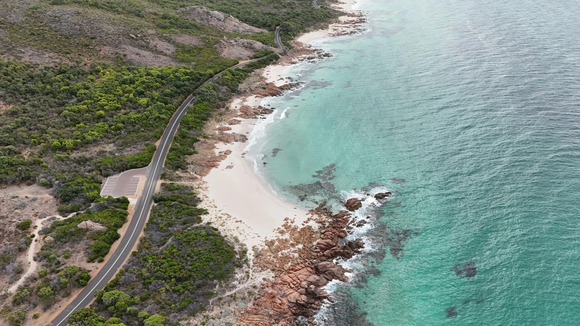
Closed section of the original telegraph track - technically very demanding and extremely remote. The track is officially closed (hence the name) meaning minimal maintenance and no emergency support infrastructure. Expert-level remote 4WD only.
Scored 2.4/10 by Contour's road quality algorithm across curviness, surface, elevation and traffic. Best suited for 4wd modified drivers.
The road
The closed section of the Eyre telegraph track is one of the most technically demanding and isolated 4WD routes in Western Australia. The "closed" designation means the road is no longer officially maintained - the surface has been reclaimed by the coastal heath and the track requires navigational skill as well as driving ability. The terrain is typical of the Nuytsland south coast - calcareous heath growing on shallow soils over limestone and granite. The wind patterns along this exposed coast keep the vegetation low and sculpted, creating an eerie landscape that feels genuinely ancient. The Southern Ocean exposure is relentless and the offshore conditions are often extreme. This track is not accessible to inexperienced operators. The closed designation means no expectation of a maintained surface, no emergency infrastructure and no mobile coverage. Full expedition preparation including significant spare parts is required. Satellite comms are mandatory. The nearest fuel is in Esperance, over 200 kilometres away. For experienced remote 4WD operators, this is one of the most rewarding tracks in the country - the isolation is total and the coastal wilderness is undisturbed.
The closed section of the Eyre telegraph track is one of the most technically demanding and isolated 4WD routes in Western Australia.
Why this road

The region
The closed section of the Eyre telegraph track in the Nuytsland region represents the most challenging section of the old maintenance alignment. The 'closed' designation means the road is no longer officially maintained and access is at the driver's own risk. The terrain is typical south coast WA - calcareous heath on shallow soils over limestone and granite with wind-sculpted vegetation responding to the constant Southern Ocean exposure.

Before you go
This track requires higher competence and preparation than most WA south coast tracks. The closed designation means no expectation of maintained surface. Full expedition preparation including significant spare parts. Satellite comms are mandatory. Not suitable for any but experienced remote 4WD operators.
See a routing error?
Flag itWorth stopping for
Balladonia, WA
The most isolated roadhouse on the Eyre Highway, 150km east - historically significant as the landing site of Skylab debris in 1979.
Nuytsland Nature Reserve coast
The broader reserve is extraordinary for coastal wilderness - sea lions, whales in season and completely undisturbed coastal ecology.
Route
Start
Nuytsland WA, Eyre region
End
Telegraph Track closed end
Gallery

More roads like this