Telegraph Bypass Track
18 km
distance
2h 10m
Contour time
4.8
difficulty
Unsealed
surface
Scenery
Western Australia
The WA south coast between Esperance and the Nullarbor is one of Australia's least visited coastal areas. The Nuytsland...
Road quality
Grade 4.81
Every segment scored on 40+ data signals.
Accessibility
Fully sealed
Best in 4WD modified. Peak season: Year-round.
7-day forecast
Long difficult track in one of Australia's most remote coastal regions. The Nuytsland coast between Esperance and the SA border has almost no infrastructure and enormous distances between services. Full expedition preparation is mandatory.
Recommended gear: Recovery boards, Snatch strap, Hi-lift jack, Satellite comms (mandatory), Extra water (20L+), Spare tyre, Fuel (500km range minimum).
The road
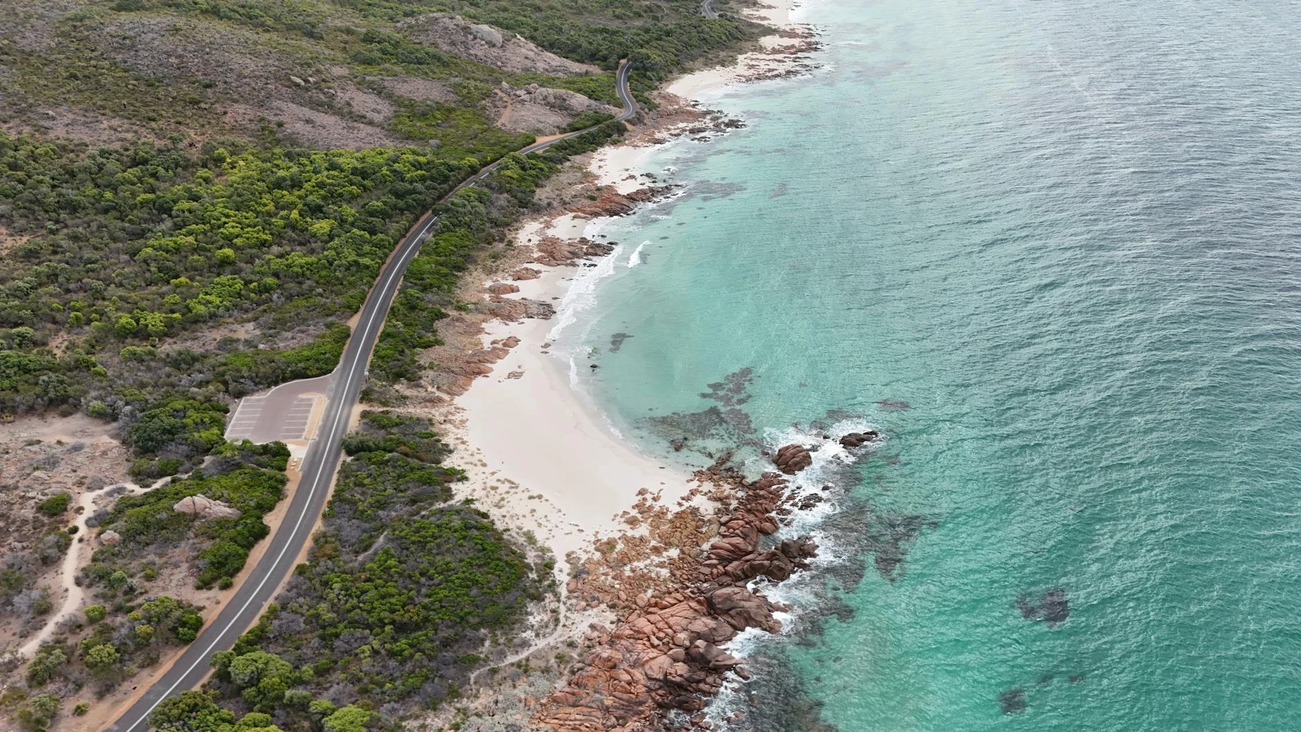
The Telegraph Bypass Track follows the alignment of the maintenance access road built in the 1870s for the Overland Telegraph Line connecting Western Australia to South Australia. The telegraph line predated the railway by decades and was the first engineered route through the coastal wilderness between Esperance and the SA border. This is expedition 4WD territory in every sense. The Nuytsland coast between Esperance and the Nullarbor is one of Australia s least visited coastal areas, with almost no infrastructure and enormous distances between services. The coastal heath along the track is exposed to the full force of the Southern Ocean and the vegetation responds accordingly - wind-sculpted, low and dense. Seabird activity along this coast is extraordinary. Planning for this track must account for the complete absence of services between Esperance and Eucla. A satellite communicator is mandatory, not optional. Fuel range of 500 kilometres minimum is required. The reward is access to one of Australia s most isolated and undisturbed coastal wilderness areas - the kind of place that makes the preparation worthwhile.
The Telegraph Bypass Track follows the alignment of the maintenance access road built in the 1870s for the Overland Telegraph Line connecting Western Australia to South Australia.
Why this road

The region
The WA south coast between Esperance and the Nullarbor is one of Australia's least visited coastal areas. The Nuytsland Nature Reserve protects a continuous strip of coastal heath, granite headlands and sand dunes along a coast that is exposed to the full force of the Southern Ocean. The original telegraph line connecting WA to SA ran through this country and the bypass track follows the alignment of the maintenance access road from the 1800s.

History
The Overland Telegraph Line connecting WA to SA was completed in 1877, predating the railway by decades. The line ran through the Nuytsland coast country and maintenance riders were stationed at intervals along the route. The bypass track follows a section of the telegraph maintenance alignment - one of the earliest European infrastructure routes through the south coast wilderness.
Before you go
This is expedition 4WD territory. Fuel in Esperance - no services for 500km. Satellite comms mandatory. Full complement of recovery equipment and spare parts. Plan this as a multi-day trip. The Nullarbor is next - fuel planning must account for the complete absence of services between Esperance and Eucla.
See a routing error?
Flag itWorth stopping for
Twilight Cove
A spectacular sea cliffs viewpoint at the edge of the Nullarbor - 200km east on the Eyre Highway, the contrast to the Nuytsland heath is dramatic.
Recherche Archipelago viewing
The offshore islands of the Recherche Archipelago, visible from the south coast, are critical Australian sea lion and New Zealand fur seal breeding habitat.
Route
Start
Nuytsland Reserve, south coast WA
End
Telegraph Bypass end
Gallery

More roads like this