Pasley Track
10 km
distance
1h 40m
Contour time
5.0
difficulty
Unsealed
surface
Scenery
Western Australia
Cape Pasley is one of the remotest points on the WA south coast - a granite headland at the eastern end of the...
Road quality
Grade 5
Every segment scored on 40+ data signals.
Accessibility
Fully sealed
Best in 4WD modified. Peak season: Year-round.
7-day forecast
Maximum difficulty and high recovery risk in one of Australia's most isolated locations. The Pasley Track is not accessible to unprepared vehicles or drivers. Two-vehicle travel strongly recommended. This is expert-level remote WA 4WD.
Recommended gear: PLB (strongly recommended), Satellite comms (mandatory), Hi-lift jack, Multiple recovery boards, Snatch strap, Extra water (30L+), Spare tyre (full size), Fuel for 500km+.
The road
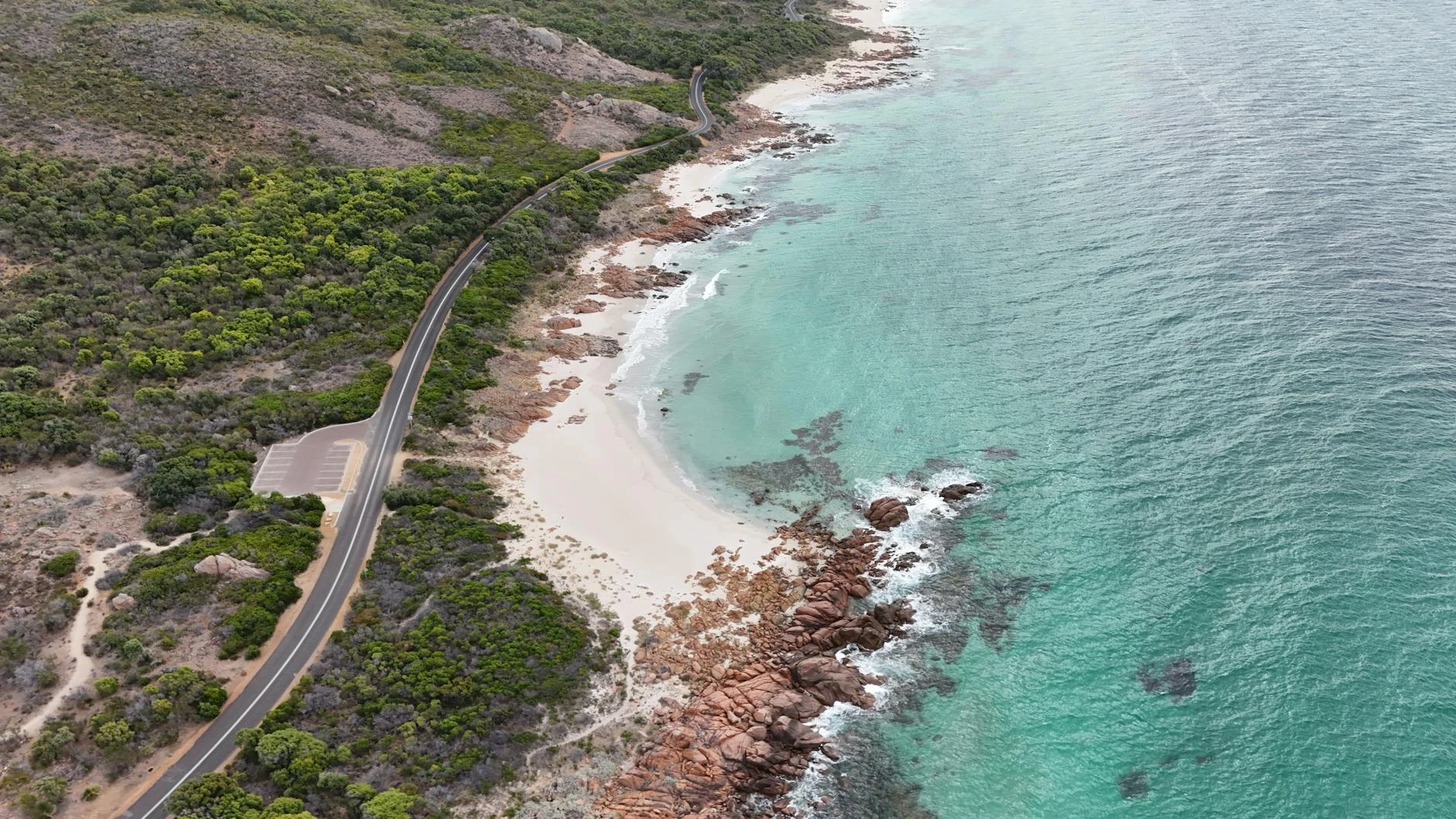
The Pasley Track accesses one of the remotest points on the WA south coast - Cape Pasley, a granite headland named by Matthew Flinders during his 1802 coastal survey aboard HMS Investigator. The cape sits at the eastern end of the Esperance hinterland with the Nuytsland wilderness reserve extending on all sides. This is maximum difficulty and maximum isolation. The track is not accessible to unprepared vehicles or drivers - two-vehicle travel is strongly recommended and a PLB is essential. The nearest fuel is in Esperance, over 200 kilometres away. All emergency and recovery equipment must be entirely self-contained. Flinders mapped much of the WA south coast on his 1802 voyage, naming features after crew members and patrons of the Investigator expedition. Cape Pasley appears on the original survey charts and remains one of the most significant historical landmarks on the south coast. The coast here is exposed to the full fetch of the Southern Ocean and the offshore sea conditions are often extreme. For experienced remote 4WD operators, the Pasley Track represents the far edge of what is achievable on Australian coastal tracks.
The Pasley Track accesses one of the remotest points on the WA south coast - Cape Pasley, a granite headland named by Matthew Flinders during his 1802 coastal survey aboard HMS Investigator.
Why this road

The region
Cape Pasley is one of the remotest points on the WA south coast - a granite headland at the eastern end of the Esperance hinterland, with the Nuytsland wilderness reserve extending on all sides. The coast here is exposed to the full fetch of the Southern Ocean and the offshore sea conditions are often extreme. Cape Pasley was a significant landmark for early voyagers rounding the south of Australia and appears on charts from 1802.

History
Cape Pasley was named by Matthew Flinders in 1802 during his coastal survey of southern Australia aboard HMS Investigator. Flinders mapped much of the WA south coast on this voyage, naming features after crew members and patrons. The cape appears on the original Investigator survey charts as Flinders documented the approaches to the Great Australian Bight.
Before you go
Nearest fuel in Esperance - over 200km away. A PLB is strongly recommended and a satellite communicator is mandatory. Two-vehicle travel is the only responsible approach to this track. All emergency and recovery equipment must be self-contained. Do not attempt without extensive remote 4WD experience.
See a routing error?
Flag itWorth stopping for
Cape Le Grand NP
The companion park 150km west is far more accessible - Lucky Bay, Cape Le Grand and the whale watching season (June-October) make it an essential addition to any Esperance 4WD trip.
Balladonia roadhouse
The isolated Eyre Highway roadhouse 250km east is the nearest fuel east of Esperance - home to the famous Skylab debris exhibition.
Route
Start
Nuytsland Eyre region WA
End
Pasley Track end
Gallery

More roads like this