Tanami Track
1013 km
distance
40h
Contour time
3.1
avg score
Unsealed
surface
Scenery
Northern Territory
The Tanami Desert is Aboriginal land throughout. The track crosses Warlpiri, Gurindji and Jaru country. Yuendumu...
Road quality
3.1 RQS
Every segment scored on 40+ data signals.
Accessibility
Fully sealed
Best in 4WD. Peak season: May-October.
7-day forecast
The Tanami is not technically difficult - it is a wide graded dirt road for most of its length. The danger is the distance, the heat, the corrugations and the isolation. Breakdowns here are serious. Two spare tyres are essential. Do not attempt solo without a satellite communicator.
Scored 3.1/10 by Contour's road quality algorithm across curviness, surface, elevation and traffic. Best suited for 4wd drivers.
The road
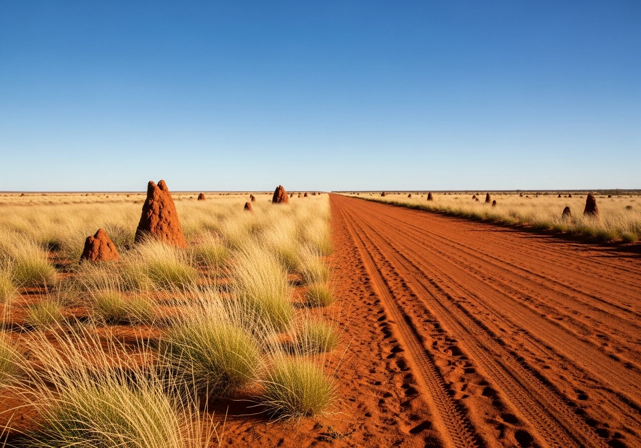
The Tanami Track is 1,013 kilometres of unsealed road connecting Alice Springs in the Northern Territory to Halls Creek in Western Australia. It crosses the Tanami Desert - one of Australia's most remote and least populated landscapes. The track follows an old stock route and was upgraded to an all-weather graded road in stages through the late 20th century, but it remains a genuine outback crossing that demands preparation and respect. The first 300 kilometres from Alice Springs runs through mulga woodland and spinifex plains, the road surface alternating between smooth compacted red dirt and sections of severe corrugation that rattle vehicles apart. The corrugations on the Tanami are legendary - deep, regular and relentless. They destroy shock absorbers, shake bolts loose and fatigue drivers over hundreds of kilometres. The recommended speed through corrugated sections is either very slow (under 40 km/h, feeling every ripple) or fast enough that the tyres skim the tops (above 80 km/h), with nothing comfortable in between. The Tanami Roadhouse at Tilmouth Well, roughly 200 kilometres from Alice Springs, is the first fuel stop. From there the next reliable fuel is Rabbit Flat Roadhouse, about 300 kilometres further - but Rabbit Flat has irregular opening hours and should not be relied upon. The practical fuel gap between Tilmouth Well and Halls Creek can exceed 600 kilometres depending on Rabbit Flat's status. Wolfe Creek Crater is a 60-kilometre detour from the track near the western end. The crater is 880 metres across, 60 metres deep and was formed by a meteorite impact roughly 120,000 years ago. It is the second-largest meteorite crater on earth where fragments of the meteorite have been recovered. The detour track is rougher than the main Tanami but the crater is worth the side trip.
The Tanami Track is 1,013 kilometres of unsealed road connecting Alice Springs in the Northern Territory to Halls Creek in Western Australia.
Why this road
The region
The Tanami Desert is Aboriginal land throughout. The track crosses Warlpiri, Gurindji and Jaru country. Yuendumu community sits about 100 kilometres off the track to the south and is the largest settlement in the Tanami region. The desert itself is flat spinifex grassland and mulga scrub, with termite mounds and dry creek beds the only vertical features across vast distances. The Tanami Gold Mine operates along the route and you will encounter mine vehicles on the track.

Before you go
Fuel at Alice Springs, Tilmouth Well Roadhouse (200 km), Rabbit Flat Roadhouse (unreliable/often closed, 500 km - do NOT rely on this stop), and Halls Creek. Carry enough fuel for 600 km minimum. Carry at least 20 litres of water per person. Two spare tyres are essential - the corrugations and sharp stones destroy tyres regularly. A satellite communicator or PLB is not optional. No phone coverage for the entire route except near Alice Springs and Halls Creek. The track is closed in the wet season (typically December to April) when the clay pans flood. Travel time is 20 to 40 hours depending on conditions. Do not drive at night - cattle, camels and kangaroos on the road are a serious hazard.
See a routing error?
Flag itWorth stopping for
Wolfe Creek Crater
60 km detour near the western end. An 880-metre meteorite crater visible from the rim walk - one of the most impressive geological features in Australia.
Halls Creek
The western terminus and gateway to the Kimberley. China Wall - a natural quartz vein running through the landscape - is worth a stop on arrival.
Route
Start
Tanami Rd turnoff, Stuart Hwy
End
Halls Creek, WA
Gallery

More roads like this