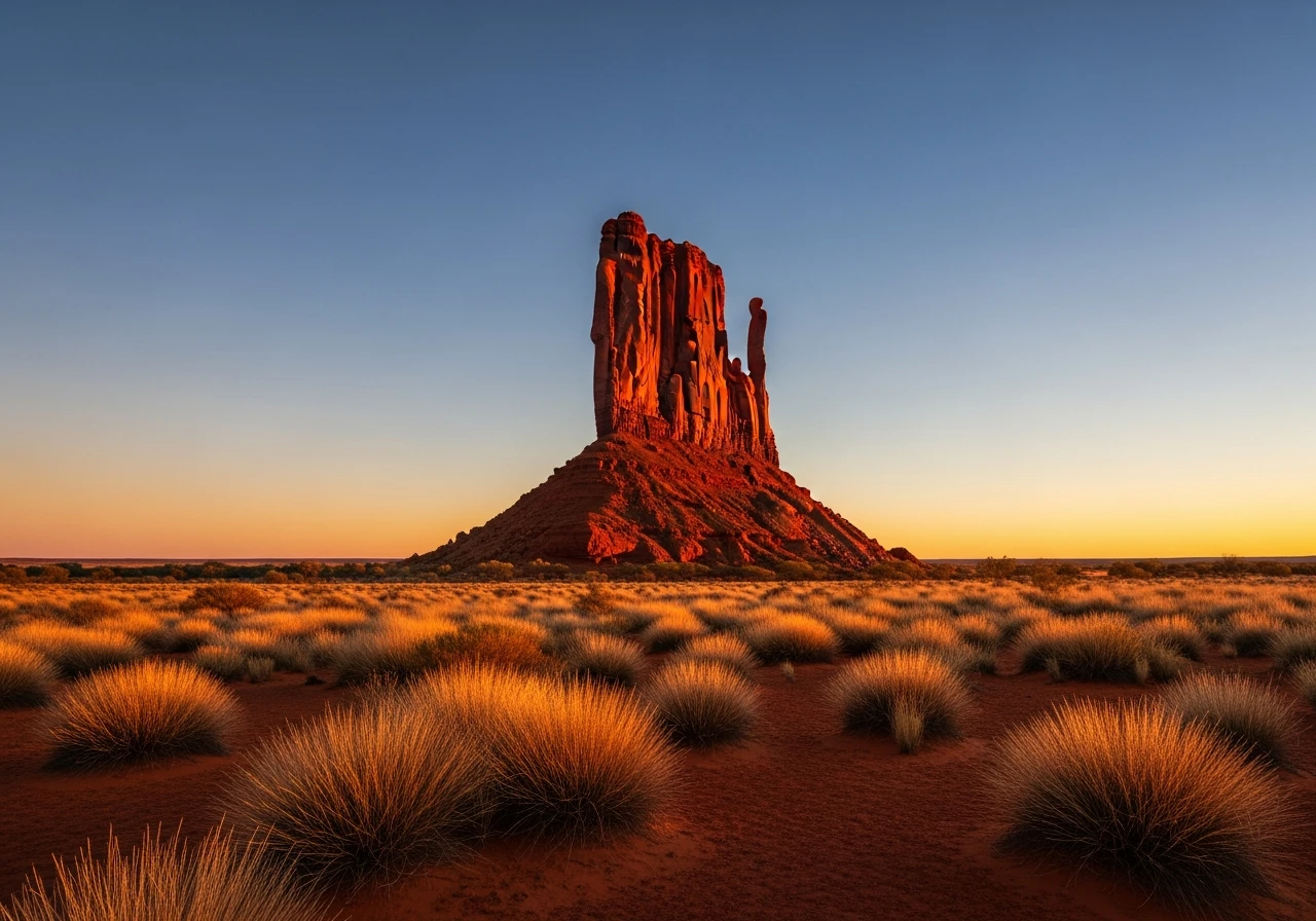
Chambers Pillar
160 km return
distance
5h
Contour time
2.4
avg score
Unsealed
surface
Scenery
Northern Territory
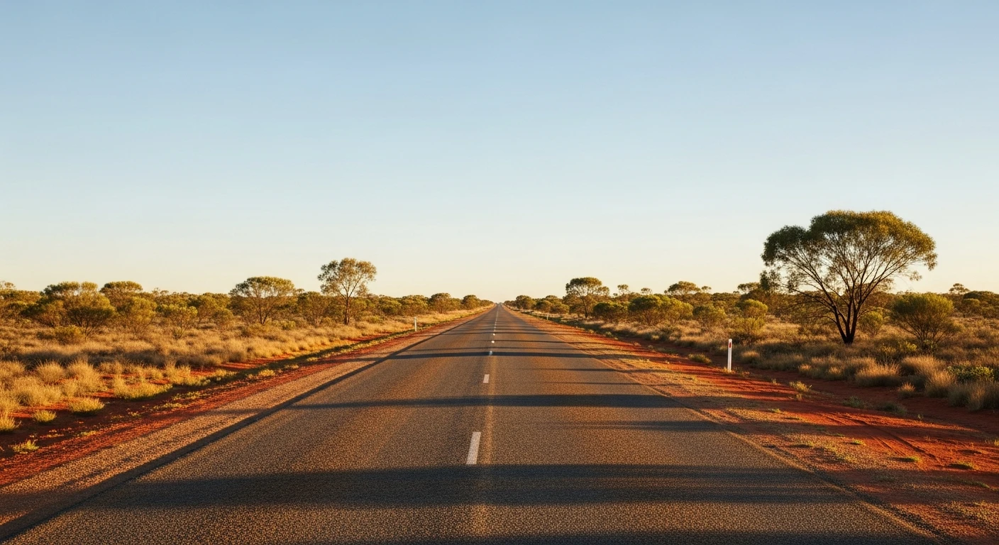
The country south of Alice Springs is flat desert and cattle station land. Maryvale Station (Titjikala community) is...
Road quality
2.4 RQS
Every segment scored on 40+ data signals.
Accessibility
Fully sealed
Best in 4WD. Peak season: April-October.
7-day forecast
The track is straightforward graded dirt and sand for most of its length. The final 10 km to the pillar has deeper sand sections. Stock 4WDs with sensible tyre pressures handle it without difficulty. The risk is the isolation, not the terrain.
Scored 2.4/10 by Contour's road quality algorithm across curviness, surface, elevation and traffic. Best suited for 4wd drivers.
The road
Chambers Pillar is a 50-metre sandstone column rising from the flat red desert floor, 160 kilometres south of Alice Springs. It was the primary navigation landmark for explorers, overlanders and Afghan cameleers approaching Alice Springs from the south in the 19th century - the pillar was visible from 30 kilometres away across the flat country and marked the route through to the MacDonnell Ranges. The track from the Stuart Highway via the Maryvale Station turnoff is 80 kilometres of unsealed road through cattle station country and open desert. The first half follows a reasonable graded station track. The second half deteriorates to a sandy desert track with bull dust pockets and the occasional washout. The final approach to the pillar crosses a sandy plain where tyre pressures matter - drop to 20 psi for the last section. Chambers Pillar itself is sandstone and conglomerate, carved by wind erosion into its distinctive column shape. The rock face at the base carries inscriptions from 19th century explorers, including John Ross (who led the Overland Telegraph construction party through here in 1871) and John McDouall Stuart (who passed the pillar on his 1860 crossing of the continent). Some inscriptions date from the 1870s Afghan cameleer era. Unfortunately, modern graffiti has damaged several of the historic inscriptions and the base is now fenced to prevent further vandalism. The pillar is at its most dramatic at sunset and sunrise when the sandstone glows deep orange-red against the darkening sky. The campground at the base is basic but the setting is extraordinary - sleeping at the foot of a 50-metre rock column in the open desert with no light pollution is a genuinely memorable night.
Chambers Pillar is a 50-metre sandstone column rising from the flat red desert floor, 160 kilometres south of Alice Springs.
Why this road
The region
The country south of Alice Springs is flat desert and cattle station land. Maryvale Station (Titjikala community) is the last settlement before the track heads west to the pillar. The surrounding landscape is red sand, mulga scrub and spinifex with scattered desert oaks. The Charlotte Range is visible to the south - a low line of hills marking the edge of the Simpson Desert proper.

Before you go
Fuel at Alice Springs only - there is no fuel on the route. The 160-kilometre return trip requires careful fuel planning. Carry at least 10 litres of water per person. A satellite communicator or PLB is recommended - there is no phone coverage beyond Maryvale. The campground at Chambers Pillar has a pit toilet and nothing else. Carry all food, water and firewood. The track is closed in the wet season when the clay sections become impassable. Best visited with an overnight stay to experience sunset and sunrise on the pillar. Park entry fees apply.
See a routing error?
Flag itWorth stopping for
Rainbow Valley
A sandstone formation 75 km south of Alice Springs on a separate track - the banded coloured rock faces are best at late afternoon. Can be combined with Chambers Pillar as a multi-day trip.
Ewaninga Rock Carvings
Aboriginal petroglyphs on the Stuart Highway 35 km south of Alice Springs - a quick stop on the way to the Maryvale turnoff.
Route
Start
Maryvale Station turnoff
End
Chambers Pillar
Gallery

More roads like this