Arltunga Historical Reserve
110 km
distance
3h
Contour time
3.9
avg score
Unsealed
surface
Scenery
Northern Territory
The Eastern MacDonnell Ranges stretch 100 kilometres east of Alice Springs. The range is lower and drier than the...
Road quality
3.9 RQS
Every segment scored on 40+ data signals.
Accessibility
Fully sealed
Best in 4WD. Peak season: April-October.
7-day forecast
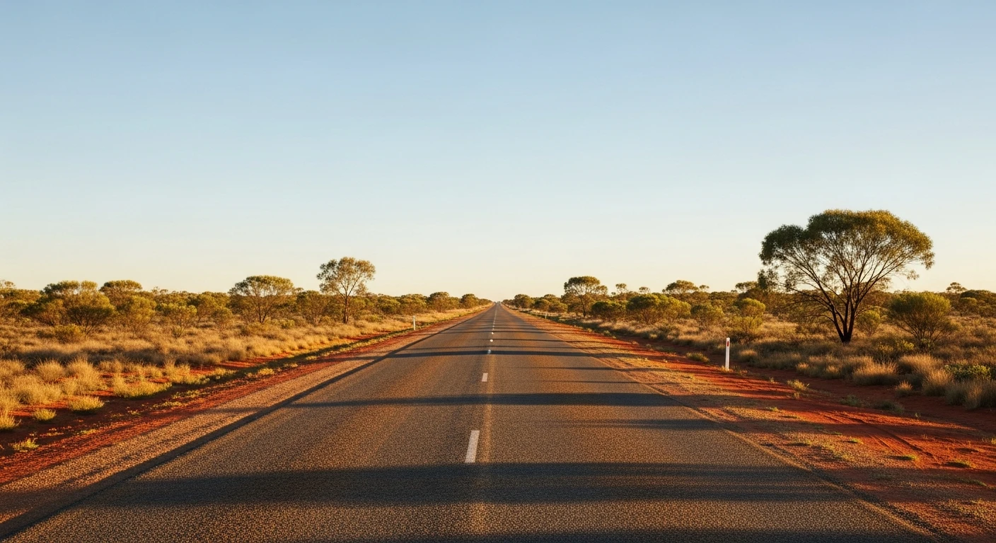
A long unsealed road through the East MacDonnell Ranges. Not technically difficult but remote with no services. The track surface varies from graded gravel to rough sections with corrugations and washouts. Stock 4WDs handle it without issue in dry conditions.
Scored 3.9/10 by Contour's road quality algorithm across curviness, surface, elevation and traffic. Best suited for 4wd drivers.
The road
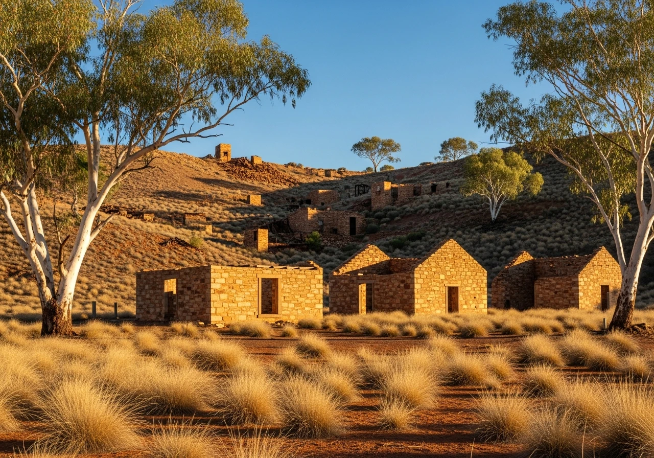
Arltunga was the Northern Territory's first official goldfield, declared in 1887 after alluvial gold was found in the Paddy's Creek area. For the men who walked here from the Oodnadatta railhead - over 600 kilometres to the south - it was one of the most remote gold rushes in Australian history. The settlement that grew up around the mines had a police station, a government battery, a cyanide works and the stone buildings that still stand today. The gold was hard-won - reef gold locked in quartz that required crushing and chemical extraction, not the easy alluvial pickings that made other goldfields rich overnight. The 110-kilometre drive from the Ross Highway junction follows the old track through the Eastern MacDonnell Ranges. The road passes through gaps in the range where the quartzite folds are exposed in road cuttings and cliff faces, the rock layers tilted nearly vertical by the same compression event that folded the entire MacDonnell chain. The country dries out as you head east - the ghost gums thin, the spinifex takes over and the landscape opens into broad valleys between low rocky ridges. Trephina Gorge is accessible as a side trip from the main track and is worth the detour for the deep red gorge walls and the permanent waterhole at the base. Arltunga itself is managed by NT Parks as a historical reserve. The mine workings are remarkably intact - the police station walls still stand, the cyanide works equipment is in place and the mines themselves are visible in the hillside above the settlement. The self-guided walking trail through the site takes about an hour and the interpretive panels do a good job of explaining the extraction process and the brutal conditions the miners endured. Arltunga is also the launching point for the Ruby Gap track, which continues east into progressively wilder country.
Arltunga was the Northern Territory's first official goldfield, declared in 1887 after alluvial gold was found in the Paddy's Creek area.
Why this road
The region
The Eastern MacDonnell Ranges stretch 100 kilometres east of Alice Springs. The range is lower and drier than the western MacDonnells but geologically identical - ancient folded quartzite and sandstone that was compressed and uplifted 300 million years ago. The gaps and gorges through the range were cut by rivers that predate the folding, creating water gaps where the rivers maintained their course as the rock rose around them. Ross River Resort, about 80 km from Alice Springs on the way to Arltunga, offers accommodation and meals.

Before you go
Fuel at Alice Springs. Ross River Resort (80 km from Alice Springs) sometimes has fuel but confirm before relying on it. Carry at least 10 litres of water per person and enough fuel for the 220-kilometre return trip. No phone coverage beyond the first 30 km of the Ross Highway. The track is closed when wet. The historical reserve at Arltunga has a campground with pit toilets and fire rings. No fees for the reserve but donations are accepted. Allow a full day for the return trip with time to explore the mine workings.
See a routing error?
Flag itWorth stopping for
Trephina Gorge
A deep red gorge with permanent water, accessible via a short detour from the Arltunga track. The ghost gum grove at the gorge entrance is one of the best in the MacDonnells.
Ross River Resort
Outback station accommodation with meals, 80 km from Alice Springs on the route to Arltunga. A practical overnight stop for a two-day trip.
Route
Start
Ross Highway junction
End
Arltunga Historical Reserve
Gallery

More roads like this