Ruby Gap
45 km
distance
5h
Contour time
3.1
avg score
Unsealed
surface
Scenery
Northern Territory
The Eastern MacDonnell Ranges are drier, lower and less visited than the western ranges near Alice Springs. The country...
Road quality
3.1 RQS
Every segment scored on 40+ data signals.
Accessibility
Fully sealed
Best in 4WD. Peak season: April-October.
7-day forecast
This is a serious remote track. The river crossings are deep and rocky, the track is rough and the nearest help is hours away. Stock 4WDs with low-range can manage in dry conditions but the isolation makes preparation critical. Travel in pairs. A satellite communicator is essential.
Scored 3.1/10 by Contour's road quality algorithm across curviness, surface, elevation and traffic. Best suited for 4wd drivers.
The road
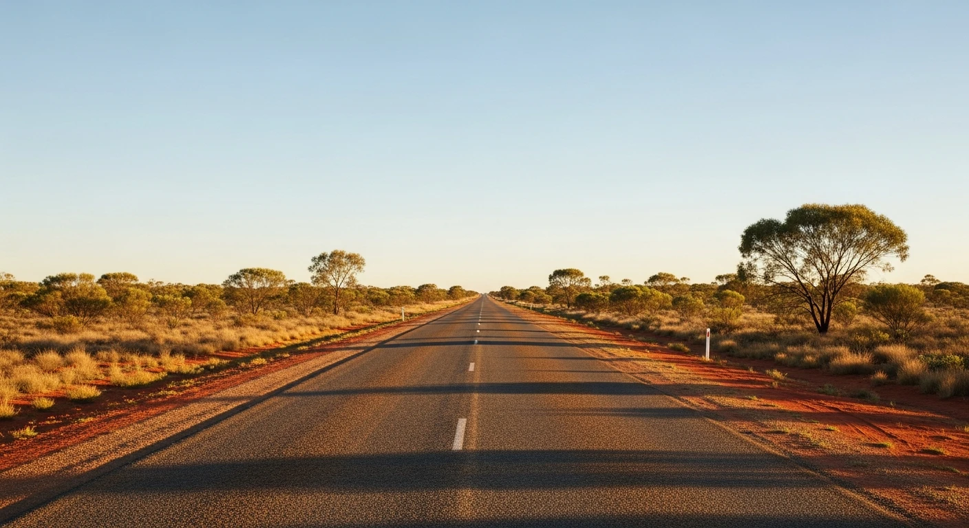
Ruby Gap Nature Park sits at the eastern end of the MacDonnell Ranges, 45 kilometres beyond the old Arltunga goldfield. It is one of the most remote and least visited parks in the Northern Territory, accessible only by a rough 4WD track that follows the Hale River through a series of gorges in the range. The ruby rush that gives the park its name happened in 1886 when what prospectors believed were rubies were discovered in the river gravel. Hundreds of men rushed to the area, enduring extreme heat and water shortages, before a government geologist confirmed the stones were garnets - worthless at the time. The rush collapsed overnight and the prospectors walked out, leaving behind the remains of their camps. The track from Arltunga deteriorates steadily as it heads east. The formed road gives way to rocky river bed driving through the Hale River, with multiple crossings that are deep enough to reach the door sills in normal conditions. The gorge walls close in along several sections, creating narrow passages where the track follows the river between vertical quartzite walls. The rock here is ancient - Proterozoic sedimentary formations folded and faulted by the same forces that created the MacDonnell Ranges over 300 million years ago. The colours shift from deep red to purple to pale cream depending on the mineral content and the light. Glen Annie Gorge is the main destination - a deep, narrow gorge with permanent water and ghost gums growing from the rock walls. The water in the gorge pools is still and clear, reflecting the coloured rock faces above. Camping at Glen Annie Gorge is basic but the setting is among the most dramatic in central Australia.
Ruby Gap Nature Park sits at the eastern end of the MacDonnell Ranges, 45 kilometres beyond the old Arltunga goldfield.
Why this road

The region
The Eastern MacDonnell Ranges are drier, lower and less visited than the western ranges near Alice Springs. The country beyond Arltunga is genuine outback - station land, desert ranges and dry river systems that flow only after significant rain. The Hale River is a major tributary of the Todd River system and its course through the ranges has carved the gorges that make Ruby Gap distinctive.

Before you go
Fuel at Alice Springs only - there is no fuel at Arltunga or anywhere on the route. The round trip from Alice Springs via Arltunga is over 300 km on unsealed road. Carry at least 20 litres of water per person and enough fuel for the full return journey. Two spare tyres are essential - the rocky river bed sections destroy tyres. A satellite communicator or EPIRB is not optional. No phone coverage from Arltunga onwards. The track is impassable when the Hale River is flowing - check conditions with NT Parks before departure. Register your trip with NT Police or the Alice Springs Visitor Centre. Travel in pairs where possible.
See a routing error?
Flag itWorth stopping for
Arltunga Historical Reserve
The gold rush ghost town at the start of the Ruby Gap track. The mine workings, police station and cyanide works are remarkably intact.
N'Dhala Gorge
Aboriginal rock art site in the Eastern MacDonnells, accessible via a separate 4WD track from the Ross Highway.
Route
Start
Arltunga Historical Reserve
End
Ruby Gap Nature Park
Gallery

More roads like this