Stockton Beach
30 km
distance
2h
Contour time
6.0
avg score
Unsealed
surface
Scenery
New South Wales
Stockton Beach sits immediately north of Nelson Bay and the Port Stephens tourism area. The Hunter River separates the...
Road quality
6.0 RQS
Every segment scored on 40+ data signals.
Accessibility
Fully sealed
Best in 4WD. Peak season: Year-round.
7-day forecast
Sand driving only - tyre pressures between 16 and 20 psi are essential. No rock or mud hazards. The main risk is soft sand and tidal miscalculation. Stock 4WDs handle this comfortably with correct tyre pressures.
Scored 6.0/10 by Contour's road quality algorithm across curviness, surface, elevation and traffic. Best suited for 4wd drivers.
The road
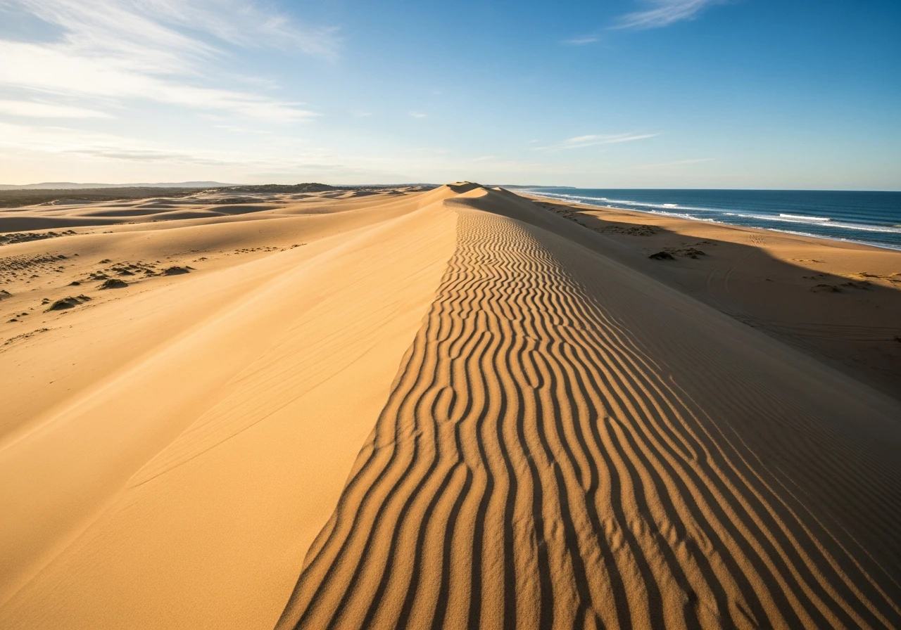
Stockton Beach is 30 kilometres of coastline between the Hunter River mouth and Anna Bay, backed by the largest moving coastal sand dunes in the Southern Hemisphere. The dune system covers 350 hectares and the tallest dunes reach 30 metres. This is Worimi Conservation Lands - Aboriginal land managed jointly by the Worimi people and NSW National Parks. The driving is pure sand. You enter at Lavis Lane near Williamtown and drive south along the beach face below the high tide line, or up into the dune system where the sand is softer and the terrain rolls and dips like a desert landscape transplanted to the coast. The beach driving is straightforward at low tide on firm sand. At high tide the driving corridor narrows and in some sections disappears entirely - getting caught by a rising tide against a dune face is the most common recovery scenario here. The dunes themselves are where the real driving begins. Cresting a 30-metre dune with nothing but sand and ocean in every direction is a genuinely unique experience on the east coast of Australia. The sand is clean, deep and unforgiving of incorrect tyre pressures. At 16-20 psi most stock 4WDs handle the terrain well. Above 25 psi you will bog within minutes. The Tin City ruins sit partway along the beach - a collection of corrugated iron fishermen's shacks that have been here since the 1940s, slowly being consumed by the advancing dunes. Birubi Point at the southern end has a car park with a compressor for re-inflating tyres before returning to the road.
Stockton Beach is 30 kilometres of coastline between the Hunter River mouth and Anna Bay, backed by the largest moving coastal sand dunes in the Southern Hemisphere.
Why this road
The region
Stockton Beach sits immediately north of Nelson Bay and the Port Stephens tourism area. The Hunter River separates the beach from Newcastle to the south. Port Stephens is one of the most popular holiday destinations on the NSW coast, with dolphin watching, oyster farms and a string of sheltered beaches on the harbour side. The dune system is the wild counterpoint to the resort feel of Nelson Bay across the water.

Before you go
Fuel at Williamtown or Nelson Bay. A Worimi Beach Vehicle Permit is required - $88 annual or a 3-day option available from the Worimi Conservation Lands office or online. Check tide times before entering - beach driving is only safe in the two hours either side of low tide. At high tide the beach corridor closes in several sections and vehicles can be trapped against the dune face. Carry a tyre deflator and a compressor for re-inflation at the exit. Birubi Point at the Anna Bay end has a public air compressor. No phone coverage in the dune system. Do not drive above the vegetation line - fines apply and the dune ecology is fragile.
See a routing error?
Flag itWorth stopping for
Tin City
Corrugated iron fishermen's shacks from the 1940s, slowly being buried by the dunes. Worth a stop for the photos and the history.
Port Stephens dolphin watching
Nelson Bay across the water has daily dolphin cruises in the harbour - a sharp contrast to the raw dune landscape.
Route
Start
Lavis Lane, Williamtown
End
Birubi Point, Anna Bay
Gallery

More roads like this
