K'gari Eastern Beach
105 km
distance
5h
Contour time
3.5
avg score
Unsealed
surface
Scenery
Queensland
K'gari sits off the Hervey Bay coast in the Great Sandy Strait, 300 kilometres north of Brisbane. The island was World...
Road quality
3.5 RQS
Every segment scored on 40+ data signals.
Accessibility
Fully sealed
Best in 4WD. Peak season: April-October.
7-day forecast
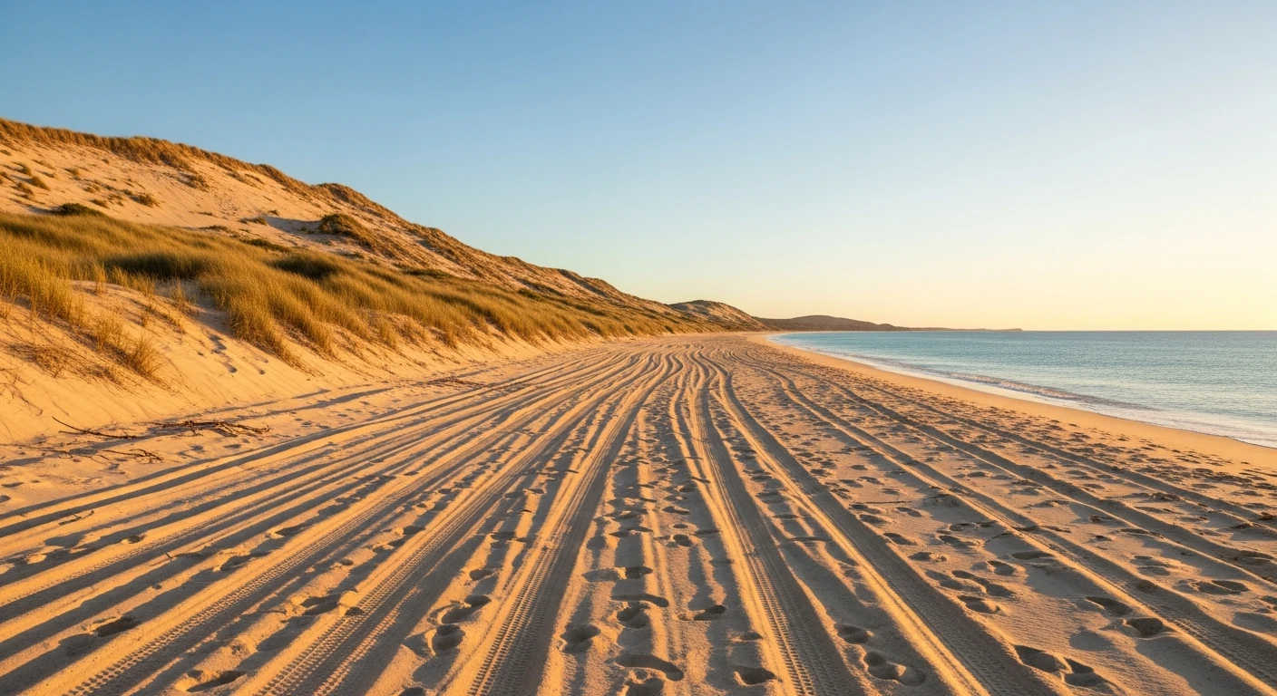
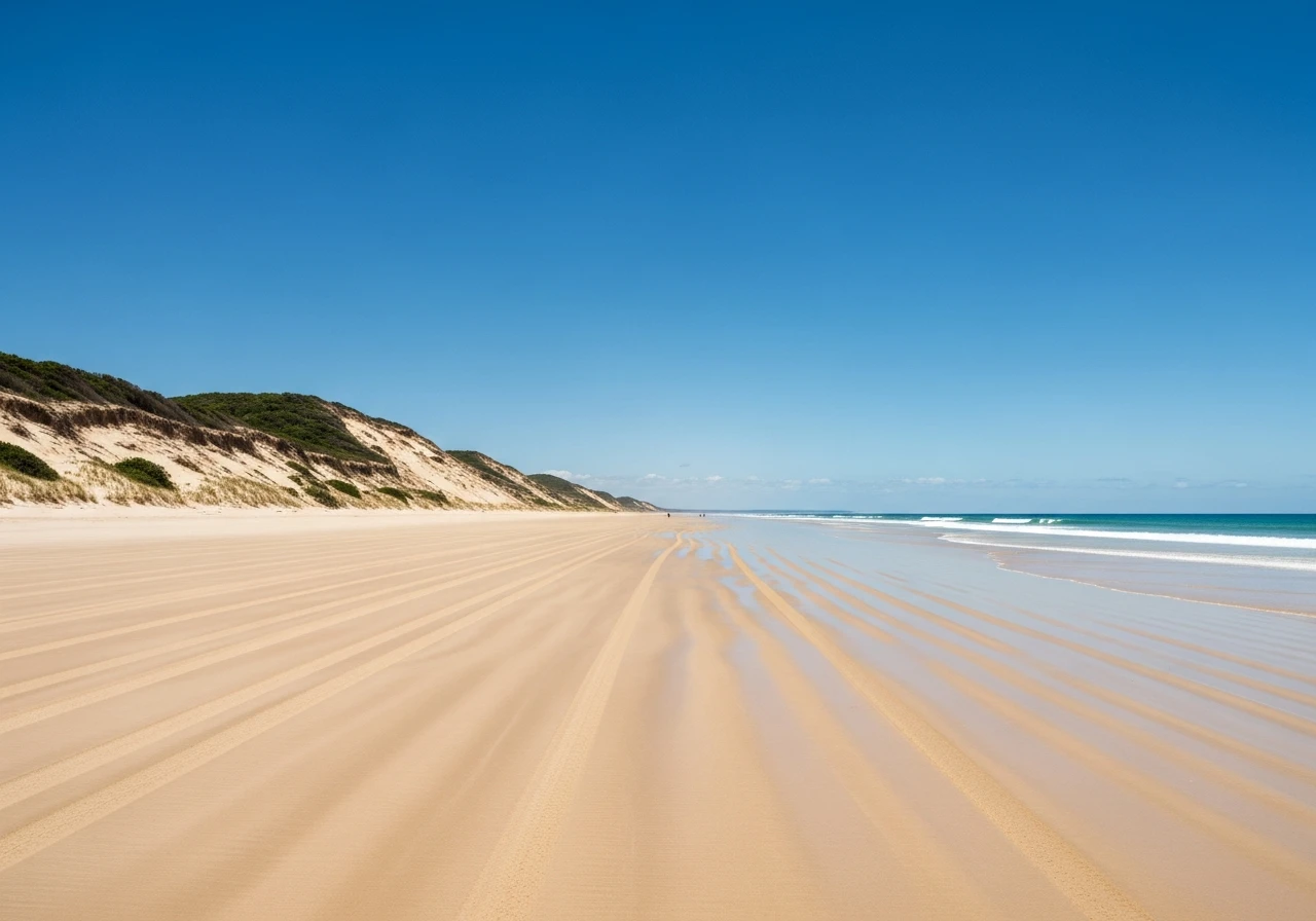
Beach sand driving at 18-22 psi for the full length. The eastern beach is a gazetted road with a 80km/h limit. Straightforward for any 4WD with correctly deflated tyres, but soft sand at creek crossings and the inland tracks to lakes require low range and some experience. Tidal windows are the main constraint - not vehicle capability.
Scored 3.5/10 by Contour's road quality algorithm across curviness, surface, elevation and traffic. Best suited for 4wd drivers.
The road
K'gari is the world's largest sand island - 123 kilometres long, entirely sand, entirely national park. The eastern beach is the main highway. It runs 105 kilometres from Hook Point at the southern tip to Orchid Beach near the northern end, and for its entire length the beach is the road. There is no bitumen on K'gari. Every road is sand. The eastern beach run is the backbone of any trip and the one that defines the island experience. The drive passes the rusting hull of the SS Maheno, a trans-Tasman liner that washed ashore in a cyclone in 1935 and has been disintegrating on the beach ever since. Eli Creek crosses the beach about halfway up - a wide, clear freshwater creek that you can float down in a tube before it drains onto the sand. The Pinnacles are coloured sand cliffs above the beach, layered ochre and red from iron oxide staining over hundreds of thousands of years. Indian Head at the northern end is a rocky headland where you can spot sharks, rays, turtles and sometimes whales from the clifftop. The beach surface is firm at low tide and becomes progressively softer as the tide rises. At high tide the driving corridor narrows to almost nothing at some headlands and sections become impassable. This is not a problem if you plan around the tides - it is a serious problem if you do not. Vehicles have been trapped and swallowed by incoming tides on this beach. The inland tracks to the perched lakes - Lake McKenzie, Lake Wabby, Lake Birrabeen - branch off the beach at marked turnoffs. These are softer and slower than the beach itself. Lake McKenzie is the most famous - white silica sand, clear blue water, no visible inlet or outlet.
K'gari is the world's largest sand island - 123 kilometres long, entirely sand, entirely national park.
Why this road
The region
K'gari sits off the Hervey Bay coast in the Great Sandy Strait, 300 kilometres north of Brisbane. The island was World Heritage listed in 1992 for its sand dune ecology - the only place on earth where tall rainforest grows on sand dunes above 200 metres elevation. The western side faces Hervey Bay and is sheltered. The eastern side faces the open Pacific and takes the full force of the ocean swell, which is what creates the firm driving beach at low tide. Hervey Bay is the departure point for most barge crossings and is also Australia's premier whale watching port from July to November.

Before you go
Tide tables are essential - download the Hervey Bay tide chart before departure and plan driving windows around low tide. At high tide some headlands are impassable and vehicles get trapped. Poyungan Rocks between Eurong and Eli Creek is a dangerous pinch point where the driving corridor narrows sharply at high tide - vehicles have been trapped and lost here. Do not attempt this section within two hours of high tide. Barge from Inskip Point (Rainbow Beach) to Hook Point or from River Heads (Hervey Bay) to Kingfisher Bay. Vehicle permits required from Queensland Parks and Wildlife - book online before departure. Fuel at Orchid Beach, Eurong and Happy Valley but prices are steep. Deflate tyres to 18-22 psi for the beach and 16-18 psi for inland sand tracks. Carry a portable compressor - you will reinflate before the barge home. Speed limit 80km/h on the beach, enforced by rangers. No driving on the beach at night.
See a routing error?
Flag itWorth stopping for
Lake McKenzie
A perched freshwater lake with white silica sand and impossibly clear water - one of the most photographed spots in Queensland. Reached via an inland sand track from the eastern beach.
Champagne Pools
Natural rock pools at the northern end of the island where waves crash over the rocks and fill sheltered pools - safe swimming in the ocean wash.
Central Station Rainforest
A boardwalk through tall rainforest growing on sand dunes - the ecological anomaly that earned K'gari its World Heritage listing.
Route
Start
Hook Point
End
Orchid Beach
Gallery

More roads like this