Moreton Island 4WD
38 km
distance
1h 50m
Contour time
7.0
avg score
Unsealed
surface
Scenery
Queensland
Moreton Bay Marine Park surrounds the island and supports the resident pod of humpback dolphins, seasonal whales and...
Road quality
7.0 RQS
Strong. Above average on most quality signals.
Accessibility
Fully sealed
Best in 4WD. Peak season: Year-round.
7-day forecast
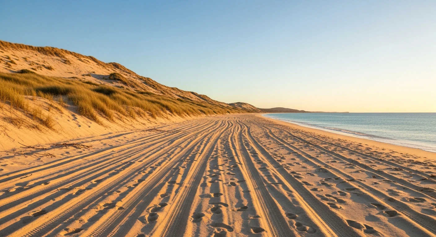
Beach sand driving at 20-25 psi. Straightforward for any 4WD with low-range and correctly deflated tyres. The soft sand at creek crossings and the dune access tracks require some skill. Easy to get bogged if tyres are not deflated.
Scored 7.0/10 by Contour's road quality algorithm across curviness, surface, elevation and traffic. Best suited for 4wd drivers.
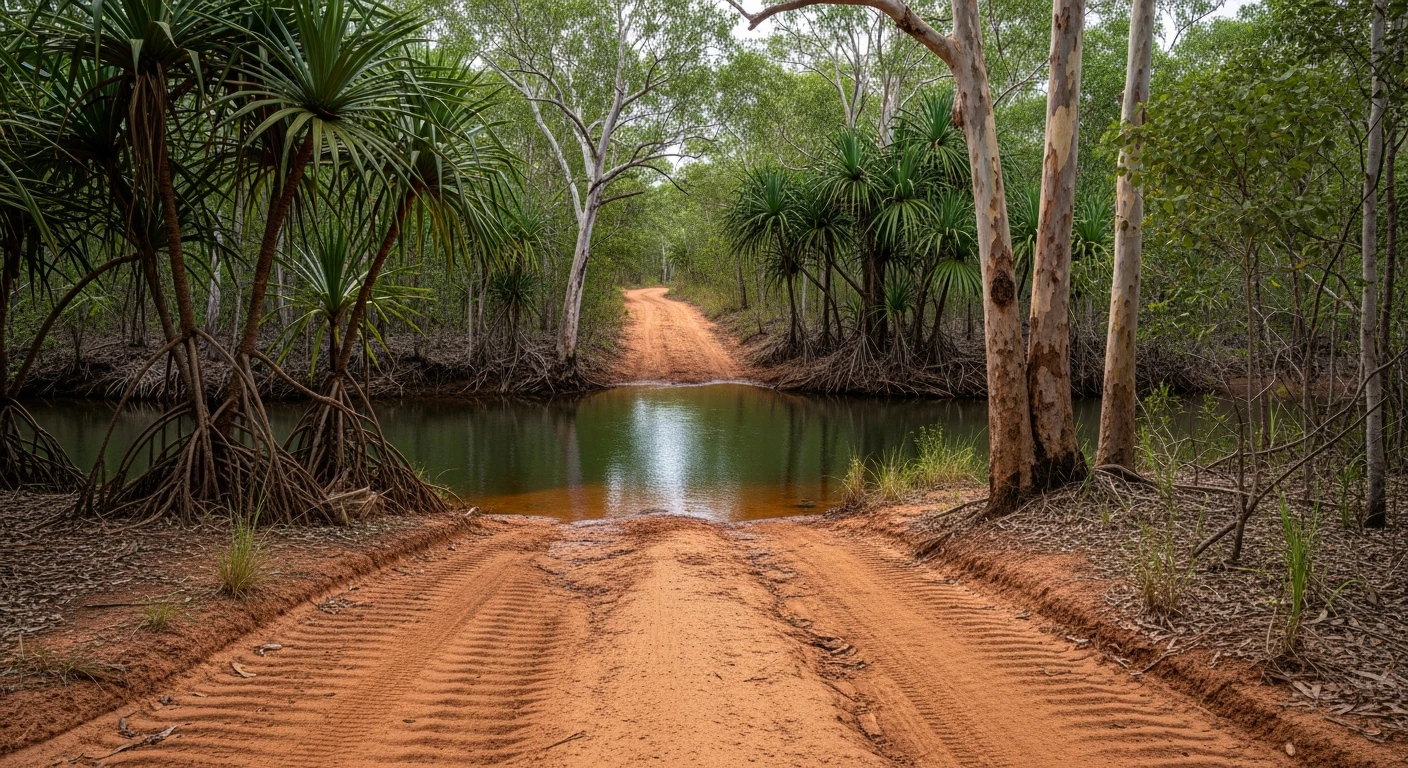
The road
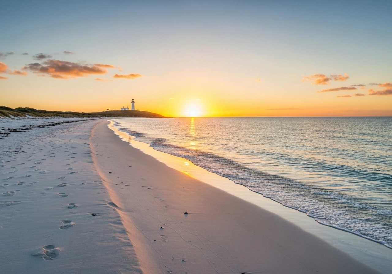
Moreton Island is 38km of sand island 40km off Brisbane. The entire island is national park. Getting there requires a barge from Scarborough or Toorbul, and once on the sand the only roads are beach and 4WD tracks through the dunes. The eastern beach run from Bulwer to Cape Moreton is the main track - 38 kilometres of open ocean beach with no other vehicles except other 4WDs, seasonal waders on the tide line and the occasional humpback whale in the channel offshore. The beach surface is firm at low tide and soft at high. Driving at mid-tide is fastest. At Cape Moreton the lighthouse sits on the northernmost rocky headland, with 270-degree ocean views. The snorkelling at Tangalooma on the western side is among the best accessible from Brisbane. The island has one resort, one general store at Kooringal in the south, and nothing else. It is as close to wilderness sand driving as you can find within an hour of a capital city.
Moreton Island is 38km of sand island 40km off Brisbane.
Why this road
The region
Moreton Bay Marine Park surrounds the island and supports the resident pod of humpback dolphins, seasonal whales and dugongs. The Tangalooma Resort on the western beach is the only accommodation on the island. Camping is available at three national park campgrounds - book through Queensland Parks and Wildlife before departure as sites fill weeks ahead in school holidays.

Before you go
Barge from Scarborough or Toorbul - book ahead in school holidays. Deflate tyres to 20-22 psi for beach and 18-20 psi for soft sand areas. Reinflate before loading back on the barge. A portable compressor is essential. Tidal timing matters - avoid high tide on the eastern beach as the soft dry sand above the tideline is significantly harder work. Fuel is not available on the island - fill up before the barge. Speed limit 50km/h on beaches, enforced.
See a routing error?
Flag itWorth stopping for
Tangalooma Wrecks snorkelling
15 shipwrecks deliberately sunk on the western side in the 1960s, now a shallow reef teeming with fish - accessible from the resort beach.
Champagne Pools
Natural rock pools on the eastern headland where ocean waves fill pools protected from the surf - one of Queensland's most distinctive swimming spots.
Route
Start
Tangalooma
End
Cape Moreton Lighthouse
Gallery

More roads like this