Dargo High Plains Road
70 km
distance
1h 30m
Contour time
5.7
avg score
Unsealed
surface
Scenery
Victoria
Dargo is a small township in the Dargo Valley, in the Shire of Wellington, 348 kilometres east of Melbourne. It serves...
Road quality
5.7 RQS
Every segment scored on 40+ data signals.
Accessibility
Fully sealed
Best in 4WD. Peak season: Dec-Mar.
7-day forecast
High clearance 4WD required. The lower ash forest section is manageable in a well-equipped stock 4WD. The upper plateau is exposed with no mobile coverage. Satellite communications are strongly recommended.
Scored 5.7/10 by Contour's road quality algorithm across curviness, surface, elevation and traffic. Best suited for 4wd drivers.
The road
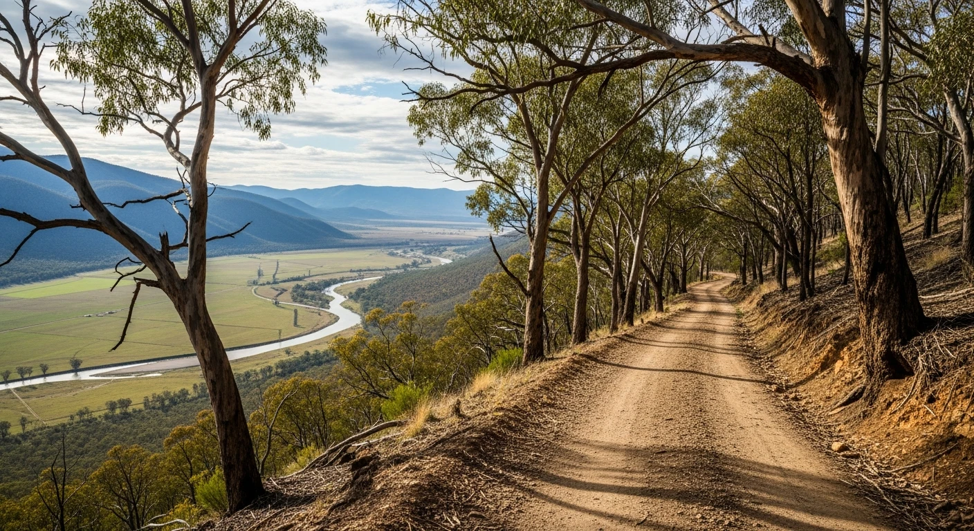
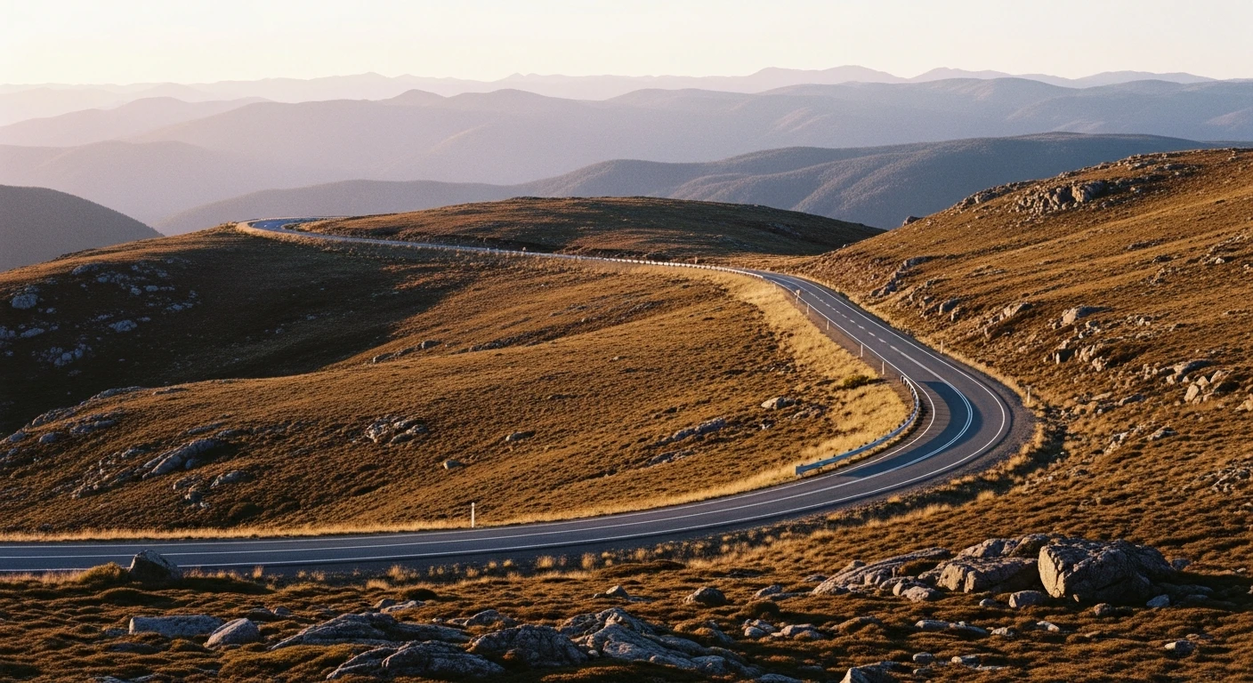
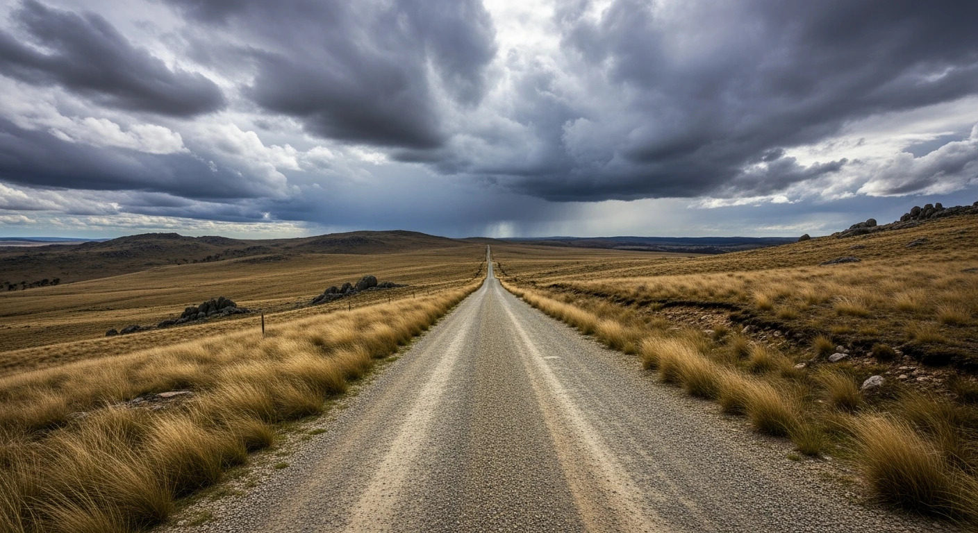
The Dargo High Plains Road is how you get from the valley floor to the alpine plateau. The 35-kilometre climb from Dargo township gains over 1,100 metres via a gravel road that is rough, steep and spectacular. The road is sealed for about 25 kilometres from the southern end, then becomes 45 kilometres of gravel and cobble before meeting the Great Alpine Road - but this stage covers the Dargo end, which is the rougher section. The lower section through ash forest is manageable in a well-equipped stock 4WD. The upper section on the plateau is exposed moorland with no shelter and no mobile coverage. In summer the high plains are clear and the driving is long and rewarding. In winter the road closes and snow sits on the plateau for months.
The Dargo High Plains Road is how you get from the valley floor to the alpine plateau.
Why this road

The region
Dargo is a small township in the Dargo Valley, in the Shire of Wellington, 348 kilometres east of Melbourne. It serves as the base camp for the Victorian High Plains and the Wonnangatta Valley. The high plains above are part of the Alpine National Park and contain some of the largest areas of alpine moorland on mainland Australia.

History
The high plains above Dargo were used for summer cattle grazing from the 1860s. High-country cattlemen drove their herds up in November and returned in April. The practice was prohibited in the Alpine National Park in 2005.
Before you go
Fuel in Dargo - last services before the plateau. Check conditions before departure. The plateau can be wet and dangerous even in summer. Satellite communicator required for solo travel. Road closed in winter - typically June to November.
See a routing error?
Flag itWorth stopping for
Dargo Hotel
Historic pub and last services before the climb - worth fuelling up and having a meal before the plateau.
Victorian High Plains wildflowers
Extraordinary in January when alpine wildflowers peak - snow daisies, billy buttons and trigger plants on the moorland.
Route
Start
Dargo
End
High Plains Plateau
Gallery

More roads like this