Glass House Mountains / Beerburrum
30 km
distance
2h
Contour time
8.1
avg score
Unsealed
surface
Scenery
Queensland
The Glass House Mountains are a cluster of 13 volcanic plugs rising from the coastal plain between Caboolture and the...
Road quality
8.1 RQS
Strong. Above average on most quality signals.
Accessibility
Fully sealed
Best in 4WD. Peak season: Year-round.
7-day forecast
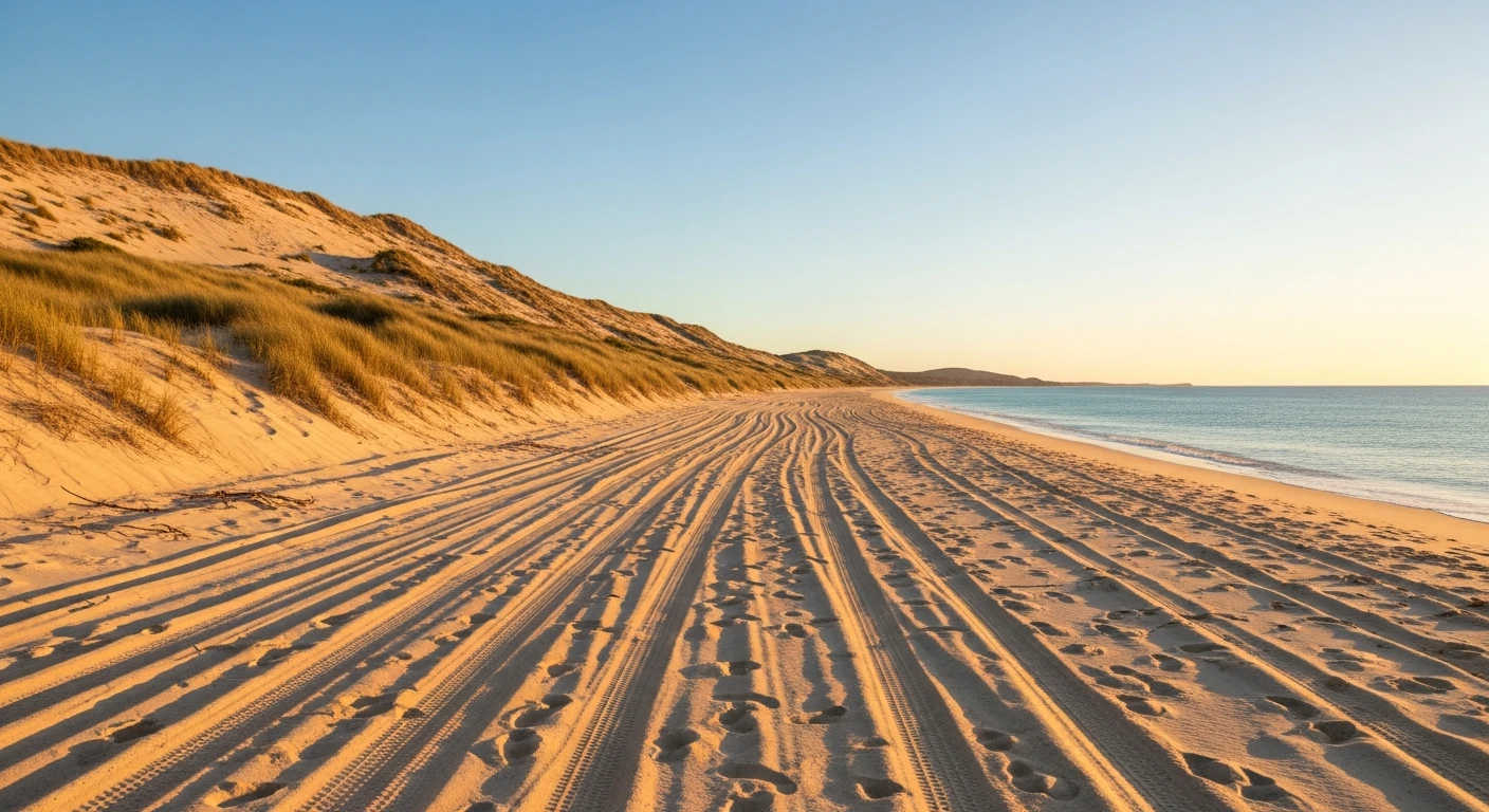
Mix of graded forest roads and rougher spur tracks. Big Red is the main challenge - a steep sandy hill climb that requires momentum and low range. Power Line Track has some rutted sections and loose surfaces. The circuit is accessible for any stock 4WD with genuine low range.
Scored 8.1/10 by Contour's road quality algorithm across curviness, surface, elevation and traffic. Best suited for 4wd drivers.
The road
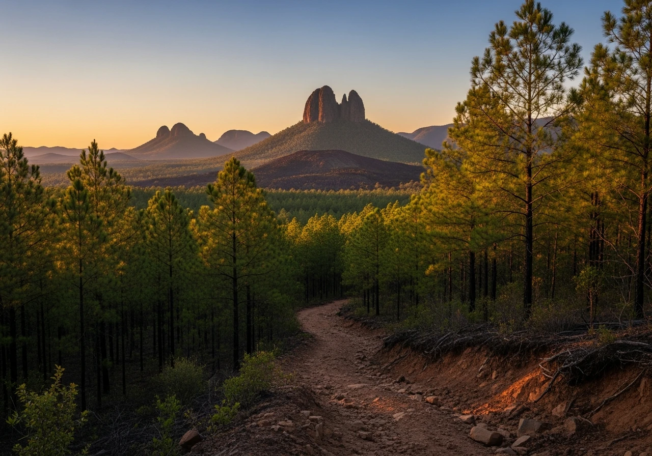
Beerburrum West State Forest sits at the base of the Glass House Mountains, an hour north of Brisbane, and it is the most accessible 4WD area for southeast Queensland. The 30-kilometre circuit through the pine plantation and native forest combines graded fire trails, rougher spur tracks and a couple of genuine obstacles into a half-day run that new 4WD owners use as a shakedown and experienced drivers use as a quick weekend fix. Big Red is the signature feature - a steep sandy hill climb on the Power Line Track that requires committed momentum and correctly selected low range. It is not long or dangerous but it punishes hesitation and rewards clean technique. The track rewards clean driving rather than brute force. Power Line Track runs along the electrical easement through the forest with views of the Glass House Mountains volcanic plugs - Mount Tibrogargan, Mount Beerwah and Mount Coonowrin are all visible from the ridgeline sections. The Glass House Mountains themselves are 25-million-year-old volcanic plugs - the eroded cores of ancient volcanoes with the surrounding material weathered away, leaving steep-sided rock pillars above the coastal plain. The Instagram factor is real. The combination of volcanic plugs, pine forest and open sky produces photographs that look like they belong somewhere more exotic. The circuit is well-signed and well-used. On weekends the car park fills early. Weekday mornings are quieter. The forest is managed by HQ Plantations and access is generally open, though sections close periodically for forestry operations.
Beerburrum West State Forest sits at the base of the Glass House Mountains, an hour north of Brisbane, and it is the most accessible 4WD area for southeast Queensland.
Why this road
The region
The Glass House Mountains are a cluster of 13 volcanic plugs rising from the coastal plain between Caboolture and the Sunshine Coast. Captain Cook named them in 1770 because their shapes reminded him of glass furnaces in his home county of Yorkshire. The peaks are significant to the Gubbi Gubbi people and several have cultural access restrictions. The surrounding state forest is a mix of plantation pine and native bushland managed for timber production and recreation. The Bruce Highway runs past the eastern side, making the area accessible from both Brisbane and the Sunshine Coast.

Before you go
Fuel at Caboolture, Beerwah or the Glass House Mountains township. No fuel in the forest. Check HQ Plantations website or signage at the forest entrance for closures due to forestry operations. The tracks are open year-round but can be slippery after rain. No permit required for day use. Camping is available at Beerburrum West campground - book through the forestry website. Mobile coverage is patchy in the forest but reliable on the ridgeline sections. The circuit starts and ends at the same car park, so there is no logistics issue with multiple vehicles.
See a routing error?
Flag itWorth stopping for
Mount Tibrogargan lookout
A short walk to the base of the most distinctive Glass House Mountain - the face-like profile is visible from the car park and the walking track gives scale to the volcanic plug.
Australia Zoo
Steve Irwin's zoo at Beerwah, 15 minutes from the state forest - a genuine wildlife experience and a good family add-on to the 4WD day.
Route
Start
Beerburrum West State Forest
End
Beerburrum West State Forest (circuit)
Gallery

More roads like this