French Line
430 km
distance
25h
Contour time
2.3
avg score
Unsealed
surface
Scenery
South Australia
The Simpson Desert Regional Reserve and Simpson Desert National Park cover most of the crossing. Entry permits are...
Road quality
2.3 RQS
Every segment scored on 40+ data signals.
Accessibility
Fully sealed
Best in 4WD modified. Peak season: May-September.
7-day forecast
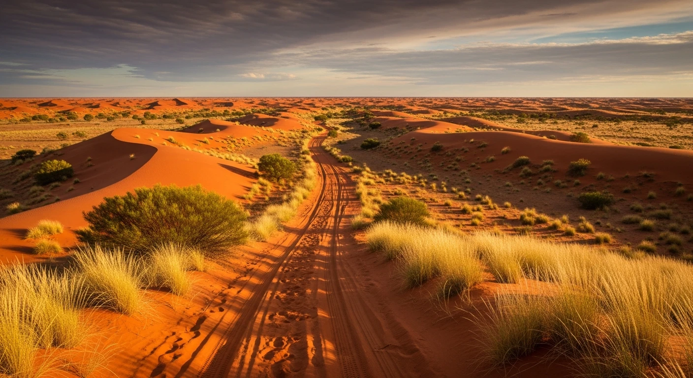
The French Line is harder than the Oodnadatta Track parallel to it and significantly harder than the WAA Line. Over 1,100 sand dunes need to be crossed east to west. Correct tyre pressure (18-22 psi) and momentum management are the key skills. Vehicles without sufficient power and clearance get stuck on dune crests.
Scored 2.3/10 by Contour's road quality algorithm across curviness, surface, elevation and traffic. Best suited for 4wd modified drivers.
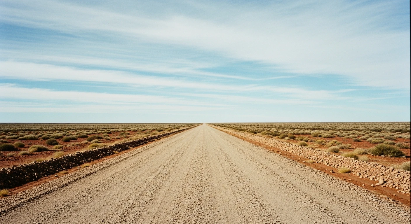
The road
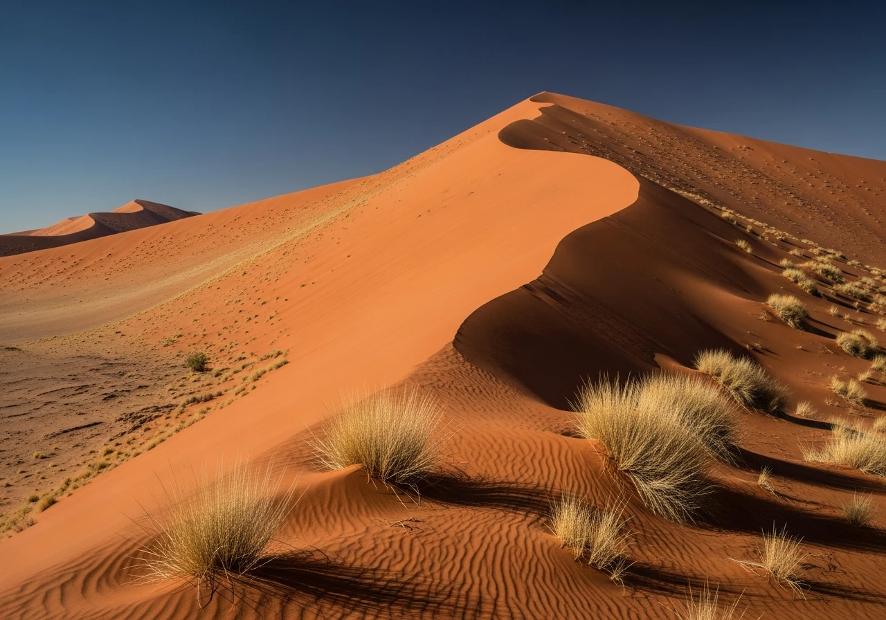
The French Line is the shortest and most direct crossing of the Simpson Desert. It runs east from Dalhousie Springs - the artesian springs that feed a warm outflow pool in a remote landscape of gibber and grass - across the desert to Birdsville in Queensland. The track crosses more than 1,100 parallel sand dunes, all oriented north-south, which means east-west travel requires over a thousand ascents and descents. The dunes rise to 30-40 metres in the central desert. The crest of Big Red, the last dune before Birdsville, has become the finish line of the crossing and is consistently difficult - a 35-degree face that has defeated countless vehicles. The surrounding landscape between the dunes is flat grey clay pan, cracked in the dry and treacherous when wet. The sky in the Simpson Desert is overwhelming - no light pollution within 200km. The silence is also overwhelming. The French Line earns its severity rating from the remoteness: 350km from the nearest town in either direction for the central section, no phone coverage, no emergency access except RFDS airstrip at Birdsville.
The French Line is the shortest and most direct crossing of the Simpson Desert.
Why this road
The region
The Simpson Desert Regional Reserve and Simpson Desert National Park cover most of the crossing. Entry permits are required from the South Australian and Queensland governments. The Dalhousie Springs at the western end are on Witjira National Park - the springs are warm (38C) and large enough to swim. They are a genuine oasis in the stone desert approach and worth a night's camping before the crossing. Birdsville at the eastern end is the classic outback Queensland town - pub, bakery, airstrip and the Birdsville Races once a year.

History
The French Line was cut in the 1960s by the French Petroleum Company during seismic survey operations. The seismic lines run perpendicular to the dunes and were passable to the survey equipment but required significant improvement before becoming a vehicle track. The WAA Line (West-East Across Australia) runs parallel to the north and was cut at the same time.
Before you go
Permits required from SA and QLD parks before entry. Travel west to east (Dalhousie Springs to Birdsville) to approach dunes from the easier west face. Minimum two vehicles with full recovery equipment, PLB and satellite comms. Fuel at Dalhousie Springs and Birdsville only - carry 600km capacity. Water 15+ litres per person per day. May to September only - summer heat makes the crossing lethal. Big Red (the final dune) has a bypass track on its northern side if you cannot make the face.
See a routing error?
Flag itWorth stopping for
Birdsville Hotel
The most famous outback pub in Australia - cold beer after the Simpson Desert crossing is one of travel's more earned experiences.
Witjira National Park
The Dalhousie Springs at the park centre are warm artesian springs in a remarkable desert setting - worth arriving a day early to swim and decompress before the crossing.
Route
Start
Dalhousie Springs
End
Birdsville
Gallery

More roads like this