Franklin River Road
10.5 km
distance
1h 15m
Contour time
3.3
difficulty
Unsealed
surface
Scenery
Tasmania
The Franklin-Gordon Wild Rivers National Park is World Heritage listed and holds the largest remaining temperate...
Road quality
Grade 3.25
Every segment scored on 40+ data signals.
Accessibility
Fully sealed
Best in 4WD. Peak season: Summer (Dec-Mar).
7-day forecast
Moderate difficulty track with a high recovery risk due to the extreme remoteness of the Franklin-Gordon area. The track itself is manageable for a capable stock 4WD. The risk is entirely about isolation - the Franklin wilderness is one of the most remote in Australia.
Recommended gear: Recovery boards, Snatch strap, Satellite comms, Waterproof gear (essential), Extra food and water.
The road
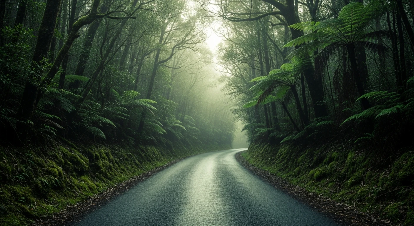
Franklin River Road is a 4WD approach into one of Australia's most significant conservation sites. The Franklin River was the subject of the 1983 campaign that stopped the proposed dam, elected Bob Hawke's government, and established the modern Australian conservation movement. The 10.5-kilometre track provides access to the Franklin-Gordon Wild Rivers World Heritage Area from the Queenstown side. The track itself is manageable for a capable stock 4WD, but the RRI of 6.0 reflects the extreme remoteness of the Franklin wilderness - there is no mobile coverage and help is many hours away. Satellite communication is mandatory. The river itself remains wild, un-dammed and inaccessible except by foot, kayak or this approach. Queenstown on the approach is one of Australia's most extraordinary towns - a century of copper smelting stripped the surrounding hills bare, creating a multicoloured alien landscape that glows in the afternoon light.
Franklin River Road is a 4WD approach into one of Australia's most significant conservation sites.
Why this road

The region
The Franklin-Gordon Wild Rivers National Park is World Heritage listed and holds the largest remaining temperate rainforest wilderness in the Southern Hemisphere. The Franklin River was the subject of Australia's most significant conservation campaign - the 1983 battle to prevent the damming of the Franklin, which played a central role in electing Bob Hawke's Labor government and establishing the modern Australian conservation movement. The river itself remains wild, un-dammed and inaccessible except by foot, kayak or this approach track.

History
The campaign to save the Franklin River in 1982-83 was Australia's first major national environmental movement. Bob Brown and the Wilderness Society blockaded dam construction on the river; the famous aerial photograph of the river with 'NO DAMS' written in rock motivated a generation. The subsequent Labor election victory in 1983 included a mandate to stop the dam, and the river was protected by Commonwealth legislation.
Before you go
Fuel in Queenstown. Satellite comms mandatory - there is no mobile coverage in the Franklin wilderness and help is many hours away. Summer travel recommended - the southwest receives extraordinary rainfall and the temperature drops sharply even in January. This is genuine wilderness 4WD - approach with full expedition preparation.
See a routing error?
Flag itWorth stopping for
Queenstown
One of Tasmania's most extraordinary towns - the bare coloured hills above the town were caused by smelter fumes stripping the vegetation, creating an alien landscape unlike anywhere else in Australia.
Lake Burbury
The large hydro reservoir west of Queenstown is excellent for trout fishing and has a good sealed loop road around its northern shore.
Route
Start
Southwest wilderness, Queenstown approach
End
Franklin River access
Gallery

More roads like this