Davies Creek and Mareeba Tracks
40 km
distance
2h 30m
Contour time
6.2
avg score
Unsealed
surface
Scenery
Queensland
The Lamb Range separates the wet coast around Cairns from the dry tablelands around Mareeba. The range rises to 1,100...
Road quality
6.2 RQS
Every segment scored on 40+ data signals.
Accessibility
Fully sealed
Best in 4WD. Peak season: May-November.
7-day forecast
Mix of graded forest roads and rougher spur tracks. The main track to Davies Creek Falls is well-maintained but narrow with some rocky sections. Side tracks to the granite swimming holes are rougher - loose rock and some washouts. Comfortable for any stock 4WD with 200mm clearance.
Scored 6.2/10 by Contour's road quality algorithm across curviness, surface, elevation and traffic. Best suited for 4wd drivers.
The road
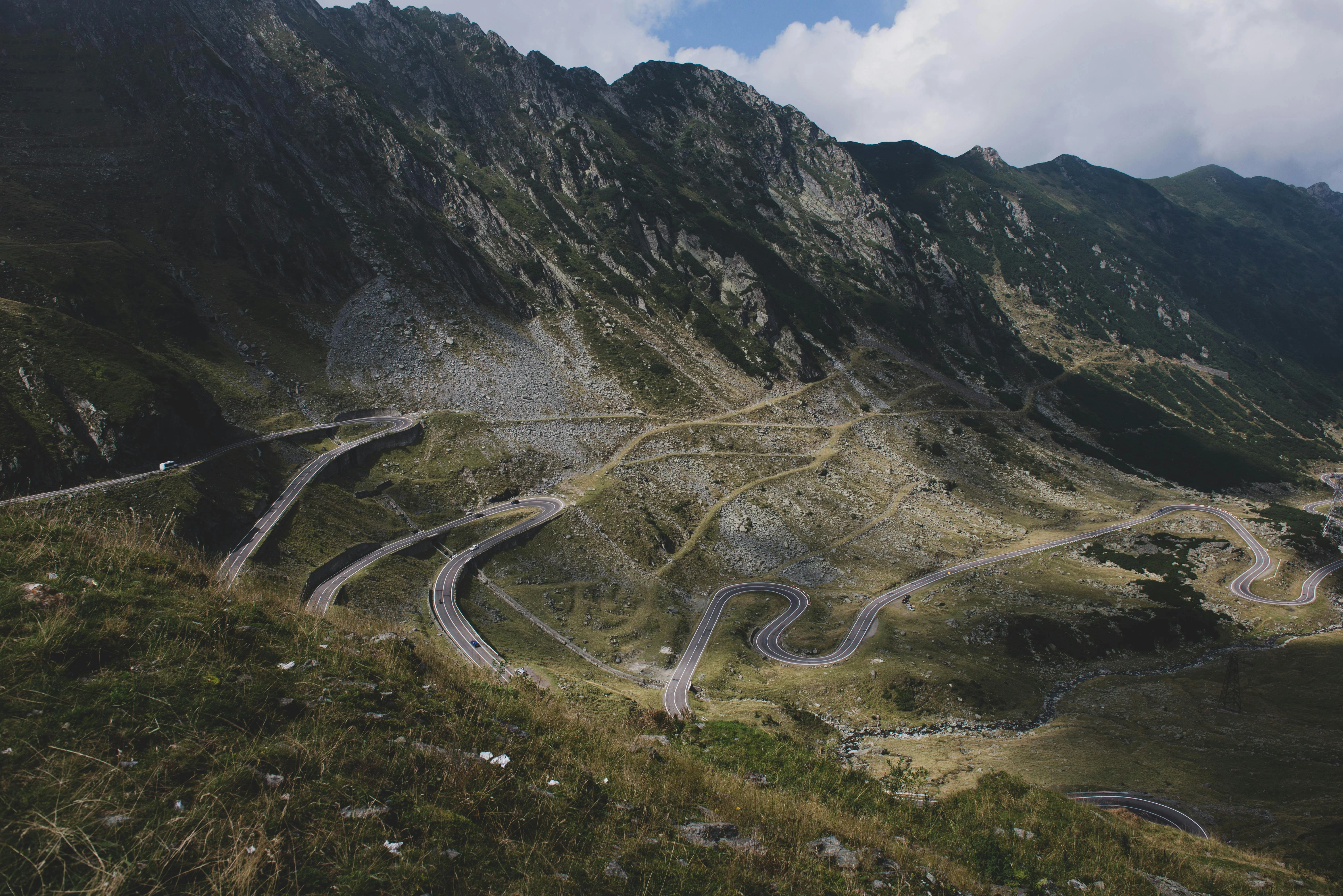
Davies Creek National Park sits in the Lamb Range between Cairns and Mareeba, and it is the closest genuine 4WD country to Cairns. The 40-kilometre track network branches off the Kennedy Highway at the range crest and drops through open eucalypt woodland to Davies Creek and its granite swimming holes. The main track to Davies Creek Falls is the draw - a 30-metre waterfall that drops into a deep pool surrounded by granite boulders. The swimming is excellent from May to November when the creek flow drops enough to make the pool safe. The granite rock platforms above and below the falls are the best spots to sit and the water is clear enough to see the bottom at 3 metres. The track network extends beyond the falls through tropical woodland - ironbark, bloodwood and grass trees on the ridges, with denser vegetation in the gullies. Several spur tracks lead to lookouts over the coastal plain towards Cairns and the Great Barrier Reef. On a clear day the reef is visible as a change in water colour on the horizon. The Dinden and Davies Creek sections connect to form a loop that can fill a full day. The country is drier than the coast - the range creates a rain shadow effect that keeps the western slopes open and grassy. Mountain bikers share the tracks on weekends. The campground at Davies Creek is one of the best in the Cairns region - shaded, quiet and close enough to the falls for a pre-dawn swim.
Davies Creek National Park sits in the Lamb Range between Cairns and Mareeba, and it is the closest genuine 4WD country to Cairns.
Why this road
The region
The Lamb Range separates the wet coast around Cairns from the dry tablelands around Mareeba. The range rises to 1,100 metres and the vegetation changes dramatically with altitude - wet tropical rainforest on the eastern slopes, open woodland on the western side, and granite country along the ridgeline. Cairns is 40 minutes east by sealed road. Mareeba is 30 minutes west. The Kennedy Highway crossing the range is one of the best sealed driving roads in Far North Queensland and the turnoff to Davies Creek sits at the highest point.

Before you go
Fuel at Cairns or Mareeba. No fuel in the park. The tracks are open year-round but the creek crossings can flood in the wet season (December-April) and the swimming holes become dangerous with high flow. May to November is the best window. Bush camping at Davies Creek campground - book through Queensland Parks. The campground has basic facilities - pit toilets and fire rings. No mobile coverage in the park. The Kennedy Highway approach is sealed and well-maintained.
See a routing error?
Flag itWorth stopping for
Mareeba Wetlands
A birdwatching reserve on the tablelands side of the range with hides overlooking seasonal wetlands - over 200 species recorded.
Kuranda
A rainforest village at the top of the range, 20 minutes from the Davies Creek turnoff, with markets, a skyrail and the scenic railway.
Route
Start
Kennedy Highway turnoff
End
Davies Creek Falls
Gallery

More roads like this