Dargo High Plains Road
26 km
distance
25 min
Contour time
5.7
avg score
Sealed
surface
Scenery
Victoria
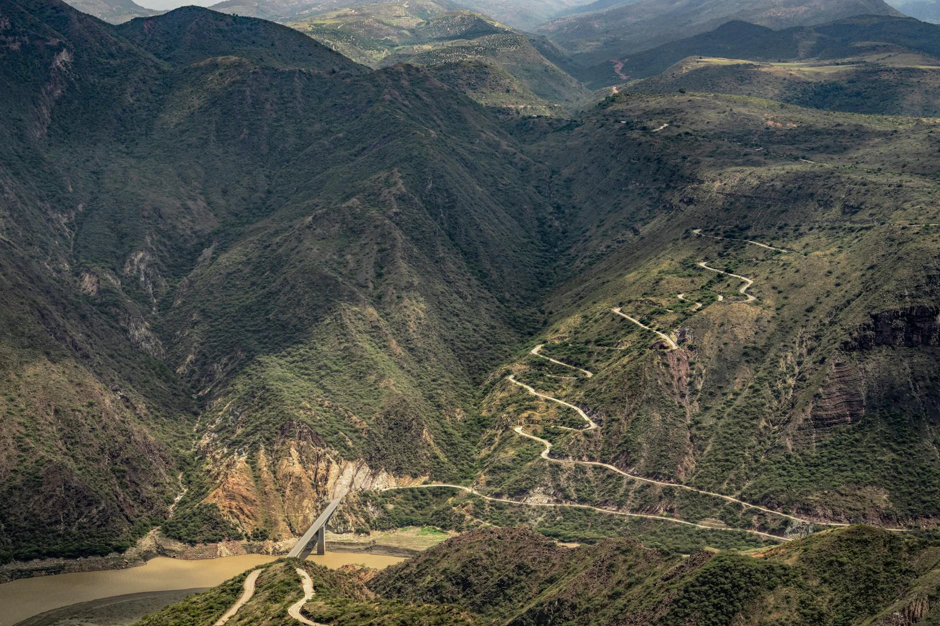
Dargo is a small cattle town in the Mitchell River valley at 350 metres elevation. The road out climbs immediately...
Road quality
5.7 RQS
Every segment scored on 40+ data signals.
Accessibility
Fully sealed
Best in Sports car. Peak season: Spring-Autumn.
7-day forecast
The best short sealed climb in East Gippsland. Constant tight corners through mountain ash with barely any straight sections. Sports car is the natural fit. Motorbike is equally rewarding. Black ice possible above 800m from June to August - the road is passable in winter with care but check conditions.
Scored 5.7/10 by Contour's road quality algorithm across curviness, surface, elevation and traffic. Best suited for sports car drivers.
The road
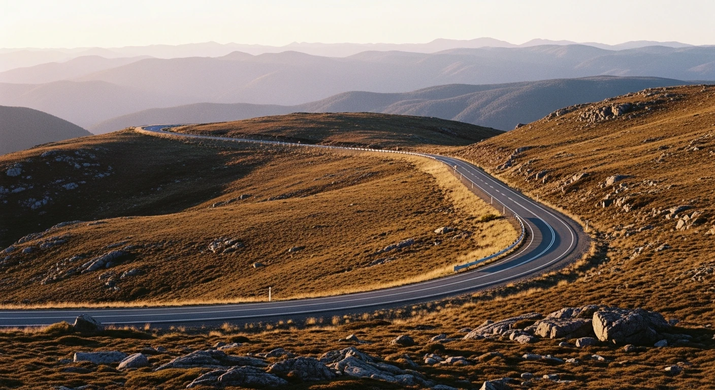
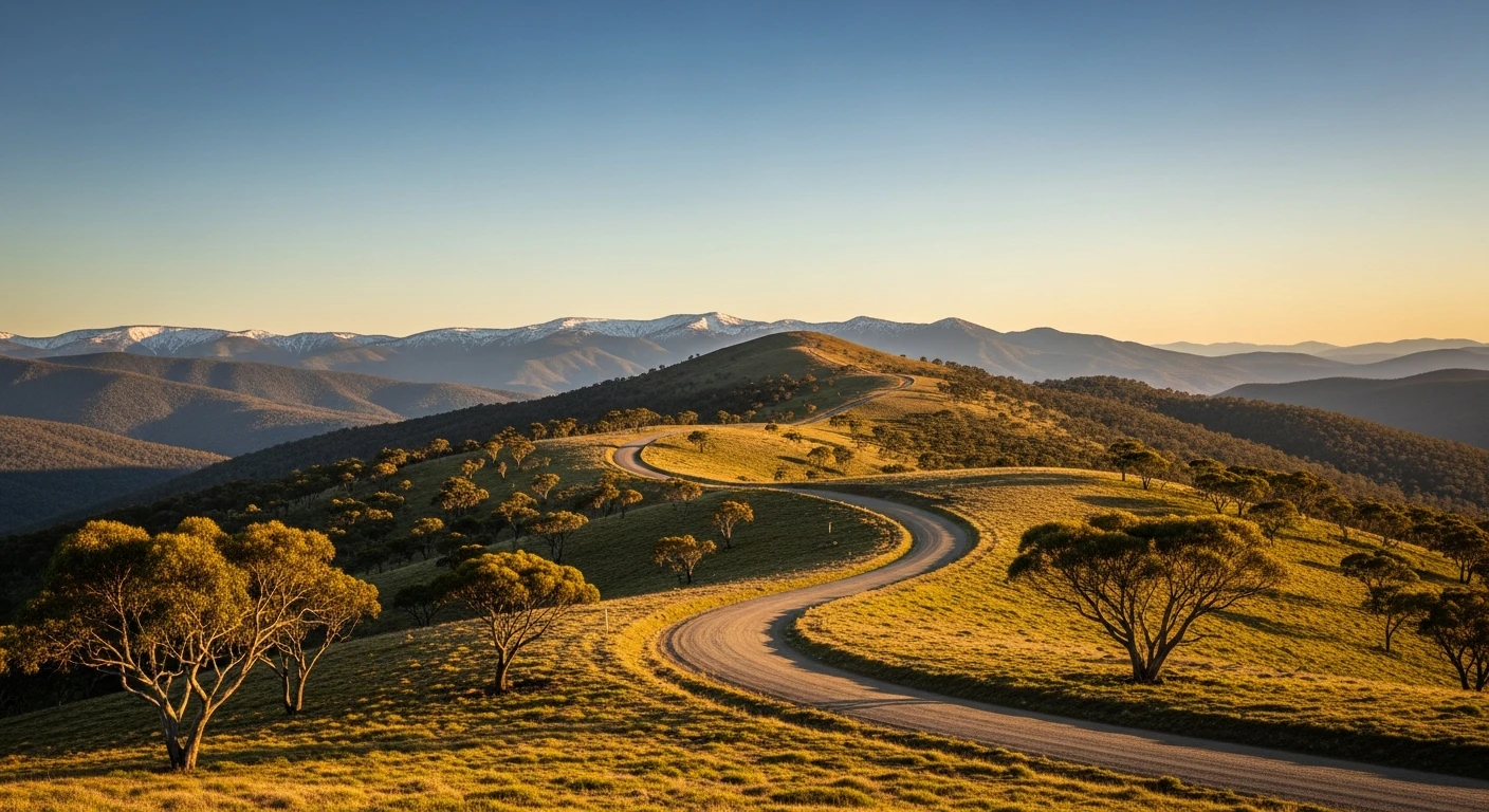
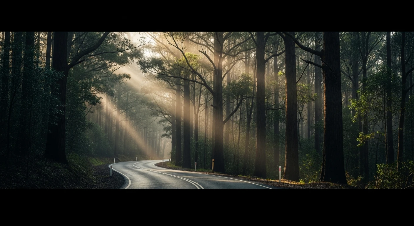
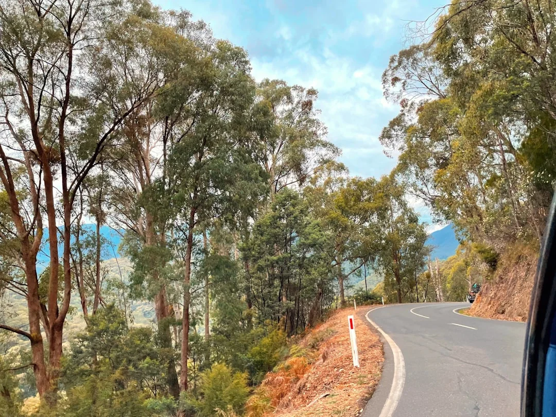
Dargo High Plains Road is one of Victoria's hidden masterpieces. The 26-kilometre sealed climb starts at the valley floor in Dargo - a small cattle town on the Mitchell River at 350 metres - and gains more than 1,000 metres of elevation in under 20 kilometres of relentless tight corners. The first section winds through mountain ash, the corners blind and constant. As the road gains altitude the vegetation opens out and the Dargo River valley begins to appear below through gaps in the canopy. The upper sections are more exposed, with views across the High Country ridgelines and alpine ash giving way to snowgum woodland. The surface is well-maintained and the traffic is almost non-existent - Dargo is not on the way to anywhere else. This is the kind of road where you set off without a schedule and arrive at the top having used every gear. The connection to the Dargo High Plains 4WD network at the summit means a full day linking this climb with the gravel tracks is possible for vehicles with the clearance. But the sealed section alone justifies the trip.
Dargo High Plains Road is one of Victoria's hidden masterpieces.
Why this road
The region
Dargo is a small cattle town in the Mitchell River valley at 350 metres elevation. The road out climbs immediately through the Dargo High Plains, rising over 1,000 metres in under 20 km. The High Country above Dargo is classic Victorian cattlemen's territory - high summer pastures, alpine ash and the Mitchell River headwaters. The road was the main access to the high country for generations of mountain cattlemen.
History
Dargo was established during the Crooked River goldfields rush of the 1860s. The surrounding High Country has been grazed by cattle since the 1840s - the cattlemen's rights to high country grazing were one of the most contested land management debates in Victorian history.
Before you go
Fuel in Dargo - stock up before the climb. Road is sealed throughout. Closed or dangerous in heavy snow (June to August on the upper section) - check conditions before departure. Very light traffic. The road connects to the Dargo High Plains 4WD network at the top. Black ice forms on the upper switchbacks in cold weather.
See a routing error?
Flag itWorth stopping for
Mitchell River National Park
The Mitchell River gorge below Dargo is accessible on a full-day walking track - one of Victoria's most impressive river gorges.
Dargo Hotel
The local pub is the social hub of a very small community - worth a stop for information on road conditions and local knowledge.
Route
Start
Dargo
End
High Plains Road junction
Gallery
More roads like this