Dampier Peninsula
200 km
distance
5h
Contour time
4.0
avg score
Unsealed
surface
Scenery
Western Australia
The Dampier Peninsula is Bardi and Jawi country. Bardi Jawi Rangers manage access and conservation across the...
Road quality
4.0 RQS
Every segment scored on 40+ data signals.
Accessibility
Fully sealed
Best in 4WD. Peak season: April-November.
7-day forecast
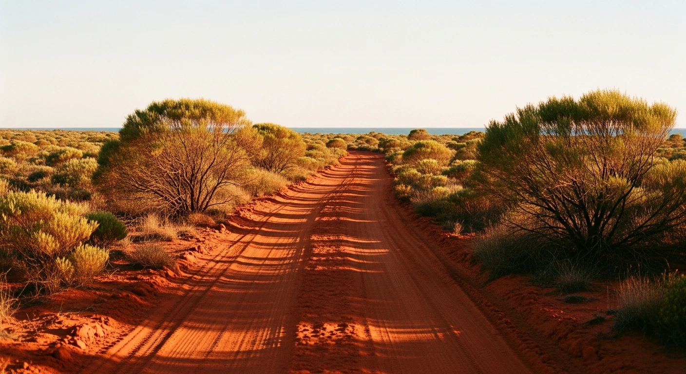
The main Cape Leveque Road is unsealed but generally accessible to any 4WD in the dry season. The side tracks to community beaches and bays are rougher - Grade 3 in sections with deep pindan sand.
Scored 4.0/10 by Contour's road quality algorithm across curviness, surface, elevation and traffic. Best suited for 4wd drivers.
The road
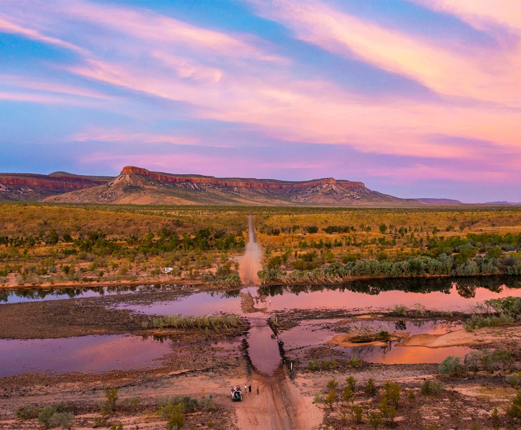
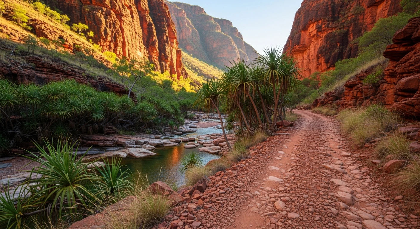
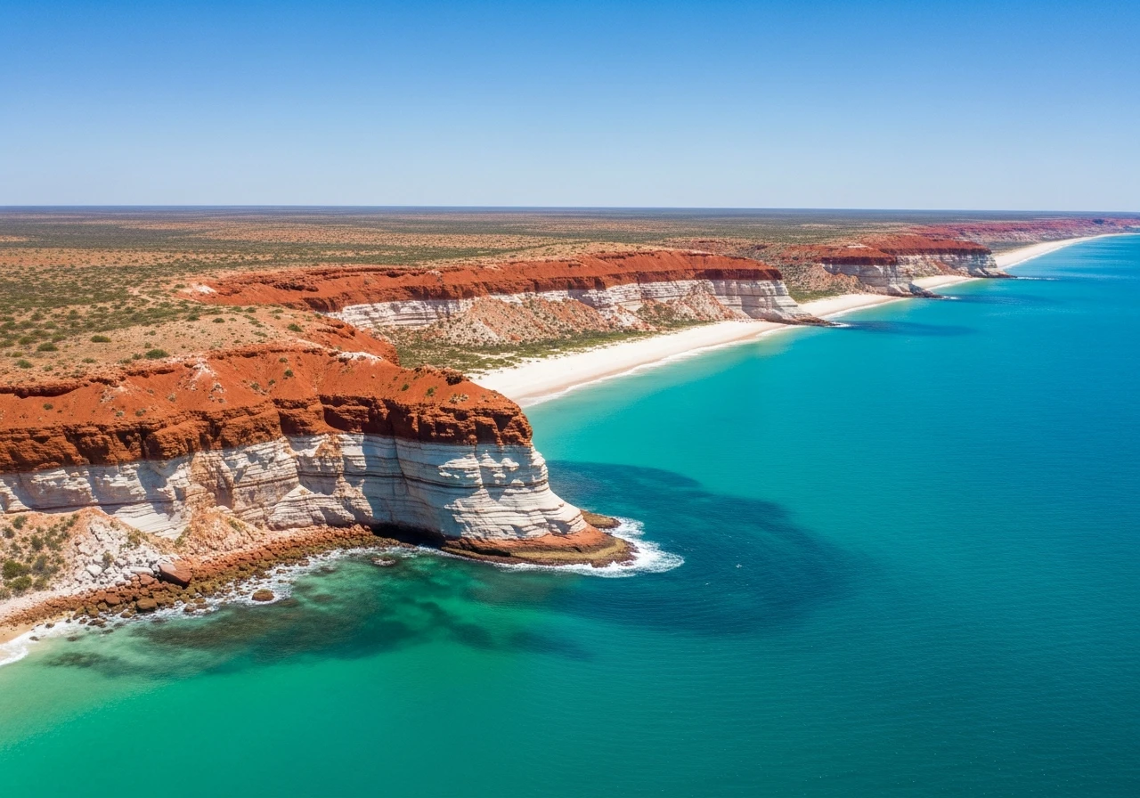
The Dampier Peninsula extends 200 kilometres north of Broome into the Kimberley Sea. The main track runs the length of the peninsula from Broome to Cape Leveque at the tip - a red pindan dirt road through tropical woodland, passing Aboriginal communities with permission required for beach access. The colour contrast here is extreme: the red dirt, the white sand beaches and the turquoise water meet at low tide in a way that photographs better than almost anywhere else in Australia. Pender Bay is a whale nursery - humpback mothers rest calves in the protected bay between June and October. Middle Lagoon and Quandong Point have protected snorkelling. James Price Point, 60km north of Broome, was the proposed site of a LNG hub that was rejected after community opposition - the beach is unmarked and nearly empty. Cape Leveque lighthouse sits on a red and white banded cliff above the Timor Sea. The lighthouse keeper's cottage is now a modest resort. The whole peninsula is on Aboriginal land - respect the community signs and obtain permits for any beach access that requires one.
The Dampier Peninsula extends 200 kilometres north of Broome into the Kimberley Sea.
Why this road
The region
The Dampier Peninsula is Bardi and Jawi country. Bardi Jawi Rangers manage access and conservation across the peninsula. Several Aboriginal tourism enterprises offer cultural experiences, fishing guides and beach access that is not available independently. Broome is the service base - a genuine town with all facilities. The peninsula itself has limited fuel (only at communities with permission) and no hospitals.

Before you go
Self-sufficient fuel required - carry enough for 400km return from Broome. Water from Broome only. The road becomes impassable in the wet season (December to March) when creek crossings flood. Tyre punctures on pindan rock are common - carry a quality repair kit. Speed limit 80km/h on the main road, strictly enforced in Aboriginal community areas (lower). Permits required for some community beaches - check with individual communities before departure.
See a routing error?
Flag itWorth stopping for
Horizontal Falls
A 30-minute seaplane flight from Broome to one of Australia's most unusual natural features - tidal water flowing at high speed through two narrow gorges creating what looks like a waterfall on its side.
Cable Beach, Broome
22km of flat hard sand - the most accessible beach driving in the Broome area at low tide.
Route
Start
Broome
End
Cape Leveque
Gallery

More roads like this