El Questro Gorge Track
25 km
distance
1h 30m
Contour time
7.0
avg score
Unsealed
surface
Scenery
Western Australia
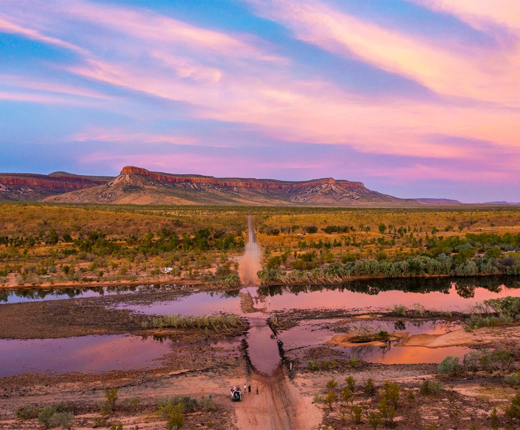
El Questro sits in the Cockburn Range country at the eastern end of the Gibb River Road, near the junction with the...
Road quality
7.0 RQS
Every segment scored on 40+ data signals.
Accessibility
Fully sealed
Best in 4WD modified. Peak season: May-September.
7-day forecast
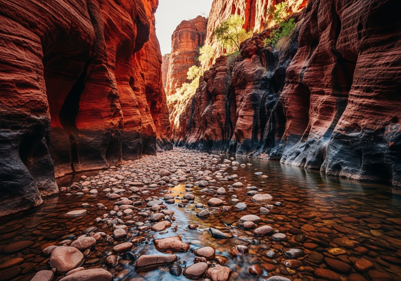
Rocky ledges, creek crossings and narrow gorge walls. Low-range essential. Clearance is tight in some sections - standard utes and SUVs can scrape. Modified vehicles with lifted suspension have more margin. Do not attempt after rain.
Scored 7.0/10 by Contour's road quality algorithm across curviness, surface, elevation and traffic. Best suited for 4wd modified drivers.
The road
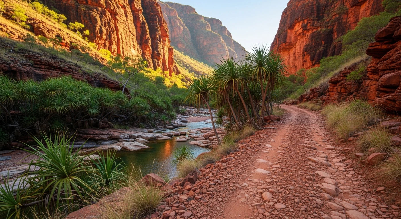
El Questro Wilderness Park covers one million acres of East Kimberley gorge country and the track network inside it is a concentrated dose of what makes the Kimberley different from everywhere else. The gorge track from El Questro Station to Emma Gorge passes through red sandstone walls, over rocky ledges, across shallow creek crossings and into the deep shade of a gorge system that cuts through some of the oldest exposed rock on the planet. The Chamberlain Gorge requires a boat ride from the station to reach its deeper sections - the boat trip is worth it. El Questro Gorge itself is a 45-minute walk from the main track - a narrow, water-polished gorge with a swimming hole at the far end. The thermal springs at Zebedee sit just off the main station track - warm, clear pools under a fig forest canopy. None of this is secret. El Questro is private property operating as an upmarket tourism venture. The track requires a park pass. But the gorge quality justifies the cost.
El Questro Wilderness Park covers one million acres of East Kimberley gorge country and the track network inside it is a concentrated dose of what makes the Kimberley different from everywhere else.
Why this road
The region
El Questro sits in the Cockburn Range country at the eastern end of the Gibb River Road, near the junction with the Great Northern Highway at Kununurra. The station runs cattle on its more accessible country and tourists through the gorge country. Accommodation ranges from camping through to the Homestead luxury lodge above the Chamberlain River. Fuel is available at the station at remote-area prices.

Before you go
Fuel at El Questro station. Purchase a park pass on arrival. Low-range is required for the gorge track - do not attempt in 2WD. Creek crossings can deepen rapidly after rain and the gorge walls trap you if water rises. The track is well-marked but narrow in sections. Vehicle width greater than 2.1m will struggle in the tightest gorge sections.
See a routing error?
Flag itWorth stopping for
Kununurra
40 minutes east on sealed road - a proper town with fuel at normal prices, supermarket, hospital and airport.
Lake Argyle
Australia's largest reservoir, 30 minutes south of Kununurra. Sunset cruises and prolific birdlife including the largest population of freshwater crocodiles in the world.
Route
Start
El Questro Station
End
Emma Gorge
Gallery

More roads like this