Cunninghams Gap
20 km
distance
30 min
Contour time
8.2
avg score
Sealed
surface
Scenery
Queensland
Cunninghams Gap is a natural pass through the Main Range on the Great Dividing Range, used by Aboriginal people for...
Road quality
8.2 RQS
Strong. Above average on most quality signals.
Accessibility
Fully sealed
Best in Sports car. Peak season: Year-round.
7-day forecast
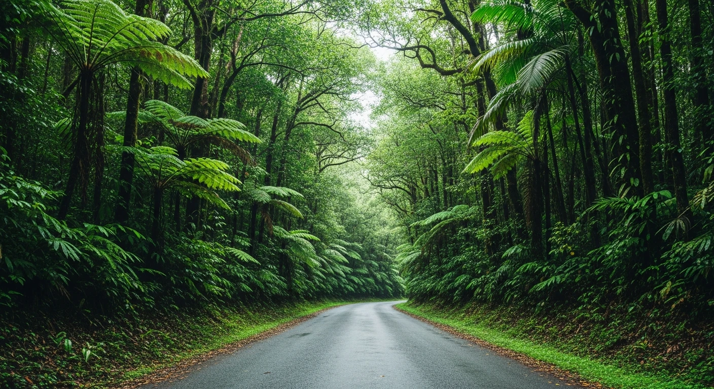
Good sealed mountain pass with consistent corners through the Great Dividing Range. Sports car handles this well - the surface is maintained highway standard and the corners on the eastern approach are tight enough to reward a skilled driver. Higher traffic than the Lamington roads - best driven early morning or on weekdays.
Scored 8.2/10 by Contour's road quality algorithm across curviness, surface, elevation and traffic. Best suited for sports car drivers.
The road
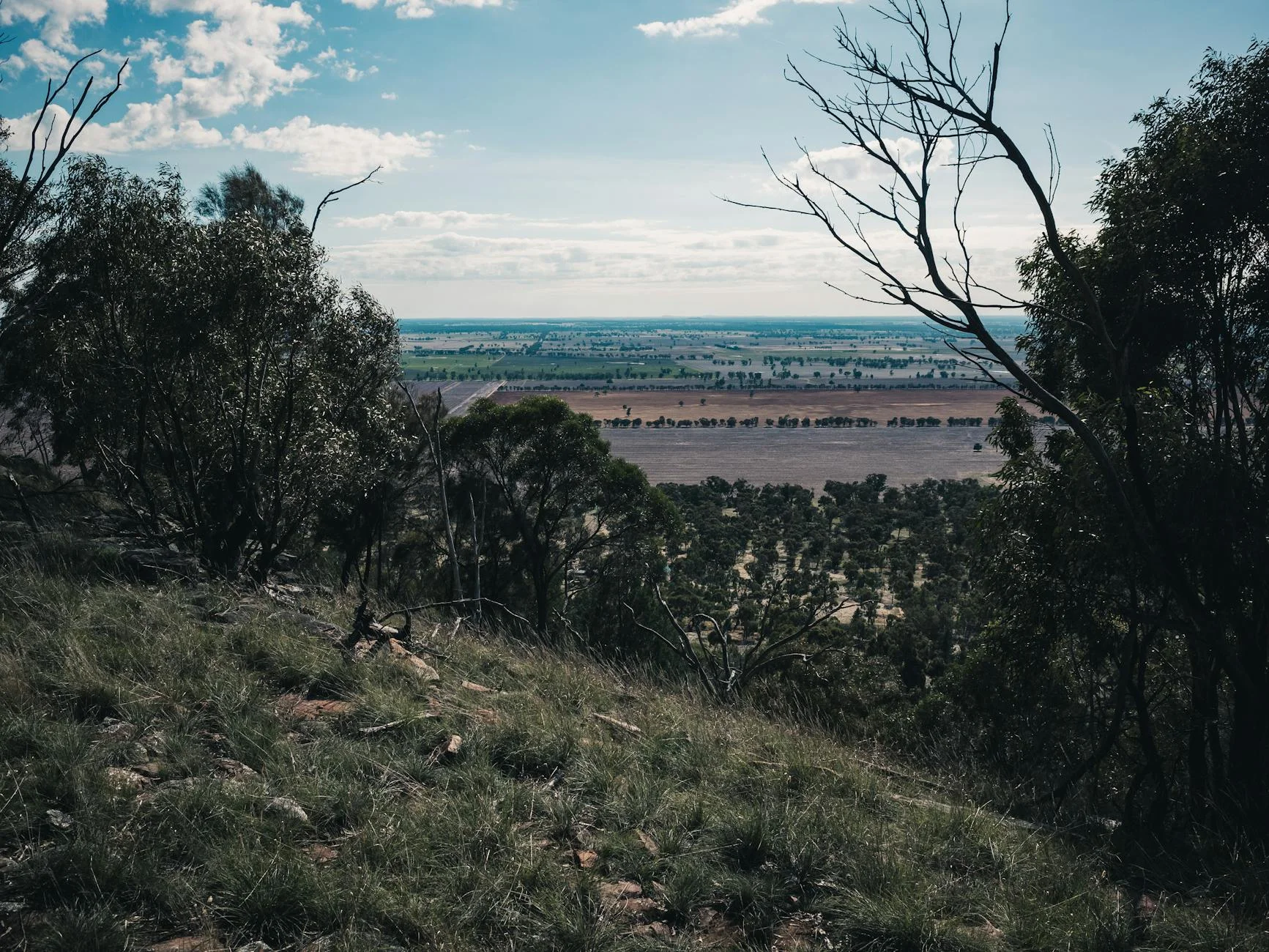
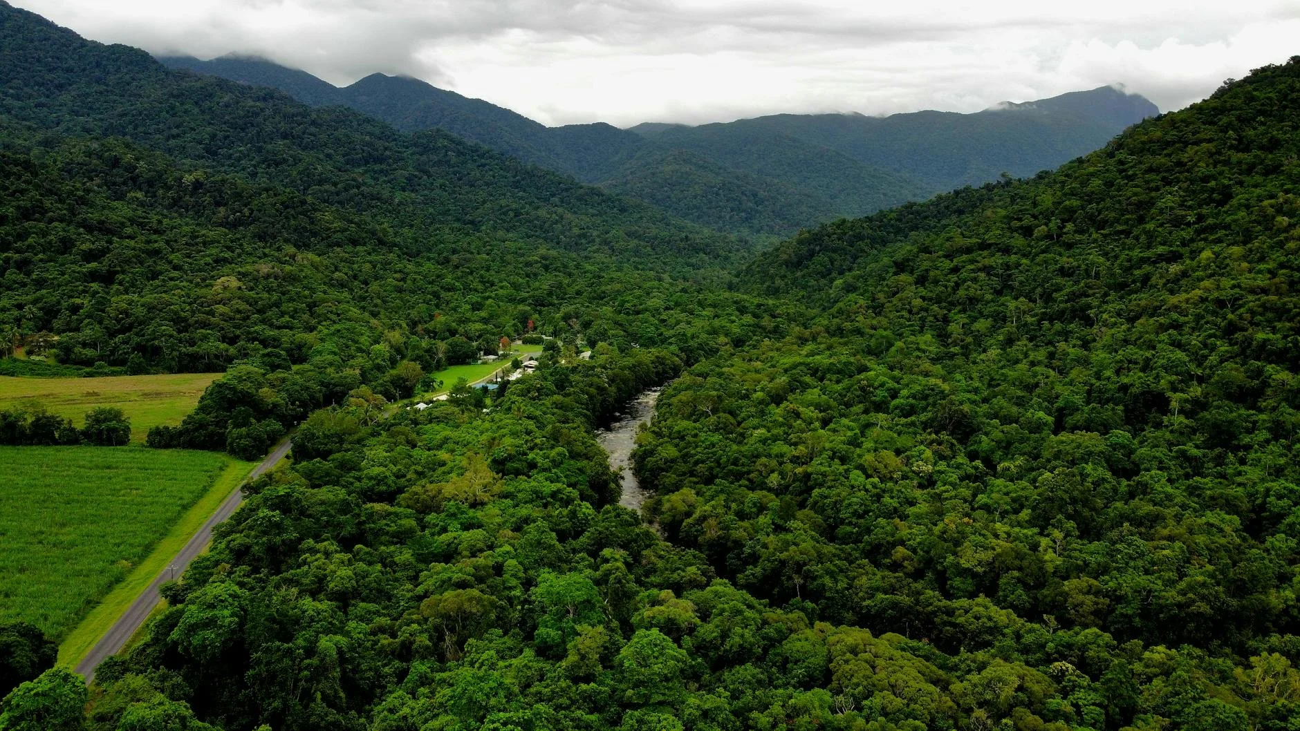
Cunninghams Gap is a natural pass through the Main Range on the Great Dividing Range that has been used for thousands of years. The 20-kilometre sealed road from Aratula climbs 700 metres to the gap, which Allan Cunningham crossed in 1827 to open the route to the Darling Downs. The Cunningham Highway follows roughly the same line today. The eastern approach has the best driving - tight corners through Main Range National Park, which is part of the Gondwana Rainforests World Heritage Area. The pass at the summit has a picnic area with short walks including views over both the eastern slopes and the western Darling Downs. Gap Creek Falls is accessible from the summit. This road carries more traffic than most Contour routes because it is a highway, but early morning or weekday driving gives the quieter experience. The Fassifern Valley below the eastern approach is one of Queensland's best agricultural districts and the drive up from the valley floor into the range is a good transition from open farming to closed-canopy forest.
Cunninghams Gap is a natural pass through the Main Range on the Great Dividing Range that has been used for thousands of years.
Why this road

The region
Cunninghams Gap is a natural pass through the Main Range on the Great Dividing Range, used by Aboriginal people for thousands of years before Allan Cunningham crossed in 1827. The Cunningham Highway now follows roughly the same line, connecting Brisbane to Warwick and the Darling Downs. The pass is surrounded by Main Range National Park, part of the Gondwana Rainforests World Heritage Area. The Fassifern Valley below the eastern approach is one of Queensland's best agricultural districts.
Before you go
Fuel in Aratula before the climb. Road is sealed and open year-round. Higher traffic than most Contour routes - this is a highway. Best driven early morning or during the week. The Cunninghams Gap picnic area at the summit has short walks with views over both sides of the range. Gap Creek Falls is accessible from the picnic area.
See a routing error?
Flag itWorth stopping for
Cunninghams Gap picnic area
The summit rest area has short walking tracks including the Morgan Lewis Walk with views back over the Fassifern Valley and out toward the Darling Downs on the western side.
Spicers Gap Road
The original coach route over the range - a rough unsealed track that follows the line Allan Cunningham surveyed. 4WD only but worth knowing about as historical context for the crossing.
Route
Start
Aratula
End
Cunninghams Gap
Gallery
More roads like this