Climies Track
19 km
distance
3h
Contour time
8.4
avg score
Unsealed
surface
Scenery
Tasmania
Tasmania's west coast between Strahan and Zeehan is mining country. The hills behind the coast were some of the richest...
Road quality
8.4 RQS
Strong. Above average on most quality signals.
Accessibility
Fully sealed
Best in 4WD modified. Peak season: November-March.
7-day forecast
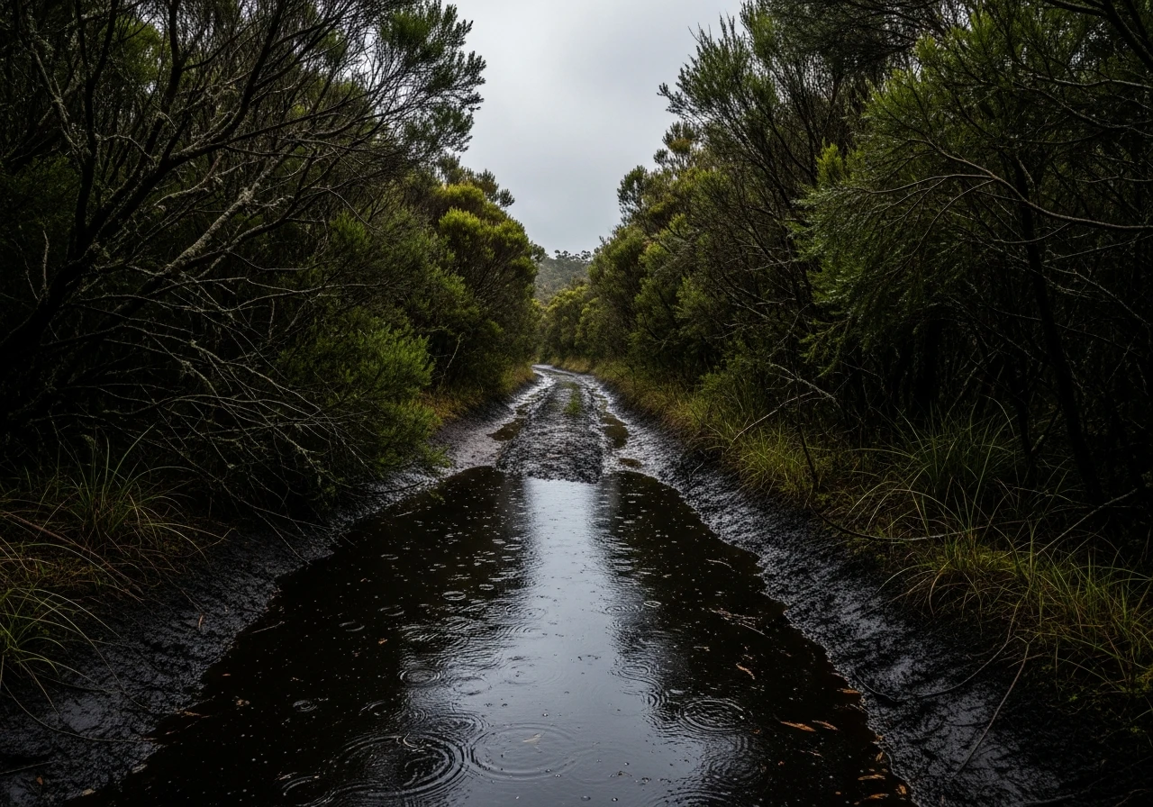
Modified 4WD required. The bog holes and hill climbs are genuine Grade 4 obstacles. Stock vehicles frequently get stuck in the mud sections. A winch is strongly recommended. The track is short but the terrain is relentless.
Scored 8.4/10 by Contour's road quality algorithm across curviness, surface, elevation and traffic. Best suited for 4wd modified drivers.
The road
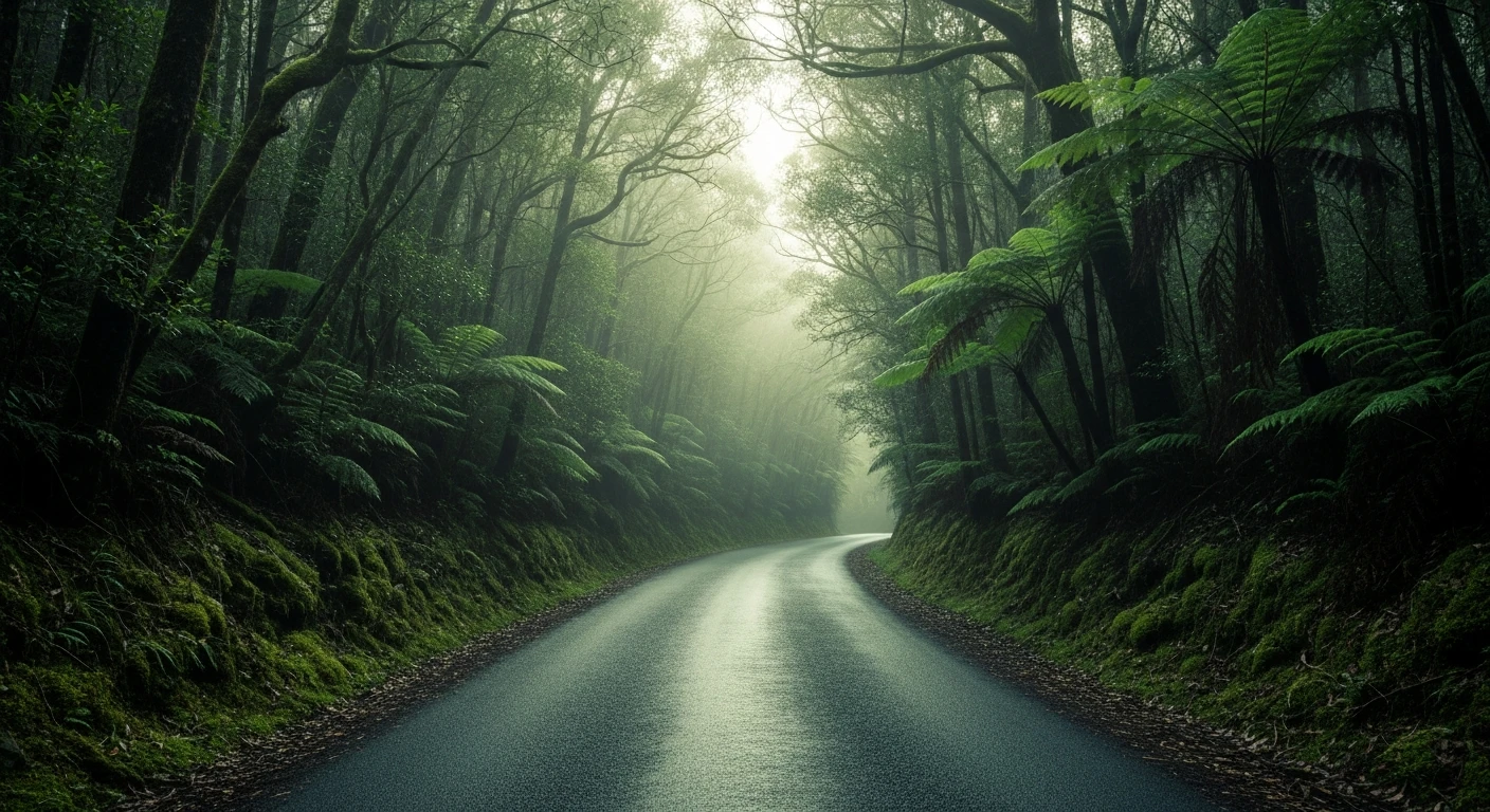
Climies Track is 19 kilometres of the roughest maintained track on Tasmania's west coast, connecting the tiny settlements of Trial Harbour and Granville Harbour along a stretch of coastline that sees almost no visitors. The track was built during the mining era to connect the two harbour settlements and has been maintained at a minimal level since. The surface alternates between rocky sections, deep mud holes, steep hill climbs and river crossings with rocky beds. The bog holes are the main obstacle. The west coast receives some of the highest rainfall in Australia and the soil here is waterlogged for most of the year. Sections of the track sit in standing water even in summer, and the mud beneath is deep, dark and has swallowed vehicles to their axles. The hill climbs are steep and loose, with rock and root obstacles that require low-range and careful line selection. The river crossings are rocky rather than deep, but the approach angles are awkward and the rocks are slippery with moisture. The mining heritage along the route is visible in scattered ruins, old tramway formations and the remains of small settlements that served the west coast mining industry. Trial Harbour at the southern end was a significant port for the Zeehan mining field in the late 1800s. Granville Harbour at the northern end was a timber and mining port. Both are now tiny clusters of shacks and holiday houses. The coast between them is wild, rocky and usually battered by weather from the west. On the rare calm day the views are exceptional.
Why this road
The region
Tasmania's west coast between Strahan and Zeehan is mining country. The hills behind the coast were some of the richest mineral deposits in Australia during the late 19th century and the towns of Queenstown, Zeehan and Rosebery were built on silver, lead, zinc and copper. Trial Harbour and Granville Harbour were the coastal ports that shipped the ore out. The mining has largely ceased but the infrastructure remains - tramway formations, smelter ruins and port walls are scattered through the bush.

Before you go
No fuel at either end of the track. Fill up at Zeehan or Rosebery. No mobile coverage on the track or at either harbour. The track is extremely wet - even in summer the bog sections hold water. After rain the track can be impassable. Carry a winch, recovery boards and a satellite communicator. Travel with a second vehicle. Allow three hours for 19 km. The settlements at both ends have no services - carry everything you need.
See a routing error?
Flag itWorth stopping for
Zeehan Mining Museum
The West Coast Pioneers Museum in Zeehan covers the mining history of the region. One of the best small museums in Tasmania.
Trial Harbour
The settlement at the southern end is a cluster of shacks on a wild rocky coast. Worth a night camping if weather allows.
Route
Start
Trial Harbour
End
Granville Harbour
Gallery

More roads like this