Balfour Track
16 km
distance
2h
Contour time
8.7
avg score
Unsealed
surface
Scenery
Tasmania
Tasmania's west coast between Temma and Marrawah is some of the wildest coastline in Australia. The prevailing westerly...
Road quality
8.7 RQS
Exceptional. Consistently high curviness, surface, and low traffic.
Accessibility
Fully sealed
Best in 4WD. Peak season: November-March.
7-day forecast
Stock 4WD with a snorkel for the canal crossing. The water crossing is the crux - 70 metres of canal with a firm bottom but depth that can reach above the bonnet in wet conditions. The rest of the track is moderate bush driving.
Scored 8.7/10 by Contour's road quality algorithm across curviness, surface, elevation and traffic. Best suited for 4wd drivers.
The road
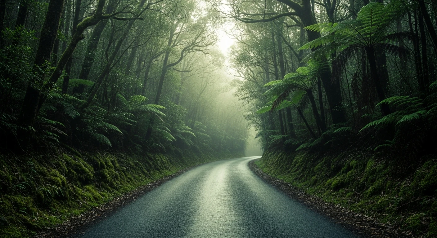
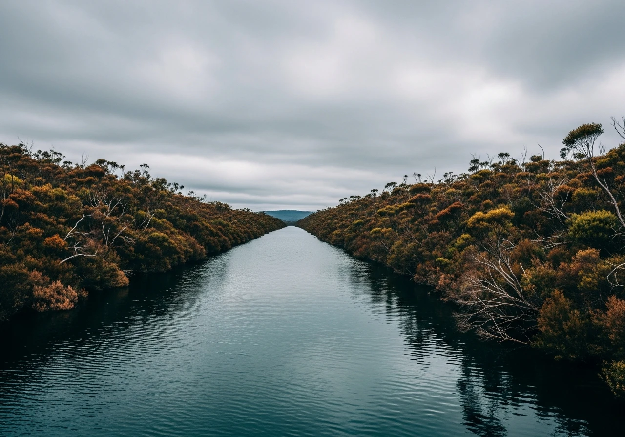
The Balfour Track runs 16 kilometres through Tasmania's wild west coast to the remains of the Balfour township, a settlement that has been abandoned since the 1930s. The track is a test of commitment more than skill. The country it crosses is remote coastal wilderness - buttongrass moorland, dense scrub and wet forest under a sky that rarely stays clear for long on this coast. The defining feature is the canal crossing roughly halfway along the track. This is not a river crossing in the usual sense. It is a 70-metre stretch of man-made canal, cut during the mining era, that the track simply drives through. The bottom is firm but the water is consistently deep - bonnet height in normal conditions, higher after rain. A snorkel is not optional. The canal crossing has a reputation in Tasmanian 4WD circles that exceeds the rest of the track combined. Beyond the canal the track continues through coastal scrub to the remains of Balfour township. The town was established in the late 1800s as a mining and timber settlement and at its peak had a store, a post office and a small population. The last residents left in the 1930s and the bush has reclaimed most of the settlement. Stone foundations, scattered corrugated iron and a few standing walls are visible in the scrub. The beach beyond the township is wild, exposed and usually deserted. The combination of the canal crossing and the ghost town destination makes this one of the most memorable short 4WD tracks in Tasmania. A Parks and Wildlife Service Tasmania written authority is required before attempting the track.
The Balfour Track runs 16 kilometres through Tasmania's wild west coast to the remains of the Balfour township, a settlement that has been abandoned since the 1930s.
Why this road
The region
Tasmania's west coast between Temma and Marrawah is some of the wildest coastline in Australia. The prevailing westerly winds hit this coast uninterrupted from the Southern Ocean, and the vegetation reflects it - low, windswept scrub and buttongrass moorland that looks nothing like the rest of Tasmania. Temma is the nearest point of access, a small settlement on the edge of the Arthur-Pieman Conservation Area. The coast here has significant Aboriginal heritage, with middens and artefact scatters throughout the dune systems.

Before you go
No fuel anywhere near this track. Fill up at Smithton or Marrawah before heading to Temma. A Parks and Wildlife Service Tasmania written authority is required - apply before your trip. No mobile coverage. The canal crossing depth varies with recent rainfall - there is no way to check in advance other than walking it. Carry a satellite communicator. The track is best attempted in a convoy of two or more vehicles. Do not attempt in winter or after prolonged rain.
See a routing error?
Flag itWorth stopping for
Arthur-Pieman Conservation Area
The broader conservation area surrounding the track, with beach driving, Aboriginal heritage sites and some of the most isolated coastline in Tasmania.
Marrawah
The nearest settlement with services. Known for big-wave surfing and west coast wind.
Route
Start
Temma junction
End
Balfour township
Gallery

More roads like this