Arthur-Pieman Beach Drive
48 km return
distance
4h
Contour time
6.6
avg score
Unsealed
surface
Scenery
Tasmania
The Arthur-Pieman Conservation Area covers 100,000 hectares of Tasmania's northwest coast between the Arthur River and...
Road quality
6.6 RQS
Every segment scored on 40+ data signals.
Accessibility
Fully sealed
Best in 4WD. Peak season: November-March.
7-day forecast
Stock 4WD with tyres deflated to 18-20 psi for beach driving. The beach surface is firm at low tide but soft sand sections exist near creek mouths and above the tideline. Tidal timing is critical - the route is impassable at high tide in several places.
Scored 6.6/10 by Contour's road quality algorithm across curviness, surface, elevation and traffic. Best suited for 4wd drivers.
The road
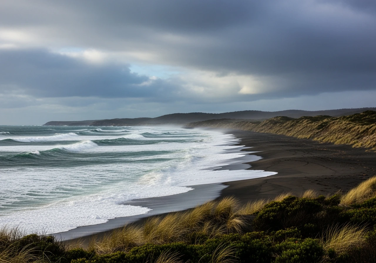
The Arthur-Pieman beach drive covers 48 kilometres return along Tasmania's wildest coastline, from the Arthur River settlement south to Sandy Cape through the Arthur-Pieman Conservation Area. This is beach driving in its rawest form - no infrastructure, no other traffic most days, and a coast that catches the full force of the Southern Ocean swells. The drive begins at Arthur River, a small settlement at the mouth of the river of the same name. The river mouth crossing sets the tone - tidal, sandy and requiring local knowledge of the crossing point. Once across, the beach opens up south towards Sandy Cape. The driving surface is compacted sand at low tide, firm enough for comfortable progress at 30-40 km/h. The coast here is exposed headlands, rocky points and long sweeps of open beach separated by creek mouths that require individual assessment. Some creeks are dry, others are deep enough to require careful approach. The Arthur-Pieman Conservation Area contains some of the most significant Aboriginal heritage sites in Australia. Shell middens, stone artefact scatters and hut depressions are present throughout the dune systems and must not be disturbed. Vehicle access permits are required from Parks and Wildlife Tasmania, and specific areas may be closed to protect cultural sites. Sandy Cape at the southern end is a large expanse of sand backed by coastal heath, with views south along the coast and usually no other people in sight. The return journey uses the same route - there is no loop option. Tidal timing is critical for both directions. Plan the drive around low tide and allow time for the return before the tide turns.
The Arthur-Pieman beach drive covers 48 kilometres return along Tasmania's wildest coastline, from the Arthur River settlement south to Sandy Cape through the Arthur-Pieman Conservation Area.
Why this road
The region
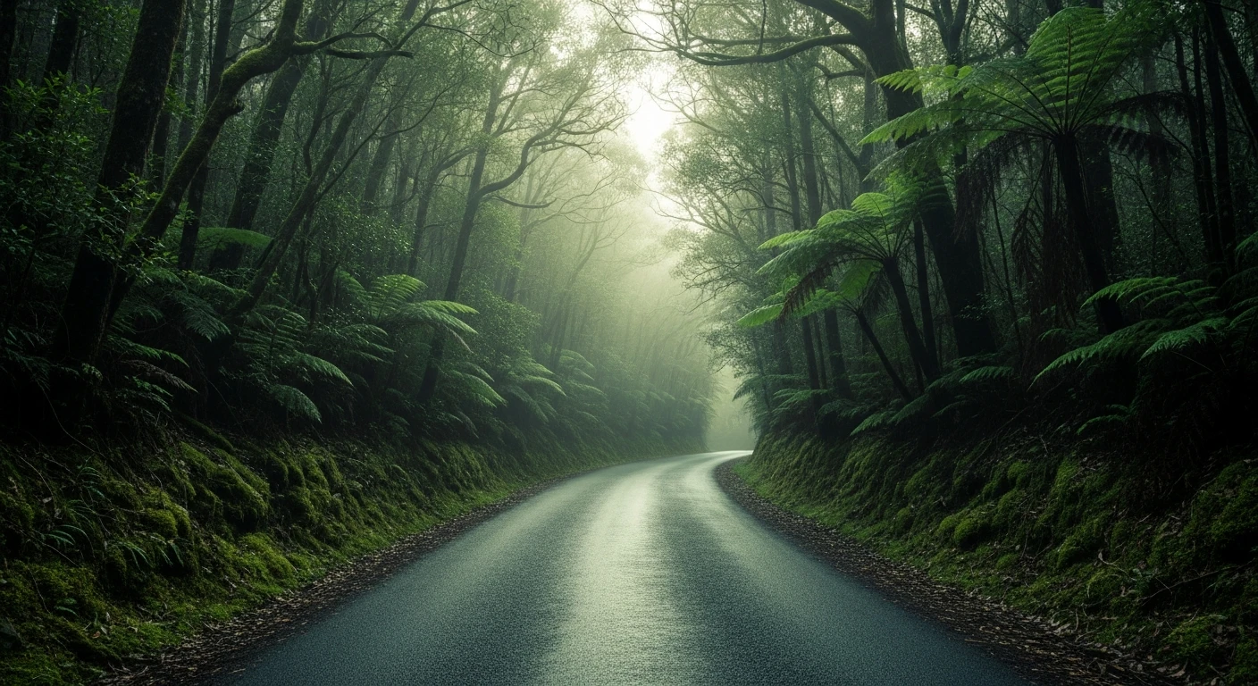
The Arthur-Pieman Conservation Area covers 100,000 hectares of Tasmania's northwest coast between the Arthur River and the Pieman River. The area is managed for its Aboriginal cultural heritage, coastal wilderness values and unusual vegetation communities. The coast here is wild, wind-battered and receives some of the highest rainfall in Tasmania. Arthur River is the gateway settlement with a general store, accommodation and boat tours up the river. The Tarkine wilderness lies immediately inland, containing Australia's largest tract of temperate rainforest.

Before you go
A vehicle access permit is required from Parks and Wildlife Tasmania - apply before your trip. No fuel at Arthur River - fill up at Smithton or Marrawah. Deflate tyres to 18-20 psi for the beach. Carry a portable compressor for reinflation. Tidal timing is non-negotiable - check tide charts and plan for low tide in both directions. Interview River crossing is a key obstacle south of Arthur River - it can be impassable in high water and has stranded vehicles. Check conditions locally before committing. No mobile coverage on the beach. Carry a satellite communicator. Do not drive above the high-tide line to avoid Aboriginal heritage sites in the dune systems.
See a routing error?
Flag itWorth stopping for
Arthur River Cruises
Boat cruises up the Arthur River into the Tarkine rainforest. A different perspective on the same wild country.
The Edge of the World
A sign at Arthur River marking the point where nothing lies between here and South America. Dramatic coastal views.
Route
Start
Arthur River
End
Sandy Cape
Gallery

More roads like this