Byfield State Forest
34 km
distance
3h
Contour time
4.1
avg score
Unsealed
surface
Scenery
Queensland
The Capricorn Coast runs from Gladstone to north of Yeppoon and is the closest beach country to Rockhampton. Byfield...
Road quality
4.1 RQS
Every segment scored on 40+ data signals.
Accessibility
Fully sealed
Best in 4WD. Peak season: May-October.
7-day forecast
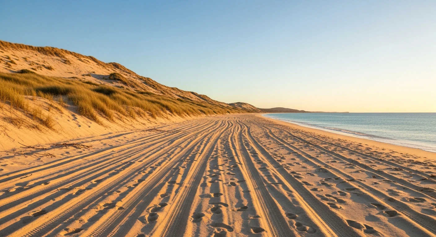
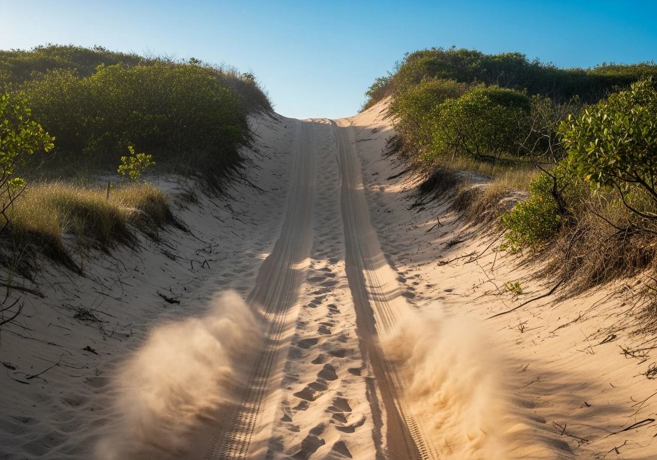
Mix of sand tracks and graded forest roads. The Big Sandy dune climb is the main challenge - a steep sand hill that requires momentum and correctly deflated tyres. Death Valley Track has some washouts and rocky sections. The beach driving at Nine Mile Beach is standard sand at 20 psi.
Scored 4.1/10 by Contour's road quality algorithm across curviness, surface, elevation and traffic. Best suited for 4wd drivers.
The road
Byfield State Forest sits on the Capricorn Coast north of Yeppoon, an area that most travellers on the Bruce Highway drive straight past without knowing it exists. The 34-kilometre main run from Water Park Creek to Nine Mile Beach passes through a landscape that does not look like it belongs in central Queensland - coastal heath, paperbarks, Byfield ferns (found nowhere else on earth) and a long, empty beach with no development. Big Sandy is the signature obstacle - a steep sand dune climb on a narrow track through the coastal scrub that requires momentum, low range and correctly deflated tyres. It is not technically difficult but it punishes hesitation. Death Valley Track runs parallel and is rougher - washouts, exposed rock and tighter vegetation. The beach at Nine Mile is the reward. It is long, quiet and empty for most of the year. The forest campgrounds along Water Park Creek are shaded and well-maintained by Queensland Parks. The swimming in Water Park Creek is safe - it is freshwater, no crocs this far south of the Tropic. The area is popular with Rockhampton and Yeppoon locals on weekends but almost unknown to interstate visitors. It is one of the best day trips for a stock 4WD on the Queensland coast.
Byfield State Forest sits on the Capricorn Coast north of Yeppoon, an area that most travellers on the Bruce Highway drive straight past without knowing it exists.
Why this road
The region
The Capricorn Coast runs from Gladstone to north of Yeppoon and is the closest beach country to Rockhampton. Byfield sits at the northern end, where the Shoalwater Bay Military Training Area begins. The military presence means that the coast north of Byfield is completely undeveloped and inaccessible - which is why Nine Mile Beach feels so remote despite being only 40 kilometres from Yeppoon. The forest behind the beach is part of a conservation area that protects the endemic Byfield fern and several rare orchid species.

Before you go
Fuel at Yeppoon (40 minutes south). No fuel at Byfield or Nine Mile Beach. The tracks are sandy - deflate tyres to 20-22 psi for the sand sections and reinflate for the graded roads. A portable compressor is essential. Water Park Creek campgrounds require booking through Queensland Parks and Wildlife. The beach is accessible at low and mid tide only. No mobile coverage at Nine Mile Beach. Big Sandy is best attempted mid-morning when the sand has warmed and firmed slightly.
See a routing error?
Flag itWorth stopping for
Keppel Islands
Great Keppel Island is a 30-minute ferry from Yeppoon with good snorkelling and walking tracks - a contrast to the 4WD day at Byfield.
Iwasaki Waterfall
A small but photogenic waterfall near Byfield township, accessible by a short walk from the road.
Route
Start
Water Park Creek
End
Nine Mile Beach
Gallery

More roads like this